
Blog

Disparate Data for Marine Life
Remote sensing data helps to inform ocean planning for energy development around the main Hawaiian islands. Using remotely sensed imagery to map physical and biological patterns in the marine environment enhances our ability to understand how environmental conditions change over broad spatial scales (10s to 100s of kilometers) and temporal scales (years to decades). These...

xyHt News Links: 12/9/16
Topcon announces next generation of online support and training Septentrio announces seismic monitoring and advanced CORS features on PolaRx5 product line. Asteri Navigation launches X-series of wearable GNSS receivers
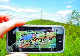
Custom, Portable Maps — Via App!
Software company Avenza has evolved its map products into an app that lets people upload their own map—or download a map of their choice—to their mobile devices, and customize it. Whether for fighting a wildland fire, delivering packages, or exploring tourist sites, using a map should be easy and quick. Well, especially when you’re fighting...
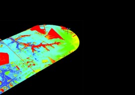
Single-Photon Lidar
SPL collects massive data from the air, uses less power, and can see through semi-porous objects with green lasers. Technological advances in our industry have truly been a sight to behold. It seems like when you blink, already there’s a faster, smaller version of the instrument you just bought. Look at aerial lidar, for instance–who...
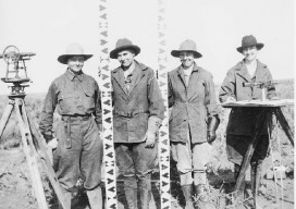
Who Is a Professional Land Surveyor?
A few months ago I wrote a piece titled, “What is a Professional Land Surveyor?” Now I will take a crack at “Who is a professional land surveyor?” I started in this business when I was 17, not even graduated high school yet. I was a hot shot architectural draftsman in high school, or so...
Right-sized? Taking the Surveying Profession to the Future
Verb -Gerund or present participle: right-sizing. As in reducing the size of (a company or organization) by eliminating staff positions, specifically when business conditions necessitate such a reduction Editor’s note: We asked esteemed Nevada surveyor and editor of the Nevada Traverse (journal of land surveying in Nevada) Carl C. de Baca to weigh in on...
Advertisement