
Blog
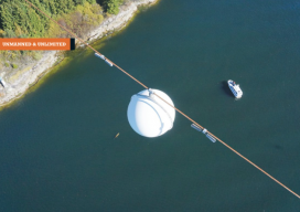
Inspecting Over the Line With UAV
One of British Columbia’s first aerial inspection firms takes on a challenging maritime mission using a UAV. Featured image: The Raecon team flies a UAV across the Strait of Georgia, performing an aerial power line inspection. AS DAWN BROKE off the Sunshine Coast of British Columbia, Canada, the Raecon Industries team set out by boat...

xyHt News Links: 1/13/17
How much does ArcGIS Online REALLY Cost? Geospatial Professionals Receive 2016 MAPPS President’s Awards for Service Vanilla Aircraft claims record with 56-hour unmanned flight Textron Systems Begins On-Water Testing for Common Unmanned Surface Vehicle (CUSV™) Sanborn Launches Mezurit.com for Subscription-Based Oblique Imagery Viewing and Analytics

Automating the Mundane: AI Geospatial Analysis
Customized geospatial exploitation services provide solutions for the defense, homeland security, and aerospace markets. You don’t have to work for huge organizations, such as the U.S. Air Force or the U.S. Forest Service, to appreciate the benefits of customized geospatial exploitation services or capabilities. Even small companies and public agencies are increasingly challenged with extracting...

Market Opportunities for Geospatial in 2017
Construction Prospects, Part One As we start a new year, it seems only fitting to take a look at what 2017 might hold in store for us. Let’s start with construction: a major source of income for the geospatial profession. Dodge Data & Analytics publishes all types of data for the North American commercial and...
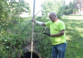
App Happy: Streaming Utility Surveys
A new app standardizes workflow by turning a list of surveyed points into underground 3D utility maps. Imagine that you’re surveying an underground waterline in your city. You use your survey devices to record the locations of the pipe system, including the manholes, the water valves, and their depths. Using your tablet on-site, you’re able...

Trimble Catalyst — No Receiver Required*
*A groundbreaking new service turns your smartphone into a high-precision, software-defined GNSS receiver. The new Trimble Catalyst is a little hard to describe in terms we’re used to regarding high-precision GNSS. Is it a receiver? Is it a service? Do we really need only an external antenna, a subscription, and a smartphone? The answer is...
Advertisement