Legislation passed by congress and signed by the president codifies NOAA’s exemplary digital coast program
Geospatial professionals and coastal communities are celebrating the passage of the Digital Coast Act (DCA) by remembering the coordinated efforts from the numerous public and private stakeholders that were necessary to help pass this important legislation. The intent of this article is to summarize the legacy and benefits of National Oceanographic and Atmospheric Administration’s (NOAA) Digital Coast Program (DCP), and highlight the 10-year journey of the Digital Coast Act. More importantly, now that this program is authorized by Congress, a critical step in the process remains to advocate for appropriating funding necessary so that the Digital Coast can realize maximum social and economic returns for all Americans, not only those living in coastal states.
Digital Coast Program, the Model for Success
NOAA National Ocean Service (NOS) is recognized around the world for leveraging advanced science, innovation, and best practices to steward America’s coastal and ocean resources. The DCP started in the late 1990s and systematically integrated geospatial data and used advanced technologies to provide long-range planning, resiliency and making informed decisions when managing coastal resources, climate adaptation and population growth.
In the beginning, the fledgling program had the daunting goal of not only creating and posting data on a website, but more importantly generating actionable coastal intelligence based on input from internal and external stakeholders. The first use of the term Digital Coast was at NOAA’s Coastal GeoTools Conference in 2001. From there, NOAA built the structure and partnerships from modest resources to the point in 2007 that NOAA’s Office for Coastal Management officially released the first version of the Digital Coast.
DCP is Important to Every American
The robust data sets available in the Digital Coast make it possible for NOAA and coastal communities to better manage oceans and coasts, which are vital to America’s economy. Data sets produced under the Digital Coast program enable communities to become more resilient by providing essential data for predictive analysis and response in times of disaster.
The marine economy, also known as the “Blue Economy,” is an important aspect of national economic stability and growth. A NOAA report in in June 2020 revealed that the Blue Economy grew faster than the overall U.S. economy and was worth $373 billion.
“These statistics are the first-of-its-kind estimate of the U.S. marine economy, a primary driver of jobs, innovation and economic growth,” said retired Navy Rear Admiral Tim Gallaudet, Ph.D., assistant secretary of commerce for oceans and atmosphere and deputy NOAA administrator. “Data such as these provide a critical baseline to inform, track progress and accelerate America’s economic recovery.”
For these statistics, experts from NOAA and the Bureau of Economic Analysis (BEA) considered 10 sectors representing businesses dependent on the nation’s oceans, coasts, and Great Lakes between the years 2014 and 2018. Marine-related gross domestic product grew 5.8 percent from 2017 to 2018, faster than the 5.4 percent growth of the total U.S. gross domestic product. Businesses included in the report also supported 2.3 million jobs in 2018.
“The marine economy statistics clarify just how dependent America is on our waters,” said Nicole LeBoeuf, acting director of NOAA’s National Ocean Service. “It is nearly impossible for most Americans to go a single day without eating, wearing or using products that come from or through our coastal communities.”
“For the first time, the United States has ocean data that can be compared with our official statistics on other U.S. industries and with the ocean economies of other nations,” said Mary Bohman, BEA’s acting director. “These prototype statistics offer a baseline for understanding the importance of the ocean economy, including recreation, seafood, transportation and ship building. Businesses, policymakers, and coastal communities can use these economic data as a compass as they chart the way forward.”
The sectors making the largest contributions to the nation’s gross domestic product, not adjusted for inflation, are:
- Tourism and recreation, including recreational fishing ($143 billion)
- National defense and public administration ($124 billion)
- Offshore minerals ($49 billion)
- Transportation and warehousing ($25 billion)
- Living resources, including commercial fishing and aquaculture ($13 billion)
- Ship and boat building ($9 billion)
- Power generation ($4 billion)
- Research and education ($3 billion)
- Construction ($2.5 billion)
- Professional and technical services ($31 million)
These prototype statistics are the most comprehensive and accurate produced to date, thanks to the addition of newer, more inclusive data sets. The economic statistics validate previous estimates of the value of the marine economy. The data, report and other materials are available at www.bea.gov/.
Realizing these types of economic benefits, it is easy to understand why managing our ocean and coastal resources using the Digital Coast data is important to every American. The Digital Coast offers users a variety of data themes, which facilitate resiliency and vulnerability planning and many other economic applications in coastal states.
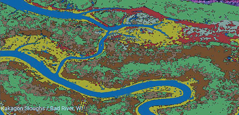
Digital Coast Stories From The Field
There are over 125 “Stories from the Field” on NOAA’s Digital Coast website that demonstrate the need for critical coastal information. One story of note would be the way the Jackson County (Mississippi) Utility Authority used the NOAA “Sea Level Rise Viewer” to determine a safe location for a wastewater treatment facility.
Past hurricanes had flooded two of the county’s wastewater treatment plants. Hurricane Katrina in 2005 and Hurricane Nate in 2017 caused millions of dollars in damage. The Jackson authority was faced with a critical decision concerning where to locate a new facility for collecting, treating, and repurposing wastewater.
Jackson County officials wanted to identify a site that would remain dry for the next 50 years. They used the Sea Level Rise Viewer to see local areas that would not flood under medium-to-high sea level rise scenarios of three to five feet.
Through this process, the team was able to decide on a location that would remain safe from floodwaters through 2070. The all-in-one treatment facility is slated to be built over the next several years near Pascagoula’s industrial center, a site that will potentially save millions of dollars in flood damage.
A next step for the project team was to combine the sea level rise findings with storm surge data, the latter provided by NOAA’s National Centers for Coastal Ocean Science, will determine the height of any protective berms placed around the new facility. The authority is partnering with the U.S. Army Corps of Engineers on the project’s conceptual design. Support for the facility includes U.S. Environmental Protection Agency funding under the Water Infrastructure Finance and Innovation Act and $3 million in support through the Consolidated Appropriations Act of 2017.
The bottom line is clear, geospatial data from the Digital Coast Program greatly enhances multidisciplinary decision making and can save taxpayers money by proactively planning for damaging storm events. The 2015 “Projected Benefits and Costs of the Digital Coast” report examined past and expected costs, and benefits associated with creating and operating this data-driven decision support resource.
According to the report, annual net benefits grew from about $2.3 million in 2009 to more than $6.7 million in 2013. Currently, benefits exceed costs by a margin of 3-to-1, with net benefits of $25 million. Continued operation of the Digital Coast over the next 15 years is expected to yield a net benefit of $117 million, equating to a return on investment of 411 percent. This high rate of return on investment is a good investment for taxpayers, and the growing base of customers who use the site to gain easy access to data and tools worth millions of dollars. A new benefits report to be released in 2021 is expected to show an even greater return on investment.
Democracy in Action
Realizing many technical and program successes, NOAA and industry stakeholders next turned to Congress to gain support to further advance to the Digital Coast Program. The legislative journey of the Digital Coast Act had many “ebbs and flows” but supporters of the mission remained committed to the cause.
The first Digital Coast Act was introduced as House of Representative bill 6215 (H.R. 6215) on September 23, 2010 by Maryland Democrat Dutch Ruppersberger. Since the initial introduction, various re-introductions were written, the latest introduced in spring of 2019 by Ruppersberger and Don Young (R-AK) in the House, and Senators Tammy Baldwin (D-WI) and Lisa Murkowski (R-AK) in the Senate.
The bill authorizes the Secretary of Commerce (NOAA falls under this Secretary) to:
- Establish a constituent-driven program to provide a digital information platform capable of efficiently integrating coastal data with decision-support tools, training, and best practices and to support collection of priority coastal geospatial data to inform and improve local, state, regional, and federal capacities to manage the coastal region, and for other purposes.
- Provide statutory authority for and revises NOAA’s Digital Coast program.
- Focus on filling data needs and gaps for critical coastal issues and support continued improvement in existing efforts to coordinate the acquisition and integration of key data sets needed for coastal management.
- As needed, enter into financial and partnering agreements and collect fees to carry out the program.
- Establish publicly available tools that track ocean and Great Lakes economy data for each coastal state.
Non-partisan legislative advocacy on Capitol Hill began by MAPPS and the National States Geographic Information Council (NSGIC) in 2013. During the next seven years, MAPPS and other associations participated in congressional briefings on Capitol Hill, provided expert witness at hearings, presented to the Subcommittee on Natural Resources and Subcommittee on Ocean, Water and Wildlife, as well as, supported NOAA field meetings in Louisiana, Wisconsin and South Carolina.
Additionally, MAPPS members wrote letters and spoke in person to their state congressional representatives during annual MAPPS Washington D.C. Capitol Hill Days. In all of these educational meetings and correspondence, the numerous benefits of the Digital Coast Program were explained so that Congress could be informed and cast a favorable vote for the bill.
For the benefit of its members and the geospatial community, MAPPS was committed to collaborate with many associations, federal agencies, and congress to move the Digital Coast Act through the law-making process.
“While it is critical to coastal communities like mine in the Chesapeake Bay watershed, we all have a stake in protecting America’s shorelines,” Ruppersberger said after passage of the DCA. “Today, we are arming local planners and managers with the tools they need to save people and property. I’d like to thank MAPPS and our private-sector stakeholders for helping to see the Digital Coast Act across the finish line after more than a decade of hard work on this important issue.”
Next Steps for Even Greater Success
With the bill being signed into law by President Trump on December 18, 2020, it is now time to execute the intent of this important legislation. To prepare for this moment, NOAA has been updating the Digital Coast Strategic Plan and Priorities.
A few of these priorities are: completing data gaps, further developing public access tools, focusing on underserved areas, and documenting best practices that can lead coastal communities towards a resilient future. Miki Schmidt, Division Chief, Science and Geospatial Services NOAA Office for Coastal Management says he “is looking forward to working with MAPPS members and our other partners to continue providing decision support resources that enable coastal communities to become more resilient.”
Of interest to the geospatial profession is filling in the gaps and updating the already extensive set of data themes within the Digital Coast. Thanks to a solid partnership with USGS, a considerable amount of coastal elevation data has already been collected through the 3DEP program.
Land use and land cover information for better local decision making is also a priority using various multispectral and hyperspectral technologies. Other data themes such as critical infrastructure, socioeconomic and human use, marine economy data, living resources and habitat cadastral, and high-resolution aerial imagery offer comprehensive data resources that will make the Digital Coast even better.
Similar to previous practices by NOAA, if data already exists within the federal government, they could become accessible through the Digital Coast. This obviously reduces redundant data costs, maximizes the Digital Coast budget, and increases the return on investment for taxpayers.
Mark Brooks of Optimal Geo and current president of MAPPS is pleased the Digital Coast Act requires contracts for data to be considered as ‘‘surveying and mapping’’ professional services. He believes that past and future achievements of the Digital Coast Program are because the high value data products created by large and small businesses possessing educated and experienced professionals that are licensed and certified, and by firms who continuously invest in innovative geomatics technologies.
Last but certainly not least, the meticulous work will begin in 2021 to advocate to the 117th Congress and appropriators to fully fund NOAA so that the many benefits of the Digital Coast Program can be realized. MAPPS, industry associations and other stakeholders are already developing strategies to meet with representatives on Capitol Hill as part of the process to explain the benefits of the program and request funding.
Given the potential for budget constraints in the upcoming years, this is a call to action for all geospatial professionals and interested parties to advocate and lobby for Digital Coast funding. To assist in advocacy efforts and make the Digital Coast bigger and better, become a MAPPS member today at www.mapps.org. The more firms speaking out to their congressional representatives about the Digital Coast Program, the more funding success is possible.
By Susan Marlow and Brian Raber