Category Archives: Aerial/UAS

Mapping for a Good Cause
When humanitarian emergencies strike, these volunteers are ready to share their geospatial skills and help communities map their way out of crisis. You, too, can lend a hand. After Cyclone Idai made landfall in Mozambique in the middle of March 2019, it left behind more than 1,000 casualties, miles of damaged roads, and ruined at...
A New Perspective with Drone Photogrammetry
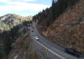
Geotechnical engineers say drones offer a safer, faster method of data collection to identify potential geohazards and assist with mitigation along vulnerable transportation corridors. Mountain roadways are prime locations for geohazards, such as rockfalls, landslides, and debris flows. These events result in road closures, injuries, and property damage, sometimes triggered by thaw/freeze cycles or...
The Yurok Tribe and Condor Aviation Soaring to New Heights with RIEGL
Sponsored Content Click Here for a higher resolution image to read
The Next Big Thing
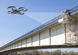
A string of high-profile bridge failures in recent years has underscored the importance of innovating the way we inspect and assess the condition of our vital civil infrastructure. Can the use of AI help prevent bridge collapses in the future? This award-winning engineer thinks so. The period spanning 1992 to 2014 could just be the...

AI in the Sky
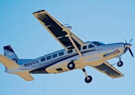
Will artificial intelligence solve the beyond visual line of sight problem for uncrewed aerial vehicles? For more than a decade now we have been moving more and more processes and tasks from crewed aviation to drones in a variety of industries, but the promise of widespread massive deployment of these electrically powered wonders is still...
A Decade of Uncrewed Photogrammetry
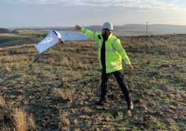
Some might have had a peek at photogrammetry drones before 2013, but for me 2023 marks a decade since I first laid eyes on an uncrewed aircraft that “claimed” to do what I had been doing for years in bigger, more stable airplanes in the joyful company of pilots, copilots, camera operators, and navigators. In...