Will artificial intelligence solve the beyond visual line of sight problem for uncrewed aerial vehicles?
For more than a decade now we have been moving more and more processes and tasks from crewed aviation to drones in a variety of industries, but the promise of widespread massive deployment of these electrically powered wonders is still unfulfilled.
The question we need to ask ourselves, the regulators, the industry, and academia is why? The reasons are many but suffice it to say that adding any new aircraft to the national airspace (NAS) is a complicated and expensive proposition and if you remove the pilot from the equation, complications rise exponentially and timing is measured in decades, not years.
The last commercial jetliner crash with fatalities in the U.S. happened in 2009 when Colgan Air flight 3407 crashed while flying from Newark to Buffalo, killing all 49 onboard and one person on the ground. Since then, the airline industry has transported more than 11 billion people safely and mostly reliably. The situation is not much different in Europe and the rest of the world where major crashes are a rarity and occupy the headlines for weeks.
So, it is understandable that civil aviation authorities throughout the world, such as the Federal Aviation Administration (FAA) and the European Aviation Safety Agency (EASA) are extremely cautious to allow thousands, if not millions, of small, unpiloted aircraft to its airspace without first making sure all provisions and redundancies are put in place to guarantee the continuity of this amazing safety record.
But it will be unfair to blame the delay only on the regulators and leave the current state of the technology off the hook. Even though we all agree that we have made amazing strides over the last 10 years in terms of reliability and capability, issues such as flying times remain low, and the outlook is not much better.
Current battery technology barely sustains multi-copter flights of more than 30 minutes and with a diminished payload, and the promise of hybrid technology has not been embraced by the public at large.
Efforts to add flying time and large capacity payloads such as Parallel Flight Technology (www.parallelflight.com) in California are still in testing stages and hydrogen powerplants are facing headwinds as the highly volatile gas is difficult to store and manipulate in a safe manner. Most in the industry and academia believe that all these obstacles will eventually be conquered, but until they are, we are restricted to short flight times and restricted payloads.
Nevertheless, it is amazing what some companies around the world are accomplishing within these current limitations, by launching innovative business models that circumvent technical and regulatory limitations by adapting and complying. Examples such as Zipline (www.flyzipline.com) in Africa, Orkid (www.orkid.tech) in Colombia, and Aerialoop (www.aerialoop.com) in various countries in the Americas are plowing the field of what is to come in terms of deliveries by drone.
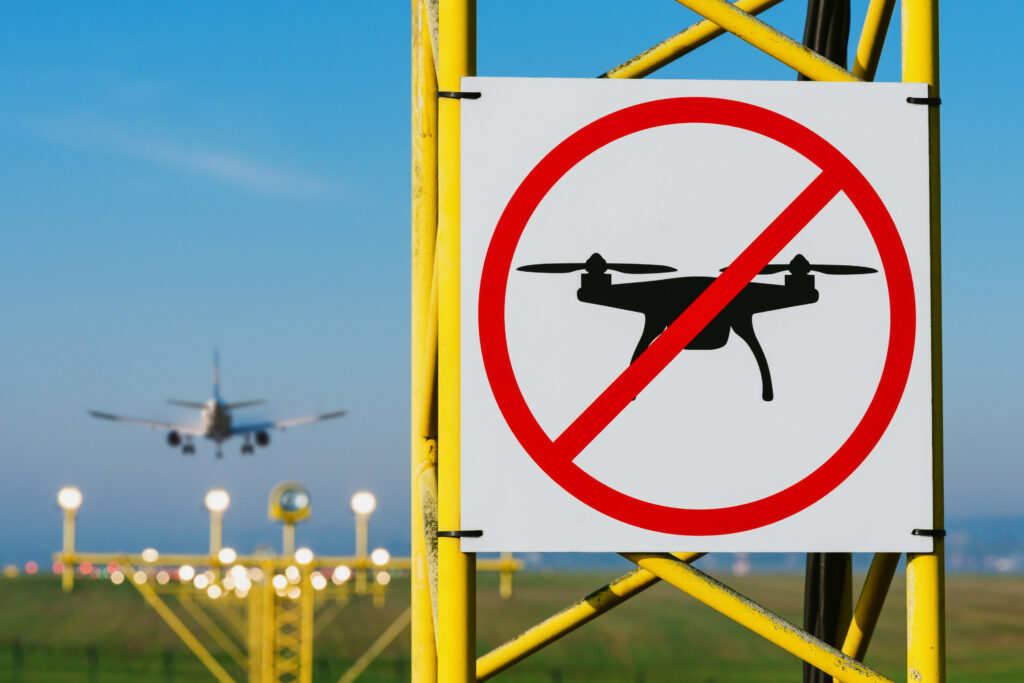
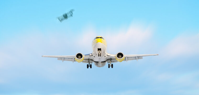
UAVs flying beyond the visual sight of their operators would change the geospatial industries like mapping and photogrammetry, but safety issues must first be more thoroughly addressed.
But, what about our mapping and photogrammetry industries? Well, the situation in this area is somewhat better in terms of advancements in sensor technology and flight times of certain types of aircraft. The advantages of using fixed-wing platforms as opposed to multi-copters is a double whammy of stability and extended flight time, resulting in increased acreage coverage, which now is getting closer to those attained with crewed aviation.
Sensor arena companies such as PhaseOne Industrial (www.geospatial.phaseone.com) have accomplished amazing miniaturization feats by reducing the size and weight of their most sensitive cameras, allowing usage in uncrewed aircraft that now can produce images of similar quality to large photogrammetric formats at a fraction of the cost.
But still, all mapping flights are restricted to compliance with the FAA Part 107 that requires flight within visual line of sight of the operator (VLOS) and that greatly reduces the number of acres that a drone can cover in a single flight.
So, when can we expect flights beyond visual line of sight (BVLOS)? That is the question that has the industry holding its breath for more announcements from the regulators worldwide. In the case of the United States, the FAA has been clear that it is already working on a new set of federal regulation codes that we suspect will be called Part 108. This is the natural progression of Part 107, not only for the sequential nature of the numbers but because it enhances uncrewed operations from highly restrictive to more in tune with crewed aviation.
What needs to happen for the regulators worldwide to accept uncrewed aviation in their national airspaces? Very simply, the technology needs to be redundant enough to guarantee the safety of the flying public as well as pedestrians and ground infrastructure.
One of the major obstacles to upgrading from VLOS to BVLOS is the fact that the controller and the aircraft will not have a direct connection between them and that creates an added degree of dependency in a third technology. Today there is direct radio communication between the operator handling the controls and the remote aircraft. In BVLOS flights that connection will have to be cellular (mobile) technology and handled by a third party, most likely telecommunications companies such as AT&T, Verizon, and T-Mobile, so these companies will be assuming a huge responsibility and that might be one of the reasons why Part 108 keeps being delayed.
The level of redundancy and emergency situations provisions that would need to be in place before any BVLOS flights are permitted are huge, and the uncrewed industry is not yet in a position to guarantee this redundancy.
Issues such as detect and avoid (DAA) have made amazing progress over the past 12 months but still is not enough to convince a regulator that it is 100 percent safe. Companies such as Iris Automation (www.irisonboard.com) have developed sensors that can be mounted onboard any aerial platform and, on the ground, to allow for better detection of incoming aircraft, thus guaranteeing safe separation between crewed and uncrewed planes.
The last snag in this long saga on how and when to integrate these two types of aviation is the issue of air traffic control (ATC). Air traffic controllers are a pivotal part of the entire aviation ecosystem and the demands in terms of stress, fatigue, and duty time are as strict if not more strict than those required for pilots, so regulators are demanding that whatever the industry comes up with in terms of integration, it does not require adding to the workload of air traffic controllers.
The conundrum haunting the industry today is how do we add these uncrewed marvels to the sky without affecting the current safety standards, and how do we do that without coordinating with ATC?
Perhaps the answer is beginning to appear: artificial intelligence (AI). OpenAI’s ChatGPT and the widespread availability of AI tools for everyone to use could be the answer to UAV problem.
Let’s imagine for a second an unmanned traffic management system (UTM) connected to the digital components of ATC and capable of discerning when two aircraft are in a potential collision course hundreds of miles in advance, instead of just seconds before. This is the promise of AI. But given the relatively new nature of the technology, it might not be enough to significantly accelerate widespread deployment of uncrewed aircraft into congested national airspaces. At least it is giving the industry hope that help is on the way.
But the potential of AI is real, and the possibilities for a gradual deployment are tangible given the accelerated nature of its development and the sudden interest in new startups that are attracting truckloads of new investment and will surely expedite the availability of tools that can safely be used in aviation. In the not-so-distant future we will be able to load millions of hours of flights into machine learning algorithms that will create models for AI to predict and anticipate changes in routings, speeds, direction, and any other factor that might affect aircraft in flight, such as weather, unanticipated airport closures, and ground conditions.
Perhaps with the availability of these AI predicting models, a comprehensive deployment of DAA, and a solid UTM in place we will be able, in this decade, to fly longer and higher missions and finally fulfill the promise of an industry that has been waiting for the opportunity to help humanity reduce pollution, decrease dependency on fossil fuels, improve delivery times, and expand mapping and inspection capabilities.
The next 12 months would surely deliver some good news in terms of advancement in all these technologies that are necessary for the regulators of the world to finally approve the full integration of crewed and uncrewed aviation even in the most crowed airspaces.