Category Archives: Hydro/Marine
Remote Sensing in Yellowstone Park
A consortium demonstrates the value of integrated remote-sensing technologies for studying and monitoring the impacts of climate change using the northern range of Yellowstone National Park as a testing area. By Dr. Olaf Niemann, Dr. Robert Crabtree, and David Brown In 2014, a consortium between environmental scientists and an airborne remote-sensing company was awarded funding...
Canadian Hydrographer Certification Scheme
Submitted by Bruce Calderbank, FRICS, CLS, P. Eng. The Association of Canada Lands Surveyors (ACLS) has developed a certification model for hydrographers and offshore surveyors that has been officially recognized by the IHO/FIG/ICA International Board of Standards and Competence for Hydrographic Surveyors and Nautical Cartographers (IBSC) in April 2016 and is now ready to receive applications....
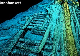
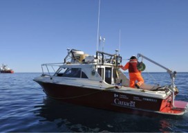
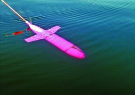
Deep-sea Mobile Mapping
We’re all familiar with lidar-based mobile mapping from ground vehicles, and most of us are aware that aerial lidar is being used effectively to do shallow-water mapping along coastal and riverine projects. Deep-water lidar mobile mapping from an ROV? Well it’s a first for me. Most all of the subsurface surveys I’ve read about were...
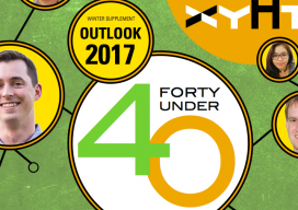
40 Under 40, 2017: Erika Woolsey
CEO AND CO-FOUNDER OF THE HYDROUS CALIFORNIA, USA AS ERIKA WOOLSEY PROGRESSED through her academic and scientific career, she felt something was missing. She said, “[My] message was reaching a limited group of people who already understood the problems.” What was needed to protect and preserve critical ocean habitats was a broader inclusion of stakeholders,...
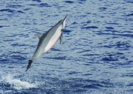
Disparate Data for Marine Life
Remote sensing data helps to inform ocean planning for energy development around the main Hawaiian islands. Using remotely sensed imagery to map physical and biological patterns in the marine environment enhances our ability to understand how environmental conditions change over broad spatial scales (10s to 100s of kilometers) and temporal scales (years to decades). These...
Hydro Insights Part 3
A Case for Big Blue Data Note: xyHt is honored to host insights from Dr. Dawn Wright and Captain (ret.) Rafael Ponce, two distinguished scientists in the fields of hydrography, marine surveying, and oceanography. Parts one and two of our interview appeared in the September and November 2015 print issues of xyHt. xyHt: Terrestrially, a boom is...