Category Archives: Hydro/Marine
Katie MacIntosh
Katie MacIntosh – Senior Hydrographic Surveyor, Subsea 7 – UK We received many nominations from the field of hydrographic surveying. One of the goals of our 40 under 40 initiative is to profile stories that could inspire young folks considering entering our fields, and what we heard from hydrographic surveyors is that many of the...
Hydro Insights, Part 2
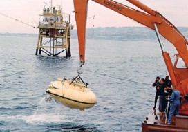
Reviving Interest in the Seas Pictured: The adventures of Jacques Cousteau, his research vessel the Calypso, and his soucoupe plongeante (diving saucer, aka “Denise”) that he co-designed in 1959 captured the imaginations of generations. Editor’s Note: xyHt is honored to feature insights from these two distinguished scientists in the fields of hydrography, marine surveying, and...
A Shore Thing
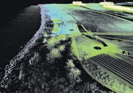
Integrity monitoring the islands of the Hampton Roads Bridge Tunnel involves combining hydrographic survey, lidar, shoreline survey, and terrestrial lidar survey. Rigorous structural integrity monitoring to extend the lifespan of critical infrastructure is an economic necessity. Remote sensing and integrated remote sensing provide new ways to monitor all elements of a structure in fine detail....
Hydro Insights
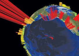
This visualization is of the high volume of commercial shipping activity into and out of ports rimming the Pacific Ocean. The data were analyzed using Esri’s new GIS Tools for Hadoop toolkit. Visualization by Mansour Raad, Esri. Available online at coolmaps.esri.com/BigData/ShippingGlobe with any browser running WebGL. Part 1: Uncharted Depths Editor’s Note: xyHt is honored to...
Quantum Navigation
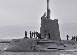
Above: The Royal Navy submarine HMS Astute. Credit: LA(Phot) Paul Halliwell/MOD. Will freezing sub-atomic particles one day supplant GPS as the primary navigation technology? Many of the most accurate measurement devices, including atomic clocks, work by observing how atoms transfer between individual quantum states. The longer the atomic transition can be observed, the more precisely it...
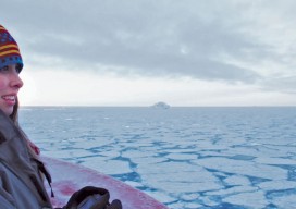
Epiphany on the Bow
Above: Shannon Hoy on the bow of the RVIB Nathaniel B. Palmer as she crossed through the Bransfield Strait in 2011. Photo by A. Margolin. A student’s journey from marine biologist to ocean mapper. Ever since I can remember I’ve wanted to work in ocean sciences. From when I was a child splashing in the tidal...