Category Archives: Sponsored
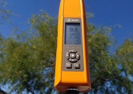
Bad Elf Flex – A Truly Affordable On-demand Accuracy GNSS Receiver
Sponsored by Bad Elf As the saying goes, “accuracy is addictive”. With the convergence of CAD and GIS, accuracy from plan to as-built embodies a critical need. Companies that monitor assets, support compliance needs or manage infrastructure, require systems that support high rigor for geospatial data. In this post, we talk with Larry Fox, Bad...
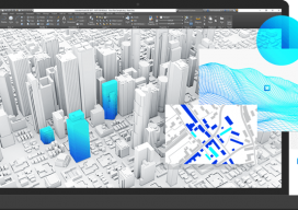
Integrating Location & Design: There must be a better way
Autodesk & Esri Sponsored Content Engineers using building information modeling (BIM) software and geographic information systems (GIS) specialists constitute overlapping segments of the infrastructure project community. Sometimes, they work for the same company or public agency, but often they don’t: for example, the engineers might work for a design firm and the GIS specialists for...
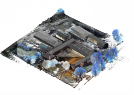
Handheld vs terrestrial lidar for building documentation
Sponsored by Paracosm Above: nmcn’s final CAD model as generated from PX-80 data. The 3D model is situated in the topographical point cloud data. Are these new tools accurate enough? Handheld mobile lidar scanners have gained market share in recent years by offering faster capture in GPS-denied indoor environments, easier documentation workflows for large, complex spaces,...
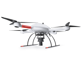
Sponsored: Microdrones goes to new ultra heights
Sponsored by Microdrones The new mdMapper3000DuoG VHR takes ultra-high resolution Photogrammetry from higher altitudes. Microdrones is releasing three new Integrated UAV Systems based on the heavy lifting power, resilience and efficiency of the Microdrones md4-3000 aircraft: the mdMapper3000DuoG VHR, the mdMapper3000DuoG and the mdMapper3000 PPK. The company has also updated the mdTector1000CH4 LR with a...
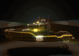
Modernizing Hydrographic Survey Operations with Autonomous Vessel Technology
Nearly every recreational boater and commercial marine operator has benefitted from hydrographic survey data by way of nautical charts, depth guides or maps showing submerged obstacles. Hydrographic data helps to keep vessels safe, but can also guide the strategies of those involved in marine construction, offshore exploration and/or drilling, coastal engineering and zone management, commercial...

How SLAM scanning helps AkitaBox make FM a no-brainer for its customers
Sponsored How handheld 3D scanning enabled one company to capture large assets with unprecedented efficiency Like many new 3D technologies, AkitaBox’s facility management (FM) software was born when someone started asking questions about the accepted way of doing things. When co-founder Josh Lowe explains the genesis of AkitaBox, he talks about how he used to...