Category Archives: Sponsored
GIS Implementation in Construction: Techniques and Benefits
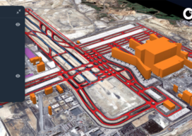
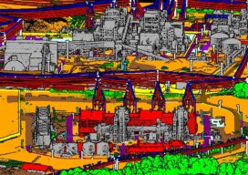
With Aspectum mapping software, construction companies can model objects down to the finest details and monitor project development from start to finish.
A whole new approach, by any measure
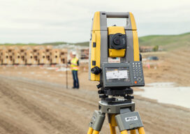
Topcon provides a next generation of products designed to make you more productive and fill the need of a more connected approach to projects.
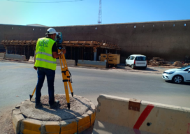
Casablanca’s Median buildings monitored during tunnel Construction
ETAFAT used the Nikon XF Total Station to monitor in real time the effects on the Medina’s aging building
Everything you ever wanted to know about Mobile Mapping
Explaining the tools and technology behind mobile mapping devices for experienced laser scanning professionals looking to make the jump to this new technology. In its short life, the market for 3D as-built documentation technology has seen considerable innovation. Among the myriad new tools to hit this market, nothing has changed the way we capture buildings...
GPI’s Advanced Geospatial Solutions for High-Altitude Mapping Projects
An established user of RIEGL airborne, mobile, and terrestrial sensors and systems, GPI Geospatial, Inc. (GPI) has added the VQ-1560 II to our toolbox of advanced digital sensors to further expand our capabilities.

New Products, Training Highlight Drones’ Increased Role in Mapping and Surveying
Drones are taking on an increased role in the world of mapping and surveying, with some companies specifically tailoring their products to appeal to this market. For instance, the companies UAVOS and Polynesian Navigation Inc. have collaborated to develop a long-distance autonomous UAS for 3-D mapping. Powered by UAVOS’s autopilot, the UVH -25EL unmanned helicopter...