Category Archives: Sponsored
Sponsored Content: Pléiades Neo
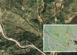
The Satellites with the Highest Spatial Resolution are also the Most Accurate Spatial resolution grabs the headlines when a new Earth observation constellation is placed in orbit. And such was the case in 2021 when Airbus Defence and Space launched the Pléiades Neo 3 and 4 satellites with the highest native spatial resolution – 30cm...
Meet the Future of Mapping and Surveying at XPONENTIAL 2022
Innovation has never existed in a vacuum. Our world’s greatest technological advances are remembered not just for their scientific significance, but for the way they transformed the fabric of society itself. That’s why it’s critical that global leaders in uncrewed and autonomous technology collaborate on cutting-edge innovations that safely, securely, and reliably improve the human...
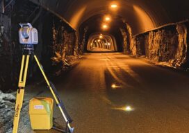
Tunnelling to a New Approach
A surveyor switches from conventional technology to the Trimble SX12, enabling her to match the frenetic pace at six times the speed of multiple-person crews.
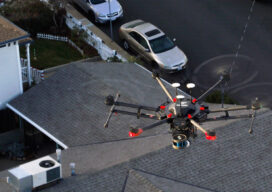
Walden Environmental Engineering Captures New Insights and Revenue
Emesent Hovermap was used by Harkin Aerial to conduct internal and external scans of assets for Walden Environmental Engineering. This resulted in simplified and streamlined projects with improved efficiency.
The Center for the Arts in Nevada County, California Optimizes Operations
Mobile LiDAR scanner Hovermap was used to conduct an internal and external scan of the facility in just over an hour to capture accurate as-builts and CAD drawings.
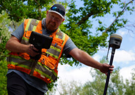
GNSS rover developments give surveyors a new edge
Chris Trevillian describes the Trimble R12i GNSS receiver with ProPoint engine with tilt compensation and calibration-free operation for flexibility, traceability and robustness