Category Archives: Sponsored
In The News: A Geospatial Year at Woolpert 2017-2018
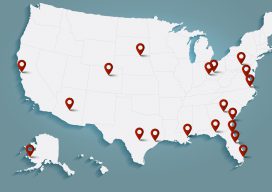
Woolpert has been in business for 107 years, building a strong, broad-based foundation through engineering, surveying, mapping, photogrammetry, lidar collection, GIS, etc., to provide the most comprehensive geospatial support in the industry. In the past year alone our work in each of these sites, represented by these red dots, were spotlighted in the press. They...
LiDAR for Forestry
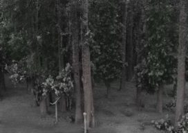
Sponsored by Green Valley Finding DBH Values from Handheld Mobile LiDAR GreenValley International’s (GVI) LiBackpack provides mobile terrestrial and handheld LiDAR solutions that allow users to efficiently capture 3D data. As part of our LiDAR in Forestry applications series we investigated the accuracy of diameter at breast height (DBH) measurements extracted from LiBackpack data using...
Dynamic Environment Data Collection
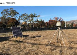
Swift Navigation’s Piksi® Multi is a multi-band, multi-constellation GNSS receiver that supports GPS L1/L2, GLONASS G1/G2, BeiDou B1/B2 and Galileo E1/E5b for RTK measurements and positioning and SBAS for robust sub-meter positioning in non-RTK mode. Critical to the accuracy of—and continuous improvements to—Swift’s receivers is ongoing testing in varying dynamic environments and conditions. This testing...

Power Line Corridor Mapping
Methodologies to Acquisition and Data Processing Sponsored by GreenValley International Routine inspection of power transmission lines is critical for securing uninterrupted distribution of electricity. Traditional, ground-based inspection methods involving teams of surveyors is typically very labor-intensive and time-consuming. Methods for calculating the distance between the sag of the transmission wire and the tree often involves...
New EOS Platform Lets You Run Image Processing Tasks Online
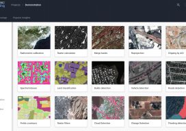
Sponsored Content by EOS Data Analytics Most of your image analysis tasks that required ENVI or Erdas Imagine software are now available online thanks to EOS Platform. This new game-changing cloud service launched by EOS Data Analytics provides GIS professionals with a one-stop solution for search, analysis, storing, and visualization of large amounts of...
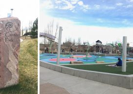
An innovative approach to service. A growing need for robust, relevant data.
With Trimble Catalyst Mobile Data Capture, City of Centennial Efficiently Proves GIS Accuracy Sponsored content by Trimble Since 2008, the City of Centennial, Colorado has partnered with global engineering company CH2M to manage its public works. The successful public-private partnership, often cited as a model of small government, has allowed the city and CH2M...