
Year one of a bold partnership—that the world of infrastructure really needed to happen.
Geospatial Giants
Esri president and co-founder Jack Dangermond and Autodesk CEO Andrew Anagnost both agreed to our interview request to provide insights on the Esri-Autodesk partnership, now entering its second year. Of course, they discussed the specific fruits of the collaboration to date, but they also focused on the motivation and impetus for this historic handshake.
If you’ve ever had to work with one foot in each of the worlds of CAD/CAE (computer aided drafting/design and computer aided engineering) and GIS, you know this partnership is a very, very big deal, for what it has become and what it might bring for the future.
You cannot design in a vacuum.
You cannot build in vacuum.
You cannot operate and manage infrastructure and assets in a vacuum.
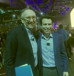
Left: Jack Dangermond, president and co-founder of Esri Inc. is widely viewed as the driving force that brought GIS to the global community and that pioneered the practical and accessible tools that people use to make the maps that change the world. Right: Andrew Anagnost, the dynamic new CEO of Autodesk, is an engineer with a doctorate from Stanford. An atypical CEO, he rose to the position from within the company after 20 years of increasingly key roles. He shared the stage with Jack Dangermond to jointly announce the Esri-Autodesk partnership at Autodesk University 2017. Photo: Esri.
The world—the built environment we inhabit—is growing so rapidly that legacy methods and resources serving architecture, engineering, and construction (AEC) simply will not be able to meet demands. With the global trends of ultra-urbanization, the buildings, bridges, roads, rail, utilities—all the infrastructure needed to be built or rebuilt—inhabit space inexorably connected with existing infrastructure, ecosystems, conditions, and liabilities. It has always been true that you cannot design/build/operate/manage in a vacuum, but in the present day—and every day moving forward—those burdens will increase, but so will the opportunities.
GIS and CAD, CAD and GIS: there is no way to disconnect the two as essential in growing and managing the built environment. For the decades that both have grown to the essential tools we use today, they have been somewhat disconnected. How many surveying, civil engineering, design, and construction entities have had to operate two environments: engineering and GIS? How many of us, out of necessity, have had to learn two different systems? How many have had to work with two systems, two camps, often two departments, and two sets of disciplines that have at times (to be frank) seemed adversarial?
Despite the apparent disconnect, over the years there have been many key areas of collaboration between the two global leaders for GIS and CAD/CAE. Remember ArcCAD?
What’s so different this time? We asked the respective CEOs and have woven their responses in this examination of a new partnership that could solve so many persistent problems. It might seem like we are sensationalizing it by saying that a kind of “cold war” is over, but that’s part of the story.
The key takeaway we see from this partnership (and others like it in the geospatial realm) is that it is a harbinger of a change in mindset and a reaction to an imperative for change.
To Build Anywhere, Any Time
I literally had to flip a coin to choose whose insights would appear first here and came up with Andrew Anagnost, Autodesk CEO.
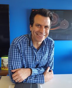
Autodesk CEO Andrew Anagnost, in his office at the company headquarters in the renovated historic One Market Building, San Francisco. Photo: Schrock.
The most recent collaboration between these two geospatial giants began about three years ago under then-Autodesk-CEO Carl Bass (details are in the section below: “Who Asked Whom?). Since Bass’ departure 2017, Anagnost as CEO has overseen the partnership on the Autodesk side. Anagnost is an engineer in aeronautics and manufacturing with a doctorate from Stanford. He has had many roles at Autodesk in his nearly two decades with the company, most notably shepherding the development of Autodesk Inventor
Like Jack Dangermond, Anagnost exhibits seemingly boundless energy and passion for his company and the future. Behind his stand-up desk in his sensible and efficient office at the company HQ in San Francisco, he has a poster diagramming the flight paths of all spacecraft and probe missions throughout the solar system and beyond. Among other passions, Anagnost is a proponent of the commercialization of space.
The interview ranged all over the place, but in a good way: automation, licensing, the cloud, challenges and opportunities for surveyors, and more (we’ll follow up in subsequent articles). But the subject today was the partnership.
Gavin Schrock: The partnership had been germinating for a while. What was your reaction when you first heard about it?
Andrew Anagnost: “My reaction was: it’s about time. This is the kind of partnership that needs to happen. You know when we [Anagnost and Dangermond] talked about it on the main stage [at Autodesk University 2017], we talked about this as our vision to be able to make anything anywhere: a little tag line we put on it.
“It is super important, it is super exciting, and it’s driven by where the world is going right now.
If you look big-picture-wise where things are going, people are trying to manage and evolve the design of urban environments and infrastructure in more sustainable, reliable ways, where they can build a lot more things under the same kind of budget and constraints they have today.
“We know we are all living in a world right now where there is not enough funding, resources, or capability to build all of the infrastructure: that which needs to be rebuilt in the mature world, and to build all of the infrastructure and cities that need to be built in the maturing world.
“At Autodesk we see this as a fundamental capacity problem, a really big deal, a persistent problem. City planners, and people trying to build a city or an infrastructure project that connects a city, they want to visualize the whole thing in context; they want to see the as-planned, the as-designed, and as-built state in a dynamic, intelligent, useful, and persistent city model.
“Esri owns the planning, city-facing context view of what the whole city looks like and the associated data at that scale, and we own the content that shows up inside the models: the buildings, the roads—all of these things.
We need the information from that system to create the correct context for the things we’re designing inside of Autodesk’s InfraWorks, inside of Civil 3D, inside of Revit—all sorts of applications. And they need the actual as-built or as-designed entities to sit intelligently inside their view of the world. We should be seamlessly sharing this information back and forth in such a way that most people never notice that it is from shared applications.
“Esri and Autodesk were once considered competitors, but that didn’t make any sense at all because our core competencies were in completely different areas.
Differences That Unite in Purpose
What distinguishes the different core competencies of the two companies is not as simple as the difference between CAD and GIS (if viewed simply as software), but those structural differences drove some of what would later become discipline-level divisions. To understand the impetus behind this partnership, we also must understand the structural and disciplinary differences and how the recognition of strengths of the other fostered collaboration.

Jack Dangermond, during our interview in his office at the Esri headquarters in Redlands, California. A master at explaining complex concepts, his high energy and passion for his work was clearly evident. Photos: Mai Schrock-Manabe (taken with a Nikon 35mm film camera).
The best explanation I know contrasting CAD/CAE and GIS is from Jack Dangermond in our recent interview at his office in the Esri HQ in Redlands, California. Dangermond, who co-founded, with his wife Laura Dangermond, the Environmental Systems Research Institute, Inc. (Esri) in 1969, did not originally intend it to be a software startup. His background and education were in landscape architecture. You see the influence of his landscape architecture roots in the Esri Redlands campus. Dangermond and his wife have been very hands-on in the design of the campus, the landscaping, the interiors (including ponds with fish and turtles), and building designs that capture light and views of the surrounding environment. It is truly one of the most beautiful corporate or academic campuses in the world.
During the course of Dangermond’s studies, an amazing opportunity changed his plans: to study and work in the Harvard labs on the emerging fields of computer graphics, spatial analysis, and quantitative geography. After Dangermond founded Esri with his wife in his hometown of Redlands after graduation, the company was at first a provider of services on a project basis, but later so many people, governments, and companies recognized the power of what Dangermond and his team could do that they pressed him to make his software a supported product. During our recent interview, Dangermond outlined that history, as well as the evolution of both Esri and GIS in general (we’ll follow up in a subsequent article).
GS: How would you describe the differences between CAD and GIS?
Jack Dangermond: “Let’s start with the core technology. In 1985 I wrote an article, “CAD vs. GIS for Mapping.” CAD is just a fabulous technology, Autodesk’s AutoCAD being the leader, but its architecture is a data model which manages and displays graphics. You store in a display list, in a file, all the little graphic elements. A table, a DXF table, you store a circle, you store a line [and so on].
“In GIS you store geographic features rather than graphic features, in a geographic form with ticks and coordinate [referencing] and attributes in a database, and you would display the geographic features—points, lines, and polygons—by associating the data. Rendering those features with attributes was so much slower in the 1980s. To display as a map of rail lines and roads and text features [was slow back then] because you were generating it from a database and associating the geographic features with the graphic tables on the fly.
“But the distinction [with GIS] was that you could do analytics on these simple geo-relational tables: polygon overlay, buffer zones, and hundreds of others, whereas you couldn’t do those analytics on a graphics-only file. Also [in GIS] you could make multiple views of the data model: you could have a police view, a planner view, a surveyor’s view, a basemap view. All from a single database, but associating graphics tables and attributes with the geographic features.
“It was fundamental difference in the technology—at that time. The advantage of CAD was that was that it had lightning speed, and still does of course, in graphics display. And so, the engineers used it as a graphic engine; surveyors used it as a graphic engine for plotting out the survey information. What I am describing is a simple view of what happened with CAD because people would build add-ons to the CAD data model that could do simple feature and table lookups for graphic display and could add a little geoprocessing to the CAD files. But the core and differences in technology remained.
“And so, Autodesk approached us in the early 1990s to work together to bring GIS and CAD together, and we created a joint project called ArcCAD. It was an extension of the CAD drawing files with simple features to do geoprocessing—that got very popular—it was a very interesting product.
“At that time Autodesk was very ambitious about the idea of getting into the geoprocessing world, so they bought a series of companies and tried to extend the AutoCAD technology in the GIS space. And they acquired technologies that were more or less competitive with us. I think the evidence is that this did not work out, and it isn’t that they were wrong in doing this. I think they were very right in doing it, but their main core business has been in the workflows of engineering design, architectural design, and civil engineering, and that includes the world of surveyors.”
GS: The two communities were divided in some ways but the combined use of both was producing successful projects. But still, there seemed to be two distinct communities—will it always be that way?
JD: “A lot of it has to do with just not having enough capacity to learn multiple sets of tools and not having the capacity to be both an engineer and planner at the same time, and so then little weird things begin emerging: them versus us.
Polarization—not to use a political term—but it is also what the world needs less of. If we are really talking about successful urban management and making cities more livable, operating more effectively, making better investments in infrastructure, we need the opposite of polarization, we need to try to break down barriers between professionals, so they can easily and seamlessly use each other’s data.”
I told Dangermond that we see less of that engineering-GIS polarization all the time. Young and old practitioners alike are increasingly open to incorporating elements of other disciplines into their daily work; the new wave of geospatial and geomatics practitioners seem especially fearless in doing so.
There will always be the light-hearted jabs, like surveyors saying that GIS means “get it surveyed,” but there have been legitimate concerns, like when some might think that a schematic parcel map can hold the same legal weight as a recorded survey by a licensed surveyor. But likewise, there are geospatial practitioners who wonder why the concepts of “fit for purpose” and low-precision features for certain types of analyses meet with resistance; does the source data for the analysis of city-wide economic or environmental data themes need to be precise and accurate down to the centimeter? And then they might also scratch their heads at the notion of just how precise and accurate surveys are when they encounter multiple surveyors’ markers set in a cluster around what is supposed to be one property corner. There are still challenges ahead in bringing the communities together, but a lot of progress has been made so far.
Who Asked Whom?
When we write about partnerships in the geospatial industry, we always try to find out “who asked whom to the dance?” In this instance, a history of collaboration has existed on some levels between these two companies as well as parties at both who had been working towards this new partnership. In all conversation about the origins of this recent partnership, we were pointed to Chris Andrews, senior product manager in Esri’s 3D product management group. Andrews was a major player in bringing the two together and is widely recognized as the author of this partnership.
GS: You had worked at a number of GIS firms, then worked at Autodesk, and now at Esri. Was having experience in both worlds a major influence in your initiative to foster a partnership?
Chris Andrews: “When I joined Autodesk in 2007, because of my familiarity with the GIS market business partner programs and tech, I was tasked with advising partners and development teams at Autodesk in how to be competitive in the GIS space. I moved into the role as technical product manager on the digital cities effort there and was involved from scratch in Infrastructure Modeler (now InfraWorks), originally built as a competitive city-planning-based concept application to go into the market against other GIS solutions.
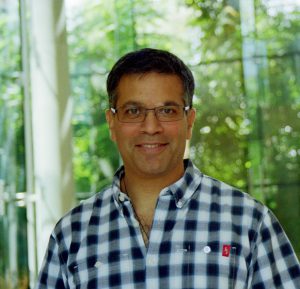
Chris Andrews is senior product manager in Esri’s 3D product management group and widely recognized as a major driver of the partnership. Photo: Mai Schrock-Manabe.
“Over the last 10 years, however, Autodesk increased re-focus on design and engineering solutions, so they looked at what was happening and made strategic decisions. You could see from the messaging on the website and conferences that they do not message much about GIS anymore; they really message about civil engineering, infrastructure, architecture, construction, and all of the solutions and personas that are needed to support those.
“I left Autodesk after being there about seven years and ended up at Esri. When I came into Esri I was approached by one of my [former Autodesk] colleagues and asked if we should start up a conversation about bringing together Esri and Autodesk, both knowing how compatible our marketing strategies had become. Autodesk really had kind of turned orthogonally away from GIS—not that it is not important to them, but just they didn’t want to sell into the GIS user-based market directly. They do still support the GIS industry a little bit, but it’s not their primary focus.
“I told them we should really hold off as I was brand new. Then about a year of my time focused on the ArcGIS Earth effort, which was really important for not only our defense and intelligence community customers, but our beta user stats revealed that 40% of those users self-identified as being from AEC disciplines. That was a pretty big surprise to a lot of folks: more indication that working with Autodesk in the AEC arena would be a good idea.

Theo Agelopoulos, Autodesk director,
infrastructure business strategy
and marketing: a key figure in implementing the partnership at Autodesk.
“Eighteen months in, I reached out to a VP at Autodesk, my former boss, and was connected to Theo Agelopoulos [director, infrastructure business strategy and marketing]. We traded emails. I went up and visited San Francisco [Autodesk HQ], put together a slide deck, talked to Jack [Dangermond] and some directors and tried to manage expectations.
Theo and others continued friendly conversations, and that fall Carl Bass [then Autodesk CEO] came to visit Jack [Dangermond] in Redlands. A real career highlight was to be part of that meeting with them for four to five hours.
“Fascinating to me was: the things I thought they would focus on were different from the topics that they actually spent the most time on. They did follow the thread of the planned discussion, but, considering the history, I thought the conversation around potential Civil 3D integration with ArcGIS would be really hard. I think they jumped through that in five minutes. It was a no-brainer: civil engineers need GIS data, and Autodesk is still going to produce desktop solutions for engineering.
Notable low-hanging fruit was in the initial collaborations, most building off the same kinds of tools available to the respective developer communities for each company: open APIs (application programming interfaces). But each with some direct guidance from development counterparts of the other.
Agelopoulos said that both companies did not want to simply say that it is a great partnership without substance. They wanted to deliver beneficial outcomes for the shared user experience in the first year. The most logical first step for Autodesk was to enable InfraWorks to be able to read data from Esri sources. The result is the recently released Autodesk Connector for ArcGIS.
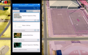
At the 2018 Esri User Conference, Wes Newman, senior technical marketing manager at Autodesk, took us for a test drive.
“This is an InfraWorks model,” said Newman. “Just terrain and imagery: simple model so far. But what we want to do is log into our ArcGIS organization, connect to a wealth of data, and continue building out our model.”
This is exactly what engineers have been doing for many years, but over the decades this might have taken many steps, lots of data conversions, exports, imports, workarounds, lost data, and attributes, and often frustration.
“Bring up a map, and this creates an area of interest from your current project extents,” said Newman. “It geographically filters all of the data from your organization based on that. It is organized by ‘my content,’ ‘my groups,’ ‘public,’ etc. A familiar look and feel for an ArcGIS user.
We select by features we would see in web maps, so both will show as componentized toolsets within Autodesk. This mimics everything we can see for ArcGIS, using their map. There may be one or more feature services underneath each feature.
The most logical first step for Autodesk was to enable InfraWorks to read data from Esri sources. The result is the recently released Autodesk Connector for ArcGIS.
“Select the data types we want and map them over to InfraWorks as objects; they become like 3D objects in InfraWorks. For instance, we can select water utilities: a feature service with a bunch of feature services underneath; select valves and tell them they’ll be like pipeline connectors; select laterals and mains and tell them those will be pipelines. Continue to select, add to the design project, and then they are live connected [not an import per se].”
I asked about survey monuments, and indeed there they were there with the same attributes as in ArcGIS, with document links, and an automated tool tip that brought up a National Geodetic Survey (NGS) datasheet for the monument—live linked from that agency.
When I asked about updates, Newman pulled out his phone, opened Esri Collector (the popular field asset mapping app), and he added a new survey monument to the corresponding feature in ArcGIS in the cloud. And that in turn showed up in the InfraWorks instance. Live, current, and rich geospatial content available to design engineers, construction professionals, asset managers, and more. I think about the decades we spent doing such things with “bailing wire and duct tape” solutions—I could not suppress a wide grin on seeing this demonstration
Initially, key developments from the partnership for the Esri community revolve around the ability to integrate Autodesk Revit models. The data-rich Revit BIM (building information models) will be able to feed essential interior elements to the soon-to-be-released ArcGIS Indoors mapping system and will be useful for fleshing out corresponding buildings in ArcGIS Urban, also forthcoming We asked Jack Dangermond to outline the concepts behind this type of integration.
GS: Is this idea of using BIM models to flesh out city models a move towards the “digital twinning” we hear about?
JD: “I think it will happen building by building. Revit is just a fabulous technology; I haven’t used it but have seen it demonstrated. It is a little database of a building. It supports the integration of all pieces of a building, and it is a transaction database, so when it changes, like down the hall here happening (gesturing to some renovations going on), it is reflected. It is a 3D twin of a building primarily focused on document management. It is not focused on analytics; it is focused on generating graphics, views, engineering design support, and document management for a building—every screw, every light fixture. Every Revit model is different; and there can be many variations.
“Revit and other BIM authoring tools produce a level of detail to optimize the design and construction process. But then there is the challenge of managing these built assets; in a campus you are dealing with tens of buildings while in a city landscape like Hong Kong there are hundreds and thousands.”
BIM is no longer limited to buildings and vertical construction; transportation, utilities, heavy civil are all adopting BIM models and digital workflows. The worlds of GIS and CAD have always bridged to some degree, but with global demands for new and modernized infrastructure, deeper partnerships are an imperative.
Services and Scenes
The ability to manage, almost without limitation, the data and models for an entire city, down to the interior of each building, is something that legacy CAD could not do and certainly that legacy GIS could not. But the way geospatial data is now handled, more as services, has revolutionized that in GIS.
If there is one key concept that we as surveyors and AEC professionals need to begin to understand better, it is that our legacy ways of dealing with data are not going to meet the coming “tsunami of data” (as Autodesk CTO Jeff Kowalski calls it) that has already arrived and will only grow.
Talk of “the cloud” is not passé and not just a buzz term for “someone else’s computers”; it enables these new ways of dealing with data, not as huge monolithic piles of big data but as efficiently accessed live data via “services.” And we are no longer hobbled by having to do full translations of data, with different tools for every data type and source. We asked Jack Dangermond to explain.
JD: “Part of the reason why this relationship is comparatively and relatively easy to implement is because we have moved from client-server to and everything-as-services-in-the-cloud platform. Let me explain more fully.
“We simply say modern GIS today is all services-based; every client talks to the database though services. So, if I’m on a desktop, I’m in ArcGIS Pro, I’m talking to an ArcGIS server through a services connection and a REST (representational state transfer) end point. I find it, connect to it; I’m never really dealing with the record change, I’m dealing with a view of the record change. And that means all the different clients that work at that level operate through REST end points, and those are open APIs. So that means that I can have distributed servers that are interconnected, and my clients can talk to those distributed services.
“If I have imagery, my clients and apps talk to the images by way of something called a web map that is a technical specification, or a web Scene that is a 3D technical specification, or a web layer which is like shape files of the old days. There is the map view, a 3D map view called a Scene, and a layer which is the actual feature behind them. We’ve taken hundreds of individual formats that live all over the internet and can now connect to big data, or real-time data, many types of 3D data, vector data, unstructured data—but we always talk to them through a service.”
“In IT parlance, this is a miracle. There was a phase during the 1990’s where enterprise service busses were created, and there was a whole bunch of them. WebSphere was an example of it, and you would plug your database into WebSphere and you could plug your client into it, so WebSphere was the answer. With the advent of web services and REST, all that went away.
“The ArcGIS portal creates a common language by abstracting multiple geospatial data sets into common view. That means the clients can talk to this distributed geospatial environment through a common set of specifications. And it is completely open. This common language of any kind of geospatial data allows an individual to create a web map and then view it and share it with a community. I can look at a web map in a Story Map, I can look at it on a Dashboard, on a 3D web Scene, I can look at it on a globe like a Google map—it is the intervention of something quite powerful.
“To create smart cities, it turns out that you need a Scene or what we call a Multipatch: you know, a shapefile was simply 2D features. A Scene is a 3D dataset; we invented this about 15 years ago, and it turns out that 3D smart Multipatch dataset really scales well, so I can fly around like you in a Google-like environment, which is a different type of model, but in a Multipatch environment you have a smart feature database with millions and millions of features.”
Warp Speed
The headquarters of Autodesk is in the renovated historic One Market building in downtown San Francisco, near the Embarcadero. On one floor is the Autodesk Gallery, a collection of products and project displays from the global community of Autodesk users: in civil engineering, manufacturing, entertainment and more. The gallery is open to the public (a recommended stop when in S.F.) but is also a meeting space for all manner of industry-related education events.

Andrew Anagnost in one of the open-collaboration style office spaces at Autodesk headquarters.
The day of our interview with Andrew Anagnost a seminar was happening, in the Gallery, about sustainable urban water systems and utilities. I sat in on some of the presentations, and it was very clear that the challenges Anagnost and Dangermond had spoken of, for which the new partnership is intended to help solve, are very real. But there was a sense of enthusiasm and optimism displayed by the attendees—a far cry from dry utility and civil engineering events I remember from days past.
I had heard the company referred to by some as the “Starship Autodesk” and now with Anagnost at the helm, there does appear to be a new mood afoot at Autodesk, this new partnership certainly being evidence of that. I asked Anagnost about the changes in the culture of Autodesk he has observed in his years there.
AA: “One of the big things you need to know about Autodesk is that over the last couple of years we moved to a world where 60% of the employees have been here less than five years. And that is dramatically different than in the past. The company is 9,000 people now; you can’t grow that fast without having a whole new infusion of talent and capability, and this new talent and capability coming in is absolutely evolving the culture.
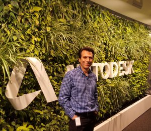
Andrew Anagnost at the “living wall” at Autodesk HQ.
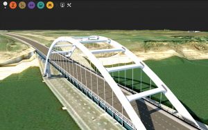
“But there’s a few things that will never change. “Like, why do people come and never want to leave? We are very unique among tech companies in that way—people don’t come to tech companies and never leave—what’s going on? The thing that attracts people to Autodesk and keeps people at Autodesk is the cool amazing work our customers do. People come here, and they go: ‘Wow! So, I’m working on this really intense high-tech stuff, its algorithms, its graphics, its compute power, its cloud, and it goes to these people that basically design everything around me!’ So, they can go home and can say, ‘Wow, you know Autodesk stuff was used on Avatar, on that bridge over there; let me tell you how we did the sequencing for that with our software.’
“This passion for impact hasn’t changed about Autodesk. And the new generation we are bringing in: they are just as passionate about the impact as the previous generation. This speed change of a large company built on delivering desktop software—we used to release software on an annual basis–has moved to one that releases constantly across multiple platforms in the cloud. There had to be substantial structural and cultural changes to do that, and it’s something that requires constant evolution and improvement.”
GS: What would you like to see next from this partnership?
AA: “I would like to see us creating a seamless opportunity in the cloud for our shared customers to have digital representations of the planning state, the in-process state, and the as-built state and be able to feed that information back into the next design. To have a closed loop and have the customer have no idea who is moderating the closed loop; they are just pulling data, using it, moderating it, and getting it from a central place where our respective technologies are feeding that location. And it’s two-way: you can push info in and pull it out, you can take info from the current state to the digital representation and use it to inform the next revision of what you are trying to do.”
GS: Digital twins?
AA: “That digital twin might actually be a twin set of twins: data residing in both, say an Esri and Autodesk environment, but make up effectively one digital twin.”
Geospatial Partnerships

The Esri campus in Redlands California is a wonderful blending of landscaping and buildings designed to capture natural light and harmonize with the surrounding. Jack Dangermond, who studied landscape architecture, together with his wife (and Esri co-founder) Laura Dangermond, were hands-on in the design of both the exterior and interior of the Esri campus.
Both Autodesk and Esri, throughout their histories, have entered into numerous partnerships with other companies. For instance, Jack Dangermond recalled the long-standing partnership with Trimble, which produced what many consider to be the first GPS handheld designed specifically for GIS data collection.
JD: “I finally met Charlie [Trimble] in India recently. We were very friendly with each other back in the 1980s 1990s; we did a lot to help him get going in our community by building bridge technologies. We packaged ArcView with his [products] and we resold his GPS equipment. This began all around that Desert Storm period, around 1990-1991. We had actually never met during that time; we communicated with other, we built strong markets, we really did a lot for each other. We continue to collaborate with Trimble. Then, decades later I meet him at a conference in India.”
Autodesk has partnered with other geospatial companies as well, and some recent partnerships have generated a lot of interest in enabling many more people to be able to do mass data capture, scanning, and remote sensing, such as a collaboration with Leica Geosystems on the BLK360 scanner.
AA: “Leica and the BLK360: that was an example where we were building stuff inside Autodesk, took a look, and realized that there’s people that could do parts of this better than us, and we’ve got so much work to do over here. So, we basically just started saying, ‘Hey, would you like some of this?’ And guess what—better outcomes were coming up.
“This is not the end of big partnerships. You’ll start to see them in other places, but you know, we’re interested in partnering with people that are best in class for their particular space. To expand, we have a real abundance-mentality here that there are more problems that need to be solved than any one company can solve. There will be a lot of partnering that will accelerate the adoption of certain key technologies for everyone.”
The Imperative
At the close of the respective interviews, we presented each of these two dynamic leaders of forward-facing companies token gifts from the days of geospatial past—before anything was called geospatial. Jack Dangermond, who has often spoken of his appreciation of surveyors and surveying, received an 1870 Gurley Surveyor’s Transit, a gleaming brass engineered wonder of those days. And to Andrew Anagnost we presented a 1936 K&E catalogue featuring beautifully drawn figures of the drafting supplies of that era.
We presented those to underscore the point: such an instrument and the supplies in the catalogue represented the state of the art in those eras and were essential in AEC projects of the day. But those would be nearly impractical to try to use for projects and asset management in today’s accelerated world. Change and modernization are an imperative.
Our gifts emphasize how accelerated our world has become by necessity. Since the publication of that catalogue in 1936 the population of the world had doubled, and since 1870, the year of the manufacture of that transit, the world’s population had more than tripled. The progress in AEC, geomatics, and geospatial tools and solutions since has managed (mostly) to keep up with the demands born of this rapid growth in global populace. But it will get tougher, and especially if we continue with legacy compartmentalized design-build-operate-manage processes.
This partnership is significant on many levels; there were multiple imperatives for it to happen.
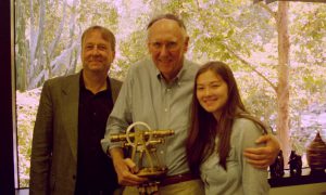
The author (left) and daughter Mai (right, who took many of the photos for this article) present an antique surveyors’s transit to Jack Dangermond for his ongoing support of surveyors and surveying.