
A First for Africa
Geospatial professionals don’t need an introduction to CORS. For everyone else, it’s an acronym that stands for continuously operating reference systems: geodetic receivers that log GNSS observables continuously which, when transmitted to users with survey-grade receivers, help them achieve centimeter-accuracy measurements.
CORS stations have a range of about 70 kilometers (~43 miles), which necessitates the existence of a network of the same to offer maximum benefit to users regardless of their location (this network enables a user to connect to a CORS station nearest to them). A wide spectrum of professionals benefit from a CORS network, including surveyors, geodesists, meteorologists, geographers, civil engineers, crew who operate machine control, etc.
In order for a professional to connect to the nearest CORS station, he or she must be aware of its existence, the agency running it, and what charges apply. In some countries, the government sets up and maintains the CORS stations and subsequently offers the logged data free of charge. In other countries, private individuals set up their own stations and offer the logged data to users for a fee.
In both cases, a potential user must log in to a platform that informs them of the distribution of the CORS so that he or she can connect to the nearest one. So, a question begs, which platform would one visit to access this information? In the U.S., for instance, one would visit the National Geodetic Survey website where all the CORS stations, both public and private, would be clearly spelled out on a map on the platform.
If you want to access a CORS station in Africa, where would you start? It is this conundrum that led to the birth of CORS Map, a platform that provides searchable map information about all the CORS stations in Africa (their location, status, receiver type, antenna type, agency, etc.). Founded by a team of three geospatial professionals across three continents, CORS Map seeks to put Africa in the CORS network conversation.
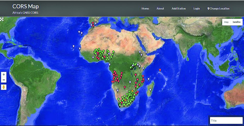
A screen cap of the CORS Map in map terrain mode.
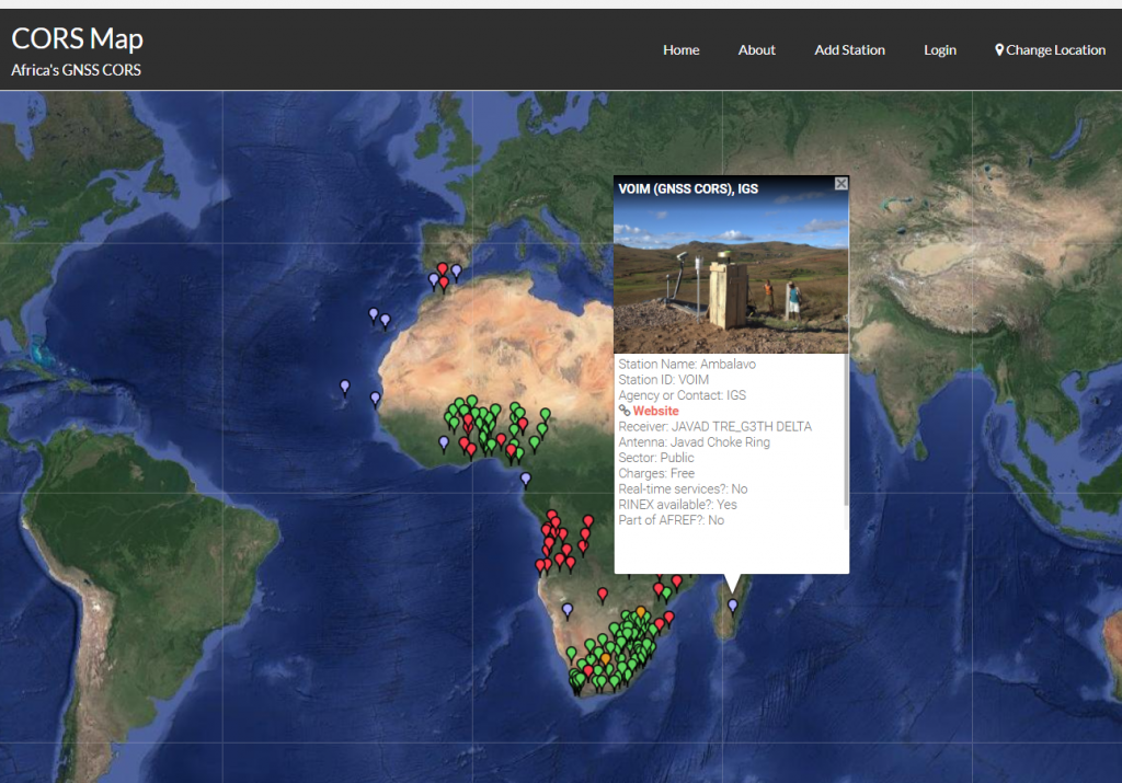
A screen cap upon clicking a bubble icon.
To access CORS Map, a user needs to visit corsmap.com. However, CORS Map is not a finished product; getting CORS information from all the 54 countries that make up Africa is an uphill task. That is why professionals want to form a community around their platform that will enable them to reach out to all of Africa.
The countries covered so far by CORS Map are South Africa, Uganda, Rwanda, Mozambique, Angola, Nigeria, Benin, Burkina Faso, and Kenya. A user can search the four-digit code of a CORS station, and results are displayed on the map. There is also background information about the station, a picture of the CORS site, and the agency running the station so that a potential user can follow the link and get connected. CORS Map thus acts as a liaison between CORS providers and users.
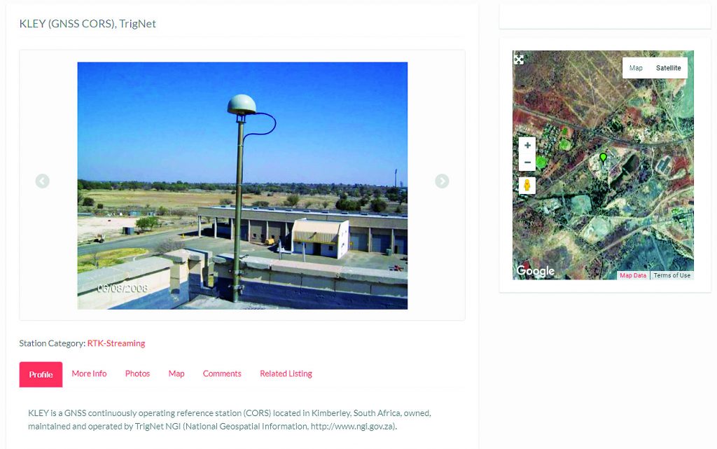
A sample screen cap of a CORS station detail page for exploring meta information.
The team has also tried to distinguish between which stations are streaming or non-streaming, which form part of AFREF (African Geodetic Reference Frame) or IGS (International GNSS Service), as well as which offer data in RINEX format.
Since CORS Map is a work in progress, the team is doing painstaking data-mining to ensure the map is a true representation of all the CORS stations in Africa. Therefore, if you operate a CORS station in Africa that is not presented on CORS Map, give the team a shout so that it can be well captured. Also, if a country is not represented, chances are either there are no CORS stations there or the team has not succeeded in obtaining data for the particular country.
To form part of the CORS Map community, you need only to register with a username and password. Once part of the community, you can add a station, post something interesting, and get loads of information about CORS in Africa. A visitor can reach the team via info@corsmap.com.
If you work in the region, join the CORS Map community today and become part of the CORS network conversation in Africa.
Image at top: A CORS antenna is installed in Mozambique.