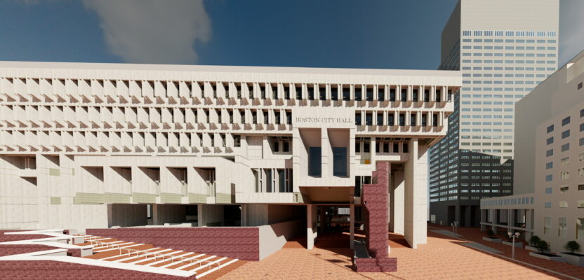
Ahead of its planned restoration works, Boston City Hall has been digitally re-imagined with 3D scanning technology, enabling architects to plan improvements for the iconic government building.
Completed in 1968, the construction of Boston’s government building sought to boost the city’s economy, modernizing the urban center while reinvigorating and refreshing the neighborhood of Scollay Square.
Although considered a leading example of ‘brutalist’ architecture in America, the City Hall caused great controversy among local Bostonians, dividing opinion with its rigid and largely concrete design.
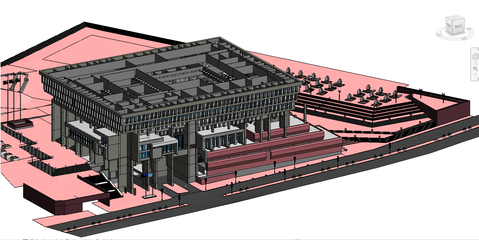
Since 2017, Mayor Michelle Wu and the City of Boston have embarked on a 50th anniversary restoration plan, in partnership with architecture and landscape design firm, Sasaki.
While addressing necessary building repairs, the proposed 30-year project will see the implementation of constructional improvements to better serve the local community for current and future generations.
Spanning a total of seven acres, the planned infrastructure upgrades for Boston City Hall and its adjoining plaza include measures to improve accessibility, the addition of new seating and gathering areas, as well as a destination playground, public art spaces, greenery and water feature fountains.
 In anticipation of the renovation project, Peter Garran and his team from data capture specialist, Aerial Genomics, were appointed by Sasaki with the task of mapping both the interior and exterior of the City Hall. Spanning nine floors, the intricate structure features both concrete exteriors and interiors, complete with a vast atrium and elevated walkways.
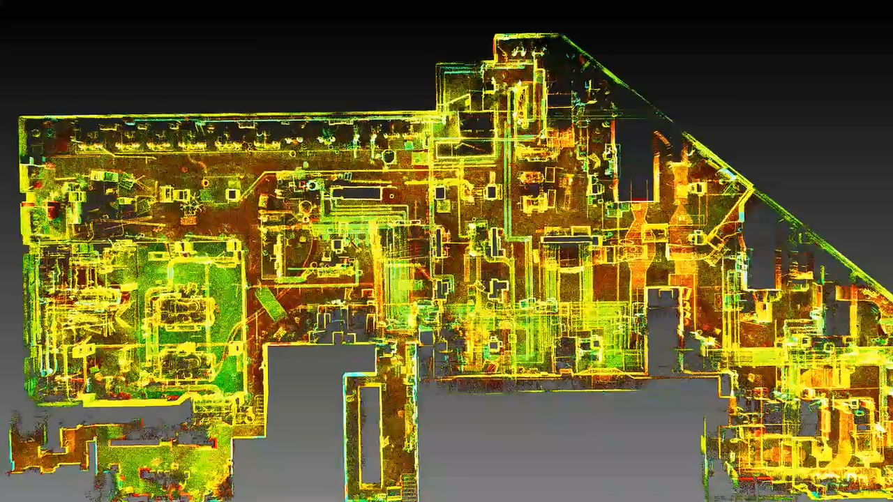
Due to the size and complexity of the building, plus the logistical challenge of minimizing the disruptions of everyday operations and confidential government matters, the team opted to use mobile lidar 3D scanning technology as a fast, reliable and cost-effective means of collecting the data and selected the GeoSLAM ZEB Horizonhandheld scanner to digitally map the exterior and inside of the main hall. The ZEB Revo RT was used to scan the building’s interior of more than one million square feet.
“The scan was conducted during the pandemic, making it imperative that my team and I spent as little time inside City Hall as possible,” said Peter Garran, founder of Aerial Genomics. “GeoSLAM’s walk-and-scan method of data collection removed the need for bulky equipment and tripods, allowing us to complete a full and comprehensive scan as quickly and as safely as possible.
The interior and exterior scans were completed in just four evenings, working solidly for five hours each night. The data was processed and compiled using GeoSLAMs processing software, and merged together to create a single point cloud. This data was used as the foundation to create a BIM Model, using Autodesk Revit, to send to the architects.