Heights 2023 Archives
The Future of Aerial Photogrammetry

Rapid advances in technology are changing the way we map from the air, but the 100-year-old technology of mapping by crewed airplanes will continue to fly into the future For thousands of years cartographers made maps using tools that mostly measured angles and distances, allowing for positioning of fixed objects over unknown topography. The earliest […]
Watching Rotterdam (and More)

What are drones doing Inside Europe’s biggest ports? Doing what they do best, of course, which is to fly. After years of test flights, authorities at the Port of Rotterdam in the Netherlands have given the go-signal to integrate UAVs in its operations, making it the first in Europe “to organize its own airspace […]
From Nadir to Oblique

Spic-and-Span Bridges Inspecting the world’s iconic bridges is becoming a UAV job When it was time last year to inspect the Sydney Harbour Bridge, the steel arc structure that spans the harbor of Australia’s capital, authorities Down Under turned to the latest technology available: drones. “The sky’s the limit when it comes to this technology. […]
Add a Drone to Survey Fieldwork
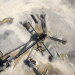
Innovative drones offer a fast, accurate option for large-area survey data collection Since the first use of drones for commercial purposes in 2006, the drone industry has rapidly gained momentum and introduced new capabilities to serve a wide range of applications. Surveying and mapping projects pose unique challenges due to the importance of accuracy and […]
Tackling the Aerial-to-CAD Bottleneck

Aerial capture is getting easier and faster, but the subsequent step of CAD linework generation is a bottleneck—especially given the present shortage of qualified drafters. AI is stepping in to help. In 2017, the co-founders of what would become AirWorks Solutions Inc. first met and began discussing ideas for a new geospatial venture. Both had […]