Innovative drones offer a fast, accurate option for large-area survey data collection
Since the first use of drones for commercial purposes in 2006, the drone industry has rapidly gained momentum and introduced new capabilities to serve a wide range of applications. Surveying and mapping projects pose unique challenges due to the importance of accuracy and reliability. With the improved stability, range, and accuracy offered in advanced drones today, surveyors have a versatile tool to add to their data collection options.
Continuous improvement
A small number of drone manufacturers offer a stable platform and high-quality accurate images that meet the strict requirements for surveying and mapping projects. When Dutch company Atmos decided to enter the surveying market in 2016, they began a successful collaboration with Sony Digital Images to integrate Sony’s cameras with Atmos’ high-end vertical takeoff and landing (VTOL) fixed-wing drones.
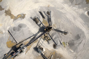
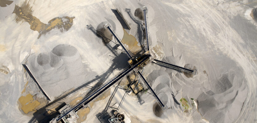
Drone imagery provides an aerial perspective for mining, construction, environmental, and agriculture applications. Photo courtesy: Atmos
The most recent version of the Marlyn Cobalt drone now includes the Sony ɑ7R Mark III or IV digital camera to optimize the coverage and accuracy that can be achieved in a single flight and better serve the surveying and mapping sector.
“Sony is the best in the business and already had experience working with drone manufacturers, so it was not a difficult decision,” said Joost Bouman, head of production and founding partner at Atmos. “Their willingness to work closely with Atmos on integrating the camera and the evolution of the SDK over the years has helped improve performance tremendously.”
The Marlyn Cobalt drone is designed with surveyors in mind. The VTOL drone is capable of autonomous flight with a pre-set flight plan, allowing the operator to focus on ground and airspace conditions rather than navigation. There are multiple safety features built in, including navigation lights visible in the air to other traffic and geofencing to avoid prohibited areas. If the radio link is interrupted or weak, the drone automatically returns to the operator, and if the drone drops below 30 meters, it transitions from airplane to helicopter mode and hovers at that position until the operator takes over.
“Safety is a priority—our step-by-step preflight checklist guides users through the inspection of each part of the drone—GPS, motors, everything,” said Vasilis Tziampiris, marketing lead at Atmos. “During the flight the operator uses a Windows-based device to track the pictures taken, wind speed, and battery life to ensure complete coverage.”
Attention to detail
Sony has an excellent reputation and a long history of innovation and quality represented by a range of cameras that are ideal for mapping and surveying, inspection, and surveillance. With 35 years of experience developing digital cameras, Sony is the camera of choice for several innovative drone companies as the industry continues to experiment and expand its capabilities with new designs.
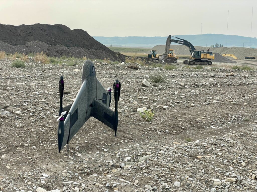
The Atmos Marlyn Cobalt VTOL drone combines the efficiency of a fixed wing drone with the convenience of vertical takeoff. Photo courtesy: Atmos
“We feel that customers want a full solution—camera, drone, software—that is integrated and will work reliably even in extreme conditions, from deserts to glaciers,” said Yasuo Baba, director digital imaging at Sony Digital Imaging Europe. “Through collaboration with Atmos we deliver excellent features and functionality needed for surveying and mapping projects.”
The Sony ɑ7R Mark III (42 MP) and IV (61 MP) are advanced full-frame cameras commonly used by professional photographers. These high-resolution cameras include high-speed CMOS image sensors with autofocus, capable of shooting 10 frames per second.
“The ɑ7R Mark III and IV are the gold standard thanks to high resolutions that allow drones to fly higher while still capturing great detail,” Baba said. “They are compact and light compared to DSLR cameras. Weight is important to allow the drone to fly as long as possible to maximize efficiency.”
The Marlyn Cobalt drone is designed so that payloads can quickly be swapped out for different projects. In addition to the Mark III and IV cameras, the drone accommodates multispectral cameras and thermal sensors.
“Sony consults with and learns from drone companies to determine what they need for future development, so we all are moving in the same direction,” added Baba. “The Camera Remote SDK continues to be developed and improved to maximize compatibility with our cameras.”
Broad range of applications
The Marlyn Cobalt was released in March 2021, with some updates applied since then to increase flight time and improve performance. The design combines the efficiency of a fixed wing drone with the convenience of a vertical takeoff that needs only a two-by-two-meter area to launch or land. The integrated Topcon Post Processing Kinematic (PPK) helps achieve accuracies as low as one cm without ground control points, just a base station or virtual base station.

High-resolution Sony cameras are fully integrated with the Atmos drone to facilitate data collection and processing. Photo courtesy: Atmos
Surveying is the primary target market, but sub-markets include construction, mining, environmental projects, and agriculture. Custom inhouse software was developed to meet the specific needs of surveyors, such as scanning a certain area and properly defining the area based on a coordinate system. The software analyzes the job and determines the most efficient way to map it.
“Projects requiring high-accuracy-data collection over large areas benefit the most from the Marlyn Cobalt VTOL drone. Small projects are better done with smaller drones,” said Bouman. “We focus on giving customers more flight time, which allows them to access hard-to-reach areas, and our drone is wind resistant up to 45 km/h (28 mph) so the flight window is extended even when conditions are not ideal.”
As Beyond Visual Line of Sight (BVLOS) rules evolve, drones with the endurance to fly long distances will be in demand. To prepare for anticipated regulations, the Marlyn Cobalt is already equipped with a remote identification system that allows people on the ground to identify unmanned aircraft in the area.
“We have customers who map thousands of hectares in a week,” Tziampiris added. “The data is very versatile. The large volume of photos produced can be converted into 3D point clouds, topographic maps, progress maps to monitor projects, volume calculations, as-built surveys, slope measurements, and more.”
The drone industry continues to push the limits of technology to meet the needs of the surveying and mapping profession for a variety of applications.