Tag Archives: uav
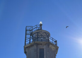
Saving Alcatraz (Digitally)
The infamous island is under attack by climate change, rising sea levels, and old age. Can scanning it from the sky and on the ground preserve it? When the first functional photogrammetry uncrewed aviation vehicles (UAVs) became mainstream technology around 2013, geodesists and land surveyors around the world adopted these flying wonders as an innovative...

xyHt Digital Magazine: May 2024 Scanning
xyHt magazine’s May 2024 issue focuses on UAVs and their continued expansion in the geospatial fields. As always, if you don’t have a subscription to our print edition, or if someone else in the office has snaffled your copy, don’t fret, here is the digital edition. Click here or on the cover to the right, to...

AI, 5G, and Geospatial Tech Team Up to Predict Wildfire Threat
AI, 5G, and Geospatial Tech Team Up to Predict Wildfire Threat

Sponsored Content: How Navigation Systems are Guiding the UAV LiDAR Revolution
Introducing UAV LiDAR When the idea of integrating LiDAR (Light Detection and Ranging) technology into unmanned aerial vehicles (UAVs) first emerged, it sparked a new paradigm for both technologies. Suddenly, UAV operators not only gained a bird’s eye perspective of the land their aircraft flew over but also the ability to simultaneously generate 3D...

AI in the Sky
Will artificial intelligence solve the beyond visual line of sight problem for uncrewed aerial vehicles? For more than a decade now we have been moving more and more processes and tasks from crewed aviation to drones in a variety of industries, but the promise of widespread massive deployment of these electrically powered wonders is still...
Is It Really Impossible?
Looking Forward As the saying goes, it’s only impossible until it’s not. In the past when I’ve heard, or used, this bon mot I would think of the moon landing in 1969. I think of all the early astronomers who gazed at and intensely studied heavenly bodies, using them for navigation and location while knowing...