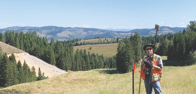
Above: Darrell Hanners, LSI completes a topographic survey in the mountains of Caribou County, Idaho.
As old-timers retire and fewer young people enter surveying, we are at a turning point where mentoring is crucial to the future of the profession, but we will need to adapt to mentor well.
Land surveying is an ever-evolving profession. New technology, new coordinate systems, and new datums all make it difficult to keep up with the latest trends and the newest developments. Even for someone like me who grew up in the age of technology, at times it is difficult to wrap my head around.
Because of GNSS, robotic total stations, UAS, and 3D scanners, fieldwork is being completed with less manpower. For many companies, the days of three- or four-person crews are no more. Firms can now get the same or comparable production from one or two field members versus an entire crew of surveyors.
Thus, the typical surveyor’s evolution from rodman to instrument man to crew chief is happening much less often because there is no crew to evolve in.
Mentoring Not Button-Pushing
The truth is that automation and technology cannot perform all of the fieldwork or—importantly—make the critical decisions that a person can. Fundamentally, measuring is what we do, but it is such a small part of the product that we deliver.
Understanding the laws and principles along with having the ability to measure and calculate accurately and precisely is what makes a good surveyor. On top of that, a field crew must know what monuments to look for and why, and why we measure this and not that.
However, the increase of automation and decrease in crew sizes and the number of people needed to execute certain tasks is making it much more difficult to provide direct mentorship that teaches these skills and knowledge.
Time and time again, I hear the argument that one-person crews will be the downfall of our profession and that mentoring is being lost. I believe that on-the-job training is still one of the most important aspects in the surveying profession; in fact, one cannot become a licensed professional without it.
Yet, teaching field personnel to set up equipment and collect data is not mentoring and can be a dangerous practice without it. Surveying and geomatics are so much more than pushing buttons. The instruments that we use have changed significantly; however, the analysis and interpretation of the measurements has not.
New Tech; New Mentoring
We must continue to train the greenhorns to become good surveyors, but we may not be able to train them in the same way we used to.
Mentorship should not be lost, but it does need to be done differently. Mentors have always been integral to the process of becoming a land surveyor, and that it is not going to change. Firms are being forced to adapt to find a way to teach the next generation of surveyors. The profession is not dying—it is changing—and we must embrace the change.
I will share with you my company’s approach to mentoring and show you how our team members are learning in the absence of conventional mentoring.
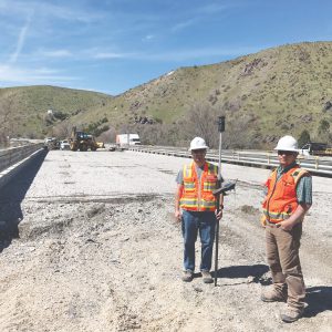
Adam Thayer, LSI and Brent Christophersen work on a bridge rehabilitation project.
Mentoring with a Small Staff
First, let me give you some background on our firm. We are a small surveying company serving southeast Idaho. We provide a variety of services, including boundary and ALTA surveys, topographic surveys, construction staking, land planning, and HDS and UAS surveying.
Currently our team consists of two licensed surveyors, two survey interns, and a handful of technicians. Each member of our team wears many hats and has the opportunity to manage their own projects with varying levels of responsibility and oversight.
Most of our projects are overseen by the PLS, with the LSIs getting the opportunity to manage the daily tasks and oversee the technicians who aid in the performance of the fieldwork, drafting, and calculations.
Our survey technicians are taught from the beginning the basics of both office and field tasks. Setting up the instrument; doing data collection, calculations, analysis, drafting; writing legal descriptions; and doing terrain modeling are all duties that each of the team members share.
On our team, there is no differentiation between field and office personnel because we all spend time on data collection as well as in the office producing the deliverables.
For me, this is the best of both worlds. We do not have dedicated crews, so we all get to share ideas and learn from one another. This dynamic allows experiences to be shared throughout the entire team. And although one-person crews are sometimes necessary, we have found ways to make sure all our experiences can still be used as teachable moments.
Our staff meets regularly to share any problems and solutions we have encountered on projects, and through this dialogue we have the opportunity to learn new skills and how to handle difficult situations. The culture we have established through our team allows us to have an open dialogue and provides everybody the opportunity to mentor one another. I believe that this model has allowed us to create a quality product and become well-rounded surveyors.
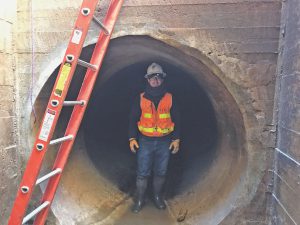
Thayer surveys the alignment of the Siphon Canal in Chubbuck, Idaho.
Making College Work in Idaho
Many of our technicians are currently students or are graduates of the local college, Idaho State University (ISU), that offers both bachelor’s and associate’s degrees in surveying and geomatics. These individuals have a vested interest in the profession and have shown that they are dedicated to learning and have the ambition to become a surveyor.
In the past few years, many of our technicians have graduated, passed the FS exam, and are now either licensed or gaining the experience necessary to become licensed.
More and more universities are offering their courses online as the demand and shortage of licensed surveyors continues to grow. Like Idaho, many states are requiring a four-year bachelor’s degree for a person to become licensed. ISU’s four-year program is offered both completely online as well as in a traditional classroom setting. For distance-learning students taking courses that include a laboratory component, the student’s local mentor, often their employer, is responsible for conducting and supervising the laboratory activities.
Idaho’s licensing board recognizes the value of those serving as mentors because they provide a critical function that makes the program accessible for a broader group of students. In this upcoming year, the board is proposing that mentors would be eligible for up to eight continuing education credits per year. These online programs are great for individuals who have surveying experience and are seeking licensure but lack the education component that is often required.
Another helpful program offered by ISU is the Technician Resource Initiative-Practical Online Development, or TRIPOD. Through TRIPOD, survey technicians can earn college credits and gain additional certifications while working in their current positions. Ultimately, students will be prepared to take the NSPS Certified Survey Technician Examinations, Levels 1, 2, or 3.
As college programs incorporate distance learning into their curriculum, mentoring has a significant impact on the students’ ability to achieve the hands-on learning that is required.
I am grateful for the mentors from early in my career who have challenged and inspired me to become a better professional. And now in this new age of automation, while my company’s solutions don’t cover all possibilities, we have had success in training the next generation of surveyors with our model of mentoring.
Quality mentors are crucial to the advancement of the profession, and we must make mentoring a priority to ensure the future success of the surveying profession.