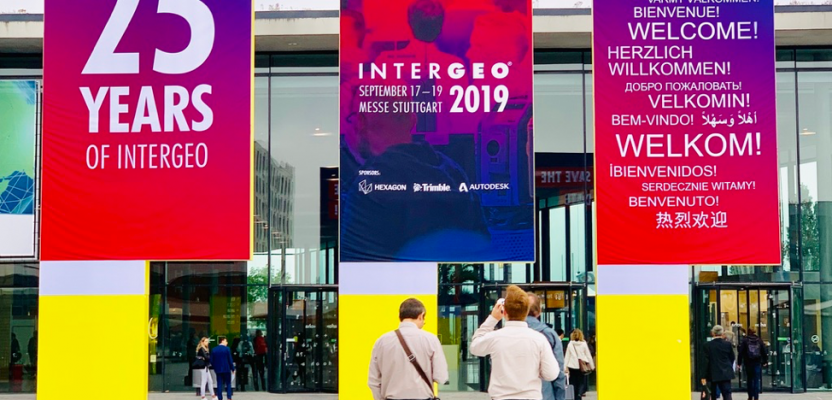
INTERGEO, the world’s largest summit in positioning and geospatial tech, wrapped up last week in Stuttgart, Germany, proving that even after 25 years it still can be a great show. It’s the biggest geospatial event of the year where companies around the world showcase their current innovations for the industry, and the xyHt team was there to check out the latest trends.
The success of the three-day get-together visibly points to how much INTERGEO has evolved after a quarter of a century. With more than 600 companies and several side events that filled up four halls for three days, it’s a far cry from the original bunch of 185 exhibitors that came together to market their mostly analog wares way back in 1985.
Still, INTERGEO’s original vision to highlight the best innovations in the geodesy industry has not receded. In many aspects it has become not only bigger but also better by including everything geospatial: UAVs, imaging, positioning, and geo-information. During this past week at INTERGEO, I saw a stronger focus on the use of digital tech in mobility, utilities. and construction. And it was a pleasant surprise to see familiar faces and companies pitching their current work on creating smart cities, building information models, and virtual augmented reality.
As there was so much to see and digest during the show, expect that I will write more about it in future articles here at xyHt. In the meantime, here are my key quick observations of outstanding tech trends at INTERGEO.
Location, Location, Location
Project managers are always going to need precise location information, so unsurprisingly companies showed off their most powerful GNSS RTK receivers this year. Not only did I hold in my hands new equipment that promises better precision and mobility and the best satellite coverage, but I also noticed that manufacturers have added better after-sales service plus other useful functions such as rugged-ready IP68 certification to be able to work in any condition, as well as support for calibration-free pole tilt compensation. It might be a good time to throw away your leveling poles and do projects in weather-challenging locations!
Fly Longer and Take Better Images
UAVs were in full force during the event, even more compared to last year. But what struck me the most was not the different drone designs that I saw there. Instead I was drawn towards drones that promise to stay longer in the air, more than the usual 30 minutes on a single battery charge. Longer flight time makes sense for UAV pilots because it would mean that more data could be collected in one go, translating to cost-effective imaging projects.
I also got to see the latest industry-grade cameras that can capture not only RBG photos, but also 3D images, thermal views, and spectral indices. Pair your UAV with any of these incredible camera payloads, and surely you can do any drone project related to construction, utilities inspection, and agriculture.
Automatic is Fantastisch
Automation is no longer a figment of the imagination, as it was present all over INTERGEO. Do you want to automatically create laser-scanned models of construction sites, even of wet concrete? Check. How about automatically extracting real-world features from your point cloud? There’s now a tool for that. Moreover, the workflows to capture geospatial information can also be automated, starting from the collection of data in the field using different tools and then sending that information in real-time to your screen or to your eye- and ear-piece so that you can make quick and informed decisions. Customers are clearly not risk-averse towards automation, contrary to what was previously thought, so companies are meeting that need to automate in order to trim down project time and costs.
Sky-high with AI
Likewise, Earth observation companies showed how artificial intelligence is now being used to extract roads, buildings, and other infrastructures from high-resolution satellite imagery data. It’s obviously sensible to let machine learning tools and computer vision technology process large imagery datasets with inputs from human experts due to the time and computing power needed to handle such bulky information. What’s more, allowing data capture and data processing to be partly or entirely handled by machines will have positive economic impacts not only in the architecture, engineering, and construction industries, but also for the insurance sector and for smart cities. What may at first glance seem like an intrusive technology actually looks set to benefit society.
With so many new and exciting innovations that came out this year from the geospatial industry, what else is in store in the next 25 years? We’ll surely have a glimpse of that next year at INTERGEO in Berlin. I hope to see you there!

This article appeared in xyHt‘s e-newsletter, Pangaea. We email it twice a month, and it covers a variety of unusual geospatial topics in a conversational tone. You’re welcome to subscribe to the e-newsletter here. (You’ll also receive the once-monthly Field Notes newsletter with your subscription.)