Tag Archives: @Dragons8mycat
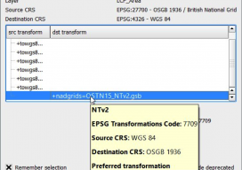
Using OSTN15 with QGIS
As you may be aware, the United Kingdom has a new transformation model that is OSTN15. But why? What does it mean to the geospatial community? Without being too nerdy, tectonic plate movement means that the “model” surface (the geoid) is slowly moving away from being the best fit for the coordinate system. It has...

Pokémon Go Leads the AR Revolution
Six months ago when I claimed that augmented reality was the future of GIS and geospatial services, it was met with a few sniggers. This week has seen the arrival of Pokémon Go, one of the most popular games to hit the mobile phone market, and yes, it is augmented reality and yes, it is...

Trolling: Always Get Independent Advice & Avoid the #geotroll
Ever since I started tweeting and blogging, I’ve received messages about using certain software, or how expensive a software is, or sometimes threats over my choice of software. It falls on deaf ears; I am independent. ANY geospatial software, no matter cost or design, is worth considering to some respect. Sure, some may meet your...
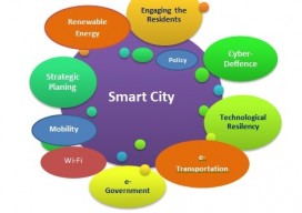
Do Your Work Right (and You Can Be ‘Smart’ Too)
Ever since I saw the phrase “smart city,” I have cringed. Not because of the term but because of what it alludes to. To me it says that we (geospatial experts) haven’t done our work right. Let me explain. From Wikipedia: “A smart city is an urban development vision to integrate multiple information and communication technology...
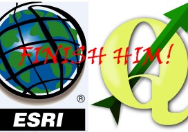
QGIS 2.14 vs ArcGIS Pro 10.4
This post almost didn’t happen. For over seven years I’ve been comparing GIS software in the hope that someone would be reading and take it upon themselves to fix a few of the issues that we all run into on a daily basis. With the new releases someone told me something, and it almost stopped...
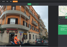
An interview with Mapillary CEO Jan Erik
Following Mapillary’s announcement yesterday, I sought to get more information about Mapillary and how they have come to be such an interesting prospect in the geospatial world. Mapillary is a pioneer in new ways to capture, share, and utilize street-level images. Yesterday I had the privilege to interview Jan Erik Solem of Mapillary to get the...