Tag Archives: drones

xyHt News Links: 10/21/16
Teledyne Optech announces new efficiency enhancement for ALTM™ Galaxy wide-area lidar mapping sensor Canon Launches the Océ PlotWave 550 Print System Designed to Greatly Enhance Large Format Technical Document Management AVEVA and AEGEX partner to deliver Digital Asset solutions in Hazardous Environments Rwanda Launches World’s First National Drone Delivery Service Powered by Zipline UAV Drones...
xyHt News Links: 10/7/16
GeoSLAM (handheld laser scanning) and Blackdog Robotics (unmanned robotic vehicles)partner for remote surveying in hazardous environments/uneven terrain TerrAvion Launches First Aerial Imaging Solution Specifically Designed for Rangeland Trimble Changes Name to Reflect Company’s Technology Evolution Teledyne Optech to introduce new static and mobile surveying solutions at INTERGEO 2016 senseFly to Unveil new RTK/PPK-Ready, Large Coverage Mapping Drone at INTERGEO 2016...
xyHt News Links: 9/2/16
Satlab New Product Announcement: SLC Handheld Four land surveyors share their experiences of using professional drones in their work. Airobotics Selects SimActive’s Photogrammetry Software for its Automated Industrial Drone Solution Carlson Software Releases BRx6 GNSS Receiver New Kespry Drone 2.0 Has Twice the Aerial Coverage senseFly launches new drone Property Drone Consortium and Marion County,...
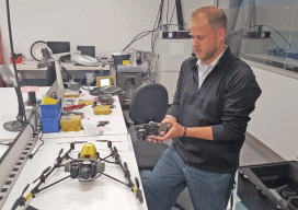
Your sUAS Un-checklist
We’re all familiar with the concept of checklists: handy organizational tools for getting things done. As business persons, you should also be familiar with the concept of “barriers to entry”: the greater the obstacles, the more difficult it is for a business to enter a market, and vice versa. And unless you’ve beaten Elon Musk...
xyHt News Links: 5/20/16
Teledyne Optech and GeoShack sign North American distribution agreement CHC launches high-end GNSS receiver for science, surveying HP Delivers World’s First Production-Ready 3D Printing System COPTRZ™ Launch: Changing The Face Of Construction With Drones Optech Eclipse to be introduced to international audiences at GEO Business UK Esri introduces high-precision GNSS mobile GIS software
An Inside Look
The New FAA UAS Registration Recommendations The UAS Registration Task Force (RTF) Aviation Rulemaking Committee has recently published its recommendations. For an insider’s look, we talked to Altavian’s John Perry, a member of the committee. Unmanned & Unlimited: Could you give us your take on the process? As a representative of MAPPS and as a...