The New FAA UAS Registration Recommendations
The UAS Registration Task Force (RTF) Aviation Rulemaking Committee has recently published its recommendations. For an insider’s look, we talked to Altavian’s John Perry, a member of the committee.
Unmanned & Unlimited: Could you give us your take on the process? As a representative of MAPPS and as a UAS manufacturer, do you feel your concerns from those perspectives were addressed?

John Perry, CEO and founder of Altavian, served on the FAA’s UAS Registration Task Force Aviation Rulemaking Committee as a representative for MAPPS.
John Perry: It was an honor to be selected to represent MAPPS on the Registration Task Force. It speaks to the importance of surveying and mapping that MAPPS was represented, both as manned and unmanned pilots in the National Airspace. At the same time, the committee was tasked with addressing the needs of the entire aviation industry in developing registration rules for drones. The committee had the difficult task of reconciling the experience, perspectives, and business ambitions of widely varying constituencies into a set of recommendations for drone registration, and in a very short timeframe.
I am confident that, while the recommendations do reflect compromise among all of the representatives, the recommendations were agreed upon because they addressed the most important issue—safety—in the most conservative manner possible. The concerns of the surveying and mapping community were heard and addressed by the committee. Our only remaining concern is that the FAA and law enforcement effectively implement and enforce the regulations; otherwise the effort was in vain.
U&U: Crystal ball question: Although the FAA has created a path for legal commercial UAS operations via its Section 333 exemptions and blanket COAs, when do you think mainstream UAS regulations for commercial operations will roll out?
JP: Well, it certainly is a crystal ball question. The regulatory process for drones is many years behind schedule, and virtually every effort has been delayed. I hope that the Registration Task Force, formed and executed on an unprecedented timeline, was the result of a renewed vigor at the FAA for effective regulation and not a knee-jerk reaction to holiday sales forecasts.
If that is the case, then we can look forward to more progress on all fronts and perhaps a rollout of the proposed Part 107 (Small UAS Notice of Proposed Rulemaking) regulations by early-to-mid-2016.
FAA Task Force’s UAS Registration Recommendations
The DOT/FAA registration task force (RTF) recommendations include: All UAS weighing 250 grams (~1/2 lb.) or more must register, owners can register more than one UAS with the same registration number, registration is free and online, and UAS serial numbers can substitute for registration numbers affixed externally. These are only a few of the recommendations; read the full report at the FAA site (PDF)
tinyurl.com/UAS-RegistrationProposed Rule 107 on sUAS: Next Phase of UAS Integration?
Earlier this year, U.S. DOT secretary Anthony Foxx and FAA administrator Michael Huerta announced release of the 195-page Notice of Proposed Rule Making. The document groups all sUAS operations into the same FAA regulation. The new Part 107 explicitly addresses requirements for operators wishing to fly sUAS for non-recreational purposes. The new rule would allow multiple innovative uses of sUAS, including mapping and aerial surveying, precision agriculture, and a wide range of other commercial and public uses.
To qualify under this rule, unmanned aircraft must:
- weigh less than 55 lbs. (25 kg),
- limit flight altitudes to 500 ft. (152 m) AGL,
- operate at a maximum speed of 87 knots (100 mph), and
- conduct flights in daylight hours only.
What’s more, the sUAS could not travel beyond the operator’s visual line-of-sight (VLOS), although MAPPS is part of an effort to enable BLVOS UAS operations (“Getting Beyond VLOS” in the October 2015 issue of xyHt).
What’s really interesting is that, for sUAS fitting into these rules, operators would be required to obtain an Unmanned Aircraft Operator Certificate (UAOC) with an sUAS rating, not a pilot’s license. To obtain an UAOC, operators would have to pass an initial aeronautical knowledge test at an FAA-approved knowledge testing center, be vetted by the Transportation Security Administration, and pass a recurrent aeronautical knowledge test every 24 months. While not a cake walk, this could well be a less-expensive alternative to obtaining a pilot’s certificate.
U&U: What excites you most about the commercial possibilities of UAS?
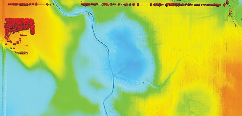
JP: Without a doubt, UAS are going to revolutionize the access we have to fresh, relevant, and on-demand geospatial data. My excitement for the surveying and mapping industry is to recognize that change. We must leverage drones to not only improve services to our existing customers but also to broaden our horizons into supporting new use cases for the data we produce in industries like agriculture and transportation.
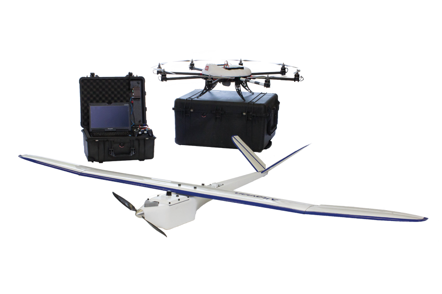
Altavian makes an octocopter called the Nova R8400 as well as the fixed-wing Nova F6500.
U&U: What gives you the most concern?
JP: Our paramount concern continues to be safety from the industry perspective. This regulatory effort is only the beginning for an industry that has not yet faced a major disaster, one which could easily derail our progress.
From a practical standpoint, however, educating customers on the value and use of geospatial data stands next in line for concern. It is our industry’s responsibility to present customers with both valuable products and accessible services. We have found that there are many new entrants into the industry that are failing at providing valuable geospatial products, which erodes our collective reputation. At the same time, the expertise in this industry is difficult for customers to readily access, and that is something we have to address. Overall, we need to be committed to educating the public and our customers about the true potential, and not the hype, of drone technology.
U&U: As a geospatial professional who founded a UAS concern, how does your background influence the development of your UAS platforms?
JP: Of course, the most direct influence is our insistence on building systems that reliably produce high-quality geospatial data in the challenging field conditions that professionals face. Now, as aircraft and payloads have matured and proven themselves, much of our attention has shifted to solving the workflow and logistical challenges of deploying UAS in the business environment. Key among those is building and automating QA/QC processes through the customer ordering, fulfillment, and delivery phases.
We continue to work with customers, particularly those new to geospatial data, to learn how to utilize the data and to develop integrations with their data workflows. This is where we see the most exciting new opportunities for the surveying and mapping community.