Tag Archives: hydrography
xyHt Magazine August 2016 Issue
Click here to view the August 2016 issue of xyHt magazine.
Hydro Insights, Part 2
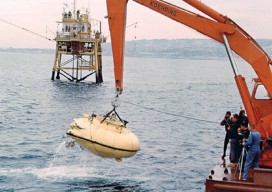
Reviving Interest in the Seas Pictured: The adventures of Jacques Cousteau, his research vessel the Calypso, and his soucoupe plongeante (diving saucer, aka “Denise”) that he co-designed in 1959 captured the imaginations of generations. Editor’s Note: xyHt is honored to feature insights from these two distinguished scientists in the fields of hydrography, marine surveying, and...

Hydro Insights
This visualization is of the high volume of commercial shipping activity into and out of ports rimming the Pacific Ocean. The data were analyzed using Esri’s new GIS Tools for Hadoop toolkit. Visualization by Mansour Raad, Esri. Available online at coolmaps.esri.com/BigData/ShippingGlobe with any browser running WebGL. Part 1: Uncharted Depths Editor’s Note: xyHt is honored to...

Epiphany on the Bow
Above: Shannon Hoy on the bow of the RVIB Nathaniel B. Palmer as she crossed through the Bransfield Strait in 2011. Photo by A. Margolin. A student’s journey from marine biologist to ocean mapper. Ever since I can remember I’ve wanted to work in ocean sciences. From when I was a child splashing in the tidal...
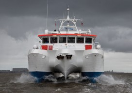
Capturing More with Shallow-water Multibeam
Interferometric sonars are providing a new tool for the hydrographic surveyor in shallow to medium-depth water applications. As we begin to return to normalcy after the deepest recession of most of our lifetimes, many ports, coastal authorities, and inland waterways are starting to look at infrastructure projects that have been kept on hold, and they...
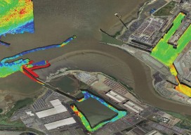
Mapping the Scottish Seabed
Six companies collaborate on a project to bury fiber optic cables under the Scottish seabed, stitching segments using hydrography, bathymetry, and surveying. On land, surveyors face challenges due to rough terrain, human activity, weather, and more. Usually, however, the ground beneath their tripods doesn’t move, they can physically occupy positions, and the air between them...