Tag Archives: uas

22 Young Geospatial Professionals to Watch in 2022 – 14 of 22
Throughout January xyHt.com will feature the young geospatial professionals who are making a name for themselves in everything from surveying to geographic information systems. xyHt featured all of them in the January issue. Here we will spotlight one each day. Name: Ethan Schreuder Company: Woolpert Current Position: Survey Technician, UAS Subject Matter Expert/Pilot Age: 29...
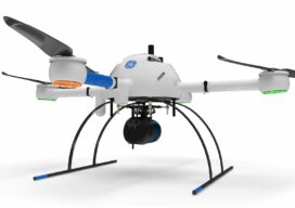
Autonomy Comes to UAVs
Trending tech has UAV software looking futuristic To a certain degree, autonomous operations are already baked into the current state of data collection (aka reality capture) software for UAVs. Pre-mission planning consists of using a map-based interface to highlight the area that needs to be mapped or inspected, the appropriate flight pattern and height (AGL)...

xyHt Weekly News Recap: 10/01/2021
Hesai Announces Distribution Agreement with LiDAR USA Open Maps for Europe Releases First Datasets ISPRA Congress Set for June in Nice, France Pix4D 24-Hour Virtual User Conference Set for Oct. 6 UAS Summit & Expo Set for October 13-14 in Grand Forks HxGN Content Program Introduces Digital Twins of Major Cities NOAA Contracts for Coastal...

Thinking Ahead
From mapping catchments to inspecting dams, there’s a solid future for UAS technology at public utility companies like the Salt River Project in Arizona
xyHt Weekly News Links: 07/30/2021
Trimble Boosts Flagship RTX Correction Services Performance Common Ground Alliance Releases Newest Edition of Best Practices Guide North Dakota DOT Selects GeoCue for UAS Program Esri to Expand Geospatial Innovation in St. Louis Area Commercial UAV Expo Exhibit Floor Nearly Sold Out dSPACE and Cepton Partner to Provide 3D Lidar Simulation infiniDome Debuts Anti Jamming...

Taking Flight
As drones begin to fill our airspace, Switzerland is figuring out how the skies will remain friendly