Tag Archives: uas

How to Get a Drone License
Here is a step-by-step guide to the basics of obtaining an FAA 107 commercial drone license. So—you’re stepping into the aerial arena, taking command of your first unmanned aerial vehicle (drone). Given their usefulness in a wide range of geospatial work, that’s absolutely a smart decision. But you know it’s not as easy as grabbing...
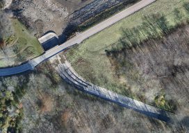
Above the Mud
An orthographic image of the exposed spillway at Geode State Park in Iowa at 1″ ground sample distance. To improve water quality in a 500-acre state park, drones are key for surveying drained lakes and the surrounding watershed. Improving water quality is a key part of the Iowa Department of Natural Resources’ (DNR) mission. Planning...
More Than Just Autopilot
Your UAS flight management system affects accuracy in photogrammetry, so get to know what you need. Unmanned aircraft systems (UAS) are arguably the most disruptive technology introduced to the geospatial profession since GPS. Advances in UAS capabilities and in photogrammetry software have significantly reduced the barrier to generating digital surface models (DSM) and orthomosaics from...
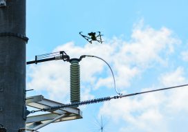
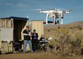
Cooperative Effort Takes Off
Tapping into UAS technology creates possibilities for a northern Arizona utility. Sometimes, the most effective, revelatory, progressive solutions to a problem can be found in the unlikeliest of places. Case in point: three and a half hours north of Phoenix in the city of Lakeside, Arizona, an electric cooperative that serves more than 33,000 member...
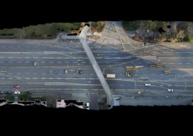
Tunnel Monitoring from Above
UAV digital monitoring delivers significant benefits as part of a major German tunneling construction project. The German city of Karlsruhe plays a decisive role in transport planning in the southwest of that country, with more than 300,000 inhabitants, 160,000 vehicles in the main part of the city, and 190 million train passengers every year. Highway...
BVLOS
Beyond visual line of sight is the next frontier for UAVs. The FFA’s Part 107 rule allows for routine civil operation of small unmanned aircraft vehicles (UAV) in the National Airspace System (NAS) and provides safety rules for those operations. Since this implementation almost two years ago, more than 70,000 drone pilot applications have been...