It wasn’t quite an Indiana Jones adventure, but Alabama-based lidar consultant Robert Graham says it’s as close as he’ll ever come to the hair-raising exploits of an audacious archaeology professor. Graham’s adventure last April did not revolve around an ark, though it did include ancient ruins, small planes landing in grass fields, machetes hacking through the jungle and a Hatfield and McCoy-like feud between neighboring villages deep in the Andes Mountains of Peru.
Ruins
Ruins—most famously the Inca ruins at Machu Picchu and the lost civilizations at Lake Titicaca—dot the backbone of the Andes as the mountain range traces the western edge of South America through Peru. Hundreds of thousands of travelers from around the world visit those remote sites every year, but Graham and Tyler VanDenBerg, an engineer at Inspired Flight Technologies in San Luis Obispo, California, were headed even further off the beaten path.
You can search long and hard for information about the Tauri Punku ruins and not find a single word, because outside of the few villagers in this nearly uncharted area 9,000 feet above sea level and 400 miles (700 kilometers) northeast of Lima, almost no one knows about Tauri Punku. The ruins are believed to be what was left behind by a pre-Incan civilization that existed in a region of the Andes still so remote it takes great effort just to get to them.
Graham and VanDenBerg were on assignment from Jeff Fagerman’s LiDAR USA, a 20-year-old Alabama-based company that continually pushes the edge of scanning, imaging and navigation technology. LiDAR USA was recruited to fly lidar-equipped drone missions over the ruins to assist a film crew planning to produce a documentary.
LiDAR USA
Fagerman and LiDAR USA have taken part in other adventure trips with film crews, like using lidar to search for the Lost Colony on Roanoke Island off the coast of North Carolina.
“We started doing a few shows and it just kept growing. We have yet to seek the adventure but it seems to do well to find us,” says Fagerman. “We had to turn some down, like scanning a live volcano in the Democratic Republic of Congo, which is more dangerous than the volcano itself, but we try to engage in these because they evangelize lidar to the general viewership.”
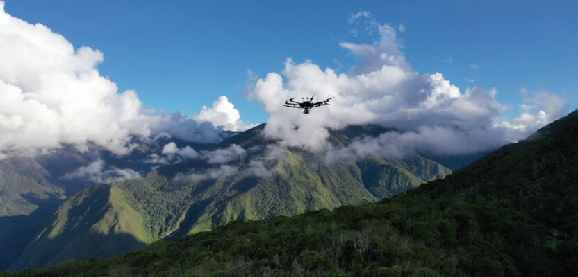
The Tauri Punku Ruins in the Andes Mountains of Peru have rarely been seen by anyone other than local villagers and have yet to be archaeologically explored. LiDAR USA flew drones over the ruins to help see what is there. Photos by Tyler VenDenBerg
Getting There
For Graham and VanDenBerg, just getting to the ruins was an adventure. Graham flew from Huntsville, Alabama, to Atlanta to Lima; VanDenBerg from St. Louis Obispo to Los Angeles to Lima. After dealing with some unexpected customs regulations concerning drones and actually having some equipment confiscated in Lima, as well as having to pay tax on the drones, they flew a small plane to Pucallpa and then a caravan plane on which they were the only two passengers to Tocache, a river town in the foothills of the Andes, where they landed in a grass field.
With about 25,000 residents, Tocache is quite a large town for this remote area, but a flight into Tocache is so rare many of the villagers stood outside the airport to watch the show.
The local police even sent escort vehicles to help the team get to its next destination, a river town called Uchiza, not far from Tocache but requiring a ferry crossing of the Huallaga River. The ferry consisted of three large metal canoes with timbers lashed across them to create a platform for the vehicles, an ingenious feat of engineering.
Arriving in Uchiza meant a night’s sleep at a hotel—but no hot water. And the next day they still had a five-hour drive to the small mountain village of San Jose, from which they would begin their three-hour hike into the jungle to the ruins. But that first day turned into a day of waiting.
Diplomacy in Action
“The mountain with the Tauri Punku ruins happens to be between two mountain villages that both claim rights to the mountain,” says VanDenBerg. “The villages were not friends and have had machete wars in the past. We had been communicating with San Jose, the closest village between us and the mountain, and had given them food, machetes (unintentionally arming them for the next war), shovels, and medical supplies.
“When the neighboring village found out we were providing San Jose with aid for access to the mountain they also owned, they were not happy.”
It meant laying low for the rest of the day while the mayor of Uchiza tried to work out the politics with the villages. But it took until the afternoon of the next day for the mayor to decide that the best plan was to send some trained commandos with the expedition in attempt to alleviate any conflict.
“We all jumped in pickups and an Arctic Cat Wildcat and headed into the mountains,” VanDenBerg says.
The roads were pretty sketchy, at times lined by steep cliffs that dropped hundreds of feet to the river below. “This part of the trip was incredible,” says Graham. “The mountain road was dirt the entire way, winding along and up this river valley for hours. The driver had everyone release their seat belts because if the truck went over the edge there would be a chance they might get thrown free.
“So there was plenty of pucker factor during this ride,” Graham says.
Safely in the high jungle the team arrived at a small village where the commandos were waiting. They followed on dirt bikes to San Jose. After a few hours a group of motorcyclists came roaring up the mountainÐmen from the neighboring village. Representatives from both villages and the commandos tensely worked out an agreement by which people of both villages would join the expedition to make sure no one harmed the ruins.
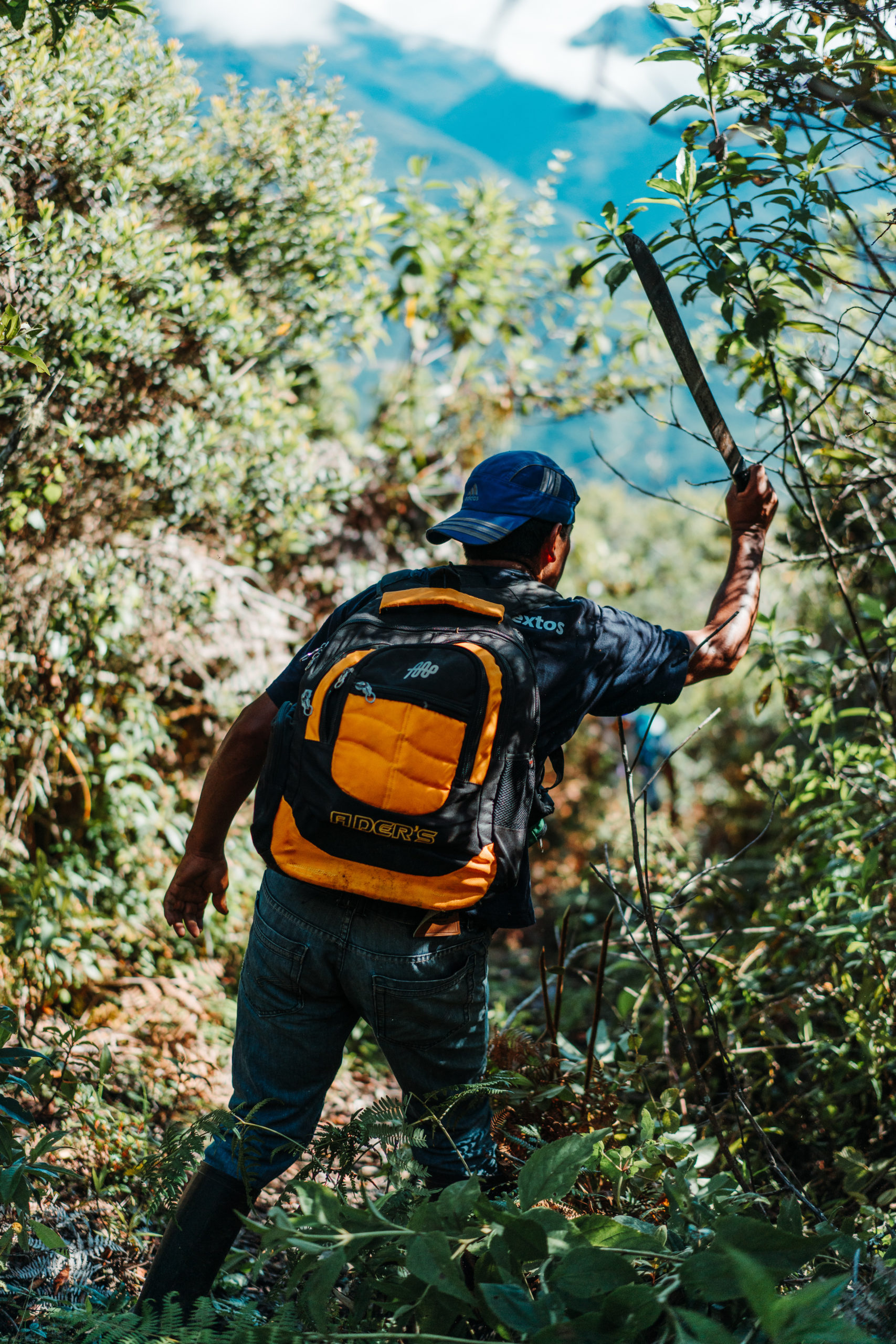
The Tauri Punku Ruins are in a remote but beautiful part of the Andes Mountains, sometimes requiring local villagers with machetes to lead the way. Photo by Robert C. Graham.
“Once an agreement was made, the neighboring villagers left and the tension subsided,” says VanDenBerg. “Our team brought out tools, machetes and food for the villagers of San Jose, and because it was so late in the day they agreed to allow us to spend the night there. They were very hospitable, feeding us and inviting us into their homes.”
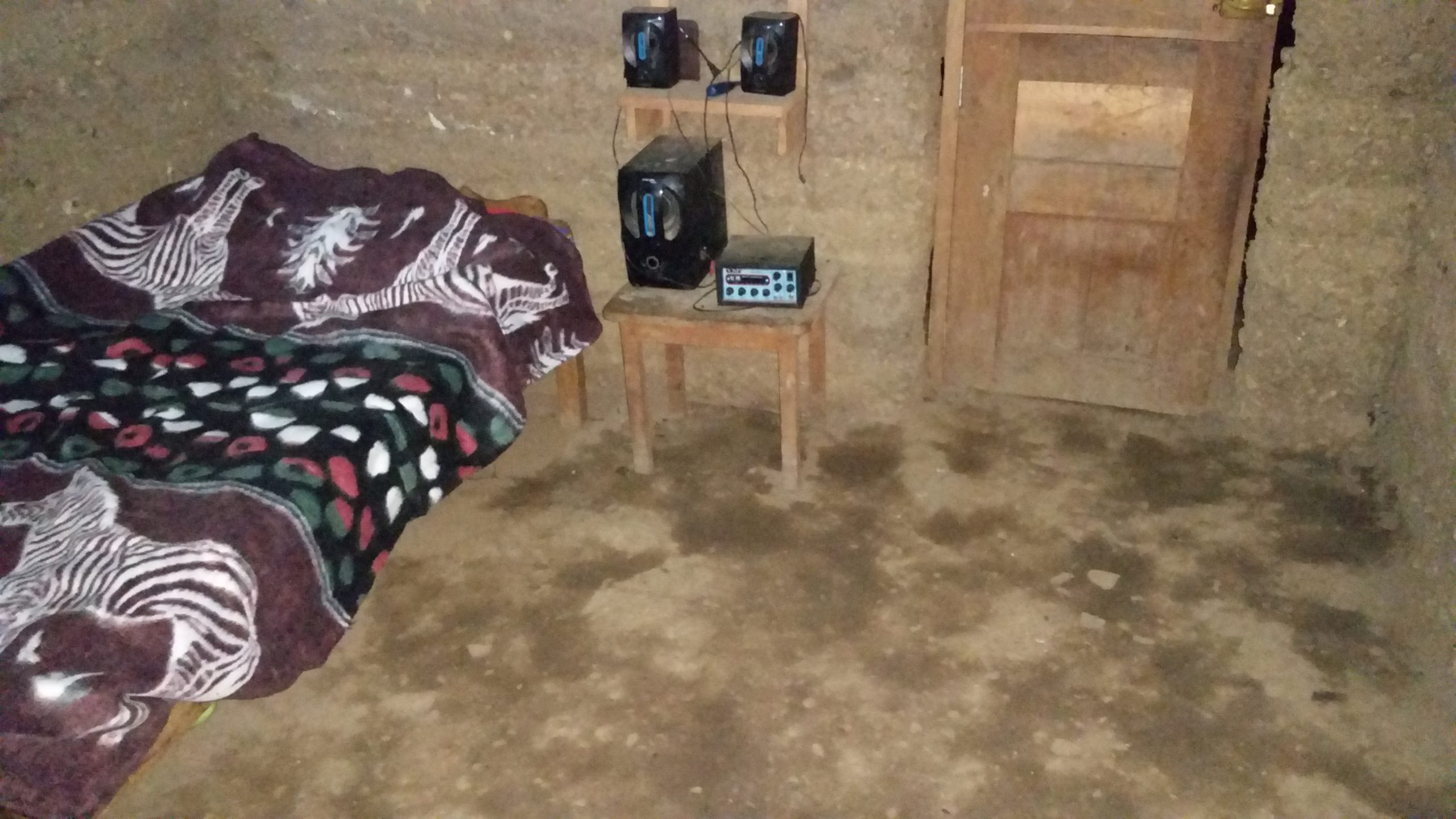
While the comraderie that night was great, the accommodations were sparse. These were mud homes with dirt floors and doors that consisted of a few boards that required a bit of muscle to open and close. The beds were basically blankets laid over a bedding of straw.
A mud hut in the village of San Jose. Photo by Robert C. Graham.
Really Getting There
The next day, finally, VanDenBerg, Graham, the film crew and their escorts headed to the ruins—still no easy task. The rest of the journey would be by foot, with villagers and horses packing in all the equipment. Villagers led the way with machetes.
“I was winded just hauling myself up the mountain,” Graham says. “The villagers didn’t even break a sweat packing all the gear.”
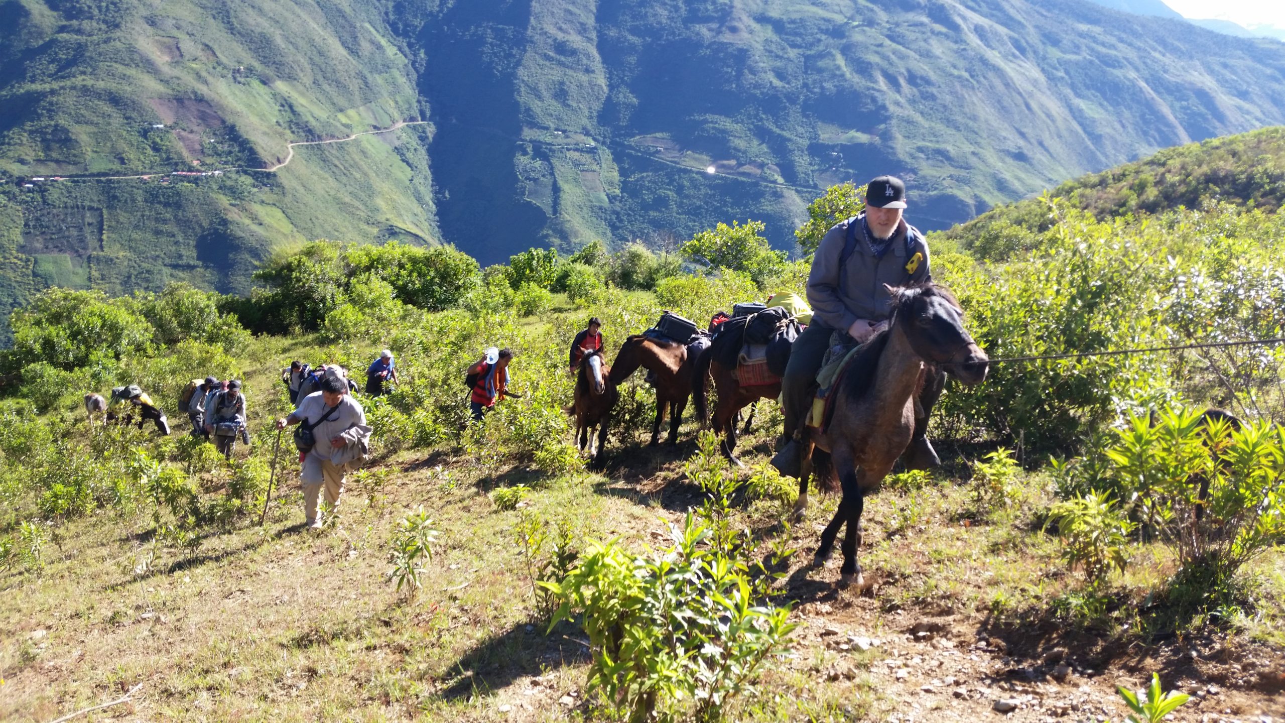
The climb to the ruins by foot and horseback was steep. Photo by Robert C. Graham.
“There were switchbacks in the trail,” VanDenBerg adds, “but it was basically straight up the mountain.”
At the top, 9,200 feet above sea level, they set up camp.
Getting to Work
It was the afternoon of the fifth day of the trip before Graham and VanDenBerg finally got to start flying their drones over the ruins. Both had pre-programmed flight paths based on a clearing in the jungle they had seen from satellite images. But when they found the “clearing,” it was completely overgrown.
This was a problem for Graham’s DJI M600 as his flights could not be altered without an Internet connection, meaning the drone would need to take off from a new spot and first fly to the no-longer-existing clearing before beginning its mission. That new launch point needed to be as close as possible to the clearing to conserve battery life.
They found a smaller clearing just down the mountain. The locals watched with curious amusement, likely never having seen a drone.
Initializing the M600 was also difficult without an Internet connection, so the IF750 went up first. VanDenBerg wanted to test the automated flight path on the mountain before mounting the lidar camera, so he conducted a quick flight and sent the drone out on its first sweep. The new clearing they were flying from was so buried in the jungle that the drone lost connection about halfway through its first flight line.
Because the lidar unit on the drone must remain 80 meters above the terrain at all times, the drone was over 600 feet below the group at this point, and line-of-sight was blocked by the mountainside and the jungle. Not being comfortable flying without telemetry feedback, VanDenBerg hit the return-to-home switch, which he had programmed to raise the drone 200 meters above terrain level before returning, ensuring plenty of clearance between the drone and the mountain.
The drone appeared overhead shortly after, but the flight was still programmed to return to the original clearing. When VanDenBerg saw the drone passing overhead, he made the mistake of flipping the controller into position mode while it was still heading full speed towards the clearing.
The force-feedback from the GPS telling the drone to immediately stop caused the frame to swing at an angle just steep enough to tell the parachute to deploy. The drone slowly lowered itself into a treetop about half a kilometer away, conveniently close to the expedition team members hacking their way through the jungle.
Because the frame had no lidar unit mounted underneath, the center of gravity was much higher, exacerbating the swing. The drone was tuned specifically for the lidar unit, so had the camera been there, the chute would not have deployed. The team was able to locate the drone and cut it down safely.
In the meantime, Graham was able to get the DJI M600 up and running. After some calibration and a test flight with no payload, he mounted the lidar unit and started his first mission down the mountain. The remote of the M600 had a weaker connection than that of the IF750’s long-range telemetry module, so connection was lost almost immediately.
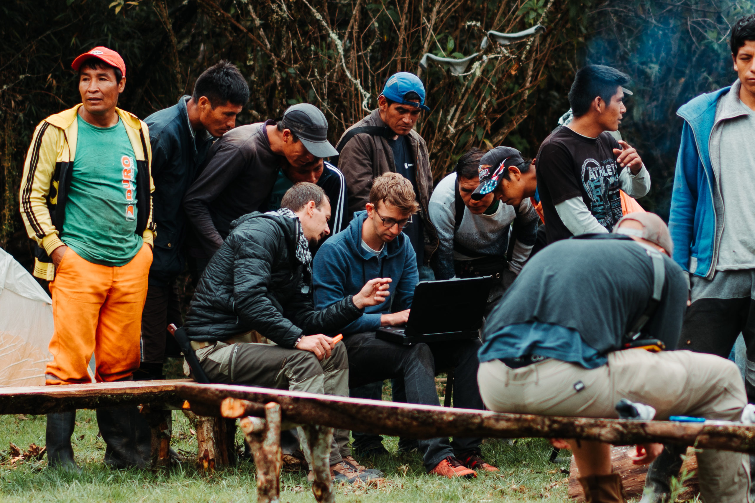
Tyler VanDenBerg (center) and Robert Graham (to Tyler’s left) drew a crowd of curious onlookers whenever he went to work programs the drones on his computer. Photo by Tyler VenDenBerg
Using third-party software for the automated missions meant there was no longer return-to-home control for the drone. If anything unexpected happened during the flight, they might never see the bird again.
VanDenBerg followed Graham as he sprinted through the jungle down the mountainside in attempt to regain a connection. At the edge of a cliff on his tippy-toes with the remote in the air, he was able to re-establish a connection.
VanDenBerg flew the smaller Mavic as a spotter for the M600, and when the mission was near completion they raced back to the clearing for the landing. The M600 came in quickly and tipped over after impact, snapping one of the six propellers.
“We then found out Peruvians have a great sense of humor,” VanDenBerg says. “The locals gathered around the injured drone and one of the men held a bird feather in place of the half-missing prop. Even through the seriousness of the situation and the language barrier we all had a good laugh.”
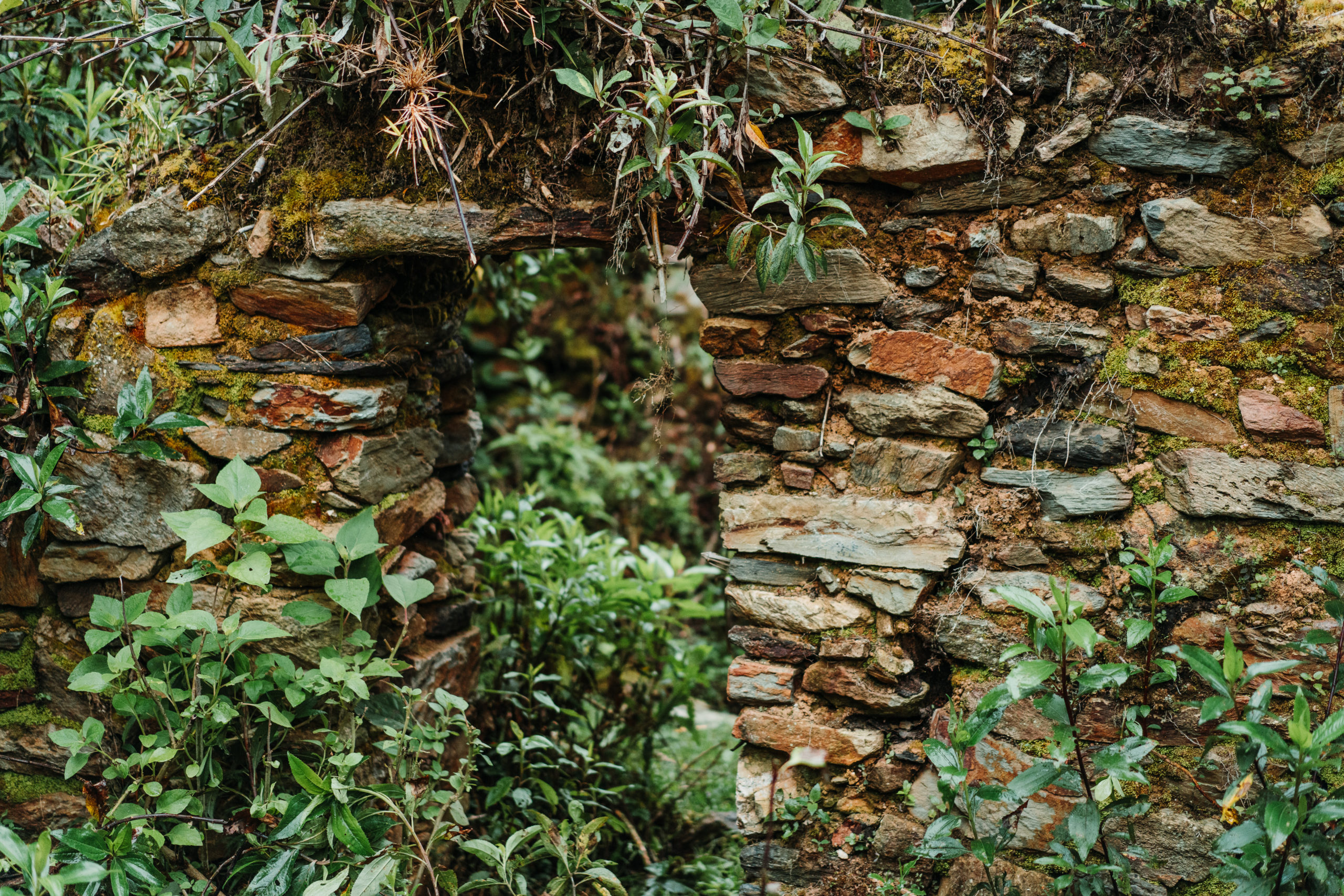
That evening VanDenBerg tuned some parameters on the IF750 while Graham processed the lidar data from the M600’s final flight. The data processed was able to strip away the foliage of the jungle, leaving behind a surface map of the jungle floor showing terracing across the entire mountain, which indicated the foundations of rooms and structures.
“It sounds like there was definitely quite the civilization up there,” VanDenBerg says. “Lots of terraced walls and even some stone towers.
The next day VanDenBerg and Graham had planned to start flying early but were held back by light rain and thick fog. VanDenBerg said he ventured into the jungle and noticed rock formations hidden under a thick layer of tree roots and vegetation. Local team members told him those were the Tauri ruins and then led him and Graham up the mountain into the jungle to see more.
“The vast amount of ruins such a short distance from our camp was staggering,” VanDenBerg said. “There were full doorways only about five feet tall, indicating short people, and storage compartments imbedded directly into the masonry. The rockwork is so consumed by the mountain that the ruins are believed to be pre-Incan. The carefully arranged stones were everywhere you went in the jungle, especially close to the ridgeline.”
“They’re pretty extensive,” adds Graham. “The lidar showed us a lot of manmade terraces on the mountain and stone terraces.”
Even with how much of the ruins are yet to be discovered, archaeologists believe the scope and significance of these ruins could be on par with Machu Pichu.
When the rain slowed, VanDenBerg and Graham got the lidar back in the sky.
“I created a new test flight on the computer and decided to work up the mountain instead of down to avoid the connectivity issues,” VanDenBerg said. “I also made the flight path slightly more conservative, and decided to take off from closer to camp on the ridge. I ran the flight path without a payload and it ran smoothly with about 50 percent battery remaining. We calibrated and initialized the lidar unit, which is when things got interesting.”
They anticipated the expected battery percentage to be about 35 percent to 40 percent after the mission with the lidar unit, which would be consistent with comparable testing missions in the U.S.
They knew elevation would play a part in reducing lift and battery capacity and figured that the aircraft without a payload flying at elevation would be a good benchmark for flying in the same location with the payload, as both flights would experience the thinner air.
“What we didn’t know is how much our maximum weight capacity was changing due to the elevation,” VanDenBerg said. “The drone behaved well on the second flight, yet was losing battery life at a much faster rate than anticipated. After a couple of passes on the survey, I decided I should play it safe and bring it home to investigate the battery issue.”
When he flipped the drone into manual mode, the aircraft began to rapidly lose thrust and they lost control of the upward direction, so VanDenBerg brought the drone rapidly back to the clearing as it dropped. The drone bounced off the ground and VanDenBerg caught it by the leg, determined to save the lidar unit. The hard landing put small cracks in the lidar mount’s carbon plate, marking the end of the scans of the ruins.
At the end of the day, VanDenBerg says he doesn’t believe either of the commercial drones were fit for such a rugged expedition that pushed the technology to its limit.
“We take things such as power and Internet connectivity for granted, and it takes missions like this to bring that crippling dependency to light,” he says. “These drones are some of the best on the market for autonomous data collection, but still have a long way to go if they are to map some of the most remote places on earth.”
He adds: “It is exciting to reflect on the trip with a plethora of new ideas for future designs and iterations that would make remote missions convenient and simple. A big takeaway from the trip is that redundancy is so important. The payload capacities and elevation ratings might check out on paper, but unplanned disturbances will always be there. Fortunately the final flight was able to obtain solid data.”
This was their final night on the mountain, and the group planned to pack out in the morning. That evening the villagers prepared a delicious meal of pork and guinea pig roasted over the fire. The next day the arduous journey home began.
“I’ve done lidar related work in a few foreign countries—Australia, New Zealand, India, Indonesia, Italy, Chile—but the Peru trip was literally the trip of a lifetime,” says Graham.