
Blog
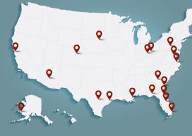
In The News: A Geospatial Year at Woolpert 2017-2018
Woolpert has been in business for 107 years, building a strong, broad-based foundation through engineering, surveying, mapping, photogrammetry, lidar collection, GIS, etc., to provide the most comprehensive geospatial support in the industry. In the past year alone our work in each of these sites, represented by these red dots, were spotlighted in the press. They...

Weekly xyHt News Links: 09/14/2018
3 geospatial events combine to form Geo Week Jan 25-31, 2019 LTI Partners with Eos and Esri to Develop World’s First Laser Offset Solution That Transforms How Field Crews Collect Data National Geodetic Survey 2018 Webinars senseFly launches the eBee X fixed-wing drone, allowing operators to map without limits

Continuing Ed Outside Your Comfort Zone
Learn new skills by taking continuing education seriously. Since its inception in the geomatics arena in the 1990s, the requirement for continuing education (also called continuing competency) has had the aura of a penalty rather than an opportunity. Obtaining legislative approval in many states for the continuing education requirement was difficult. Getting courses approved for...

The Rise of Value-packed RTK
Barriers are being removed for adaptable and inexpensive, high-precision GNSS. Many of you may be familiar with traditional base-rover applications for RTK such as surveying and mapping—with precision that typically comes with a large price tag. However, Swift Navigation provides a multi-frequency, multi-constellation, fully RTK-capable GNSS receiver called the Piksi Multi with a smaller price...
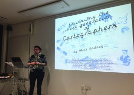
Mini Map-Makers
Cartographer “Captain Alice” teaches children to read and use maps as a communication tool. Alice Gadney believes her cartography business, Silver7 Mapping, is designed “to help people understand the world around them and their need for a great communications tool—the map.” And when she says “people,” she’s also including youngsters, starting with her five-year-old son,...
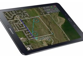
More Than Just Autopilot
Your UAS flight management system affects accuracy in photogrammetry, so get to know what you need. Unmanned aircraft systems (UAS) are arguably the most disruptive technology introduced to the geospatial profession since GPS. Advances in UAS capabilities and in photogrammetry software have significantly reduced the barrier to generating digital surface models (DSM) and orthomosaics from...
Advertisement