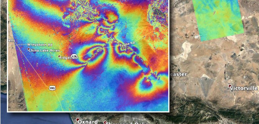
This graphic, which some folks call a rippling rainbow effect, is part of the valuable post-quake analysis of the 6.4 and 7.1 magnitude earthquakes—and thousands of minor quakes—in the vicinity of Ridgecrest, California in early July 2019.
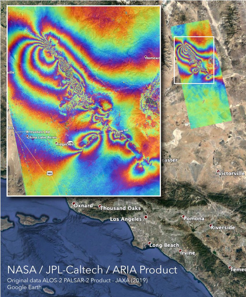
This map—produced by the Advanced Rapid Imaging and Analysis (ARIA) team at NASA’s Jet Propulsion Laboratory in Pasadena, California—was developed by comparing successive “images” from satellite-based interferometric synthetic aperture radar (InSAR). InSAR, used in this manner, does not do distance measure per se, but it is highly precise in change detection: differentials in elevation and to a lesser extent for horizontal.
What is notable about the use of InSAR and other types of remote sensing technology in situations like this is the rapidity with which such analyses can be performed.
The InSAR images used in this comparison were from the Daichi-2 (Advanced Land Observing Satellite, ALOS 2) of the Japanese space agency. Numerous satellites are equipped with InSAR radar sensors, collecting images around the clock and across the globe (both public and commercial), and some regions are imaged weekly. In the case of an event like a quake, analysts can find the latest images from whichever satellite crossed the region and compare them to archived images.
There are many real-world applications for InSAR beyond natural-event studies. It is common practice to use InSAR to monitor surface subsidence that may occur from large-scale tunneling projects, to identify and monitor landslide hazards. And in the case of L-band InSAR, the same signals can contrast subsurface water signatures to identify water leak blooms. Ground-based radar is also used for monitoring projects.
For AEC, pre-design site evaluations sometimes include a “rewind” of past InSAR images to provide a baseline of any subsidence or other ground movement trends.
There are even free InSAR images from systems like the European Space Agency’s Sentinel-1 mission—users simply need to develop processing capabilities. It may not be too long before surveyors and developers add InSAR baselines analyses to their standard deliverables along with traditional topographic models.