
Blog
Why Opus Projects? Part 1 of 2
Part 1 of 2The new version of the NGS suite of Online Position User Service tools simplifies many tasks By Philippe HenselWith Dan Gillins, Dan Martin and Julie Prusky NOAA’s National Geodetic Survey (NGS) continues to improve its suite of Online Position User Service (OPUS) tools. In addition to single-point processing, OPUS offers a web-based...

Nominations are open for xyHt’s “24 Young Professionals to watch in ’24.”
Nominations are open for xyHt’s “24 Young Professionals to watch in ’24.” If you’d like to nominate a 20-something (maybe young 30’s), Click HERE to fill out the short form and we’ll take care of the rest. Recognition for our top 24 and honorable mentions will be in the December/January edition of xyHt. Click Here...
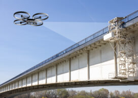
The Next Big Thing
A string of high-profile bridge failures in recent years has underscored the importance of innovating the way we inspect and assess the condition of our vital civil infrastructure. Can the use of AI help prevent bridge collapses in the future? This award-winning engineer thinks so. The period spanning 1992 to 2014 could just be the...

xyHt Weekly News Recap: 09/08/2023
Space Flight Laboratory (SFL) Announces Performance Milestone for GHGSat Greenhouse Gas Monitoring Microsatellites Sony Electronics Launches Ultra-Lightweight, E-mount Interchangeable Lens Camera UP42 and ImageSat International Partner to Unlock Critical Applications of Geospatial Data Association for Royal Geographical Society Renew Collaboration Improving Efficiency and Reducing Damages to Underground Facilities Olivia Powell and EVONA trailblaze WGIC’s DEI...

AI in the Sky
Will artificial intelligence solve the beyond visual line of sight problem for uncrewed aerial vehicles? For more than a decade now we have been moving more and more processes and tasks from crewed aviation to drones in a variety of industries, but the promise of widespread massive deployment of these electrically powered wonders is still...
What’s Inside Your GNSS Rover? Part 1
The venerable GNSS rover, has evolved into an essential part of a surveyor’s toolkit, although some mystery remains as to what that magic box does and how it does it. To demystify this, we engaged GNSS engineers to help craft this three-part “explainer” series. Part one The work of a surveyor requires a lot of...
Advertisement