Category Archives: Aerial/UAS
Primed for Growth
Aeryon epitomizes the current and coming uprising in UAS. The global UAS market (according to MarketsandMarkets) is set to grow at a 34.36% compound annual growth rate from 2015 to 2020, with UAS shipments to reach 3.8 million units in 2020. A new report from the FAA backs up this forecast, with a somewhat lower...
UAS: It’s Unstoppable and Headed Your Way
From time to time I like to stop and think about the mission of Pangaea and explain that mission to you. My task is exposing you to new, emerging geospatial technologies. But why bother? Here’s a little analogy I thought of to help explain why keeping abreast of new geospatial tech is critical. Imagine emerging...
The Practice of UAS
Above: An Altanvian employee tries out their newly redesigned Nova 7200. Advice from a pro on introducing UAS into your practice. UAS are quickly transforming from cutting-edge to standard tools for geospatial mapping and surveying. How will your firm be competitive and turn this technology into a profitable business? Get Smart about Regulations The greatest challenge...
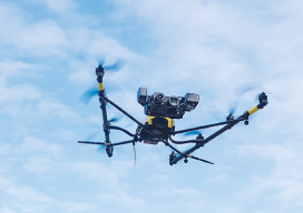
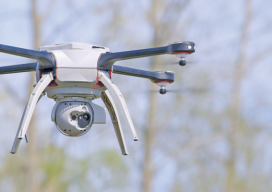
Distinguishing Features
Inside the unique design of the Falcon 8 I must confess a little bit of UAS fatigue. Among the flood of new UAS, it takes a bit of research to find distinguishing features. It does make sense at one level that a basic form might evolve from so many parallel development efforts, but it makes...
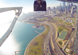
Closer Than It Looks
Above: High-definition mapping sensors (lidar, digital, and oblique imagery, here mounted on a helicopter during collection of an autonomous vehicle mapping project) provide an accurate, cost-effective approach to limit the interference and potential delays related to collecting extensive control on a right of way. A hybrid of geospatial technologies could help autonomous vehicle mapping drive...
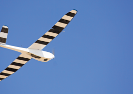
UAS — Don’t Blink
The audible signature of drones is readily recognizable. With the flood of consumer drones, the distinctive whir of those little propellers fills our skies and thoughts. But there is another sound associated with drones and their commercial manifestation in the form of UAVs and UAS that might someday soon be cause for alarm: the “whoosh”...