Category Archives: GNSS/Location Tech
Sponsored Content: Revolutionizing Utility Mapping in North America
As many of you already know, inaccurate utility locational data is one of the main causes of utility strikes. In 2021, this has led to an estimated $30 billion societal cost due to delays and damages in the USA alone, according to The 2021 Damage Information Reporting Tool (DIRT) Report released in October by the...
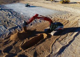
The Construction Automation Continuum
It’s more about many minor triumphs than major leaps. Surveyors can play an essential role in implementing these changes To those outside of the industry (and some within), the term “construction automation” evokes visions of bots and autonomous equipment plying construction sites—efficient and tireless—yet always on some far horizon. In present reality, construction automation takes...
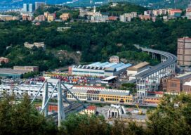
Bridge Watchers
Smart sensors and satellites are being used to actively monitor bridges and large infrastructures. With eyes in the sky and ears on the ground, can this new technology improve public safety? Despite what the lyrics of the popular English nursery rhyme may have our young ones believe, the London Bridge has actually never fallen down. ...
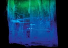
Built for Danger
While the operator stays safe, indoor drones carrying lidar and SLAM technology create a 3D map of the inside of hazardous spaces Nuclear power plants, ballast tanks, underground mines, toxic chemical plants, sewers, offshore oil storage, decommissioned industrial facilities—none of these are places suitable for humans; yet monitoring and inspection of the interiors are often...
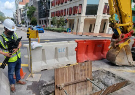
Disruptive Lidar Tech
Technologies developed for autonomy and consumer applications are opening up new user segments and rewriting conventional workflows A construction inspector sweeps their phone over an open trench creating a 3D as-built of the utilities within. This is just one example of low-cost, rapid, simplified reality capture is challenging conventional wisdom on how reality capture should...

Bruno Alexandre Krenski
23 Young Geospatial Professionals to Watch in 2023 – 15 of 23 Name: Bruno Alexandre KrenskiCompany: Top Terra & Measuring MastersCurrent position: Land SurveyorAge: 32 Education: Surveying Technician When my father was young, he got to know the profession and became a practical surveyor and a while bought his first total station and project software....