Category Archives: Hydro/Marine
Ocean Observation
Monitoring and comprehensive data collection is now a national security imperative For most of the second half of the last century there was general agreement that the primary existential threat to humanity was the purposeful or accidental exchange of nuclear weapons. While that threat has not been completely eliminated, in the 21st century there is...
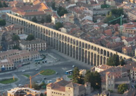
The Challenge of Channeling Water
From the Romans to the Everglades, the art of directing water flow has never been easy For thousands of years impromptu land surveyors tried, sometimes successfully, to force water to flow in a direction it did not want to go. This was done to help grow crops in areas where water was not abundant enough...
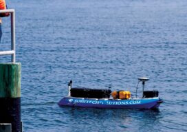
No Barrier Between Land and Water
Innovative tools and technology help hydrographic mapping deliver detailed data in previously inaccessible areas. Underwater mapping presents unique logistical challenges that are increasingly being met with technology used in creative ways, and by combining multiple types of data to develop a complete picture. From unmanned surface vessels (USV) to multi-beam sonar, advanced equipment yields accurate...

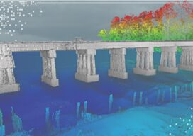
What to do With All the Lidar Data
An age-old Aesop’s Fable adage says, “Be careful what you wish for, lest it come true!” When the U.S. Geological Survey (USGS) embarked on the National Enhanced Elevation Assessment (NEAA) in 2012, the goal was to document the national-level requirements for enhanced elevation data. Little did USGS know at the time, the report would be...
Teledyne Forms New Geospatial Company
Teledyne Optech and Teledyne CARIS have united to form the new Teledyne Geospatial, offering holistic solutions to seamlessly map land and sea through the integration of industry-leading lidar sensors and world-renowned software workflows. This collaboration empowers customers with a competitive edge in mapping and delivering data products inside of one complete workflow.Ease of collection and...
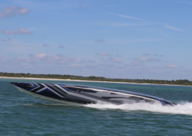
Mapping the Surface of the Ocean?
It is crucial that we keep accurate maps of the ocean’s shorelines, but when my company got a request to map the ocean’s surface 50 miles out in the Gulf of Mexico, my initial reaction was: Why? Isn’t the ocean just the ocean that far out? There aren’t any geographic features or elevation changes. It’s...