
Cutting-edge 3D city models lead the way to better urban planning via digital simulation
Take a peek at Helsinki’s virtual 3D city model and what might at first seem to be just rows of solid objects soon reveal themselves as handsome blocks of buildings that line gridiron streets. This is the digital doppelganger of Finland’s capital, viewable to anyone with Internet access and freely downloadable to all. Helsinki is proud to be one of the first European cities to have completed a publicly accessible 3D city model, and quite rightly so.
That’s because there is a strong design legacy behind its 3D creation. Developed under various urban design projects spanning three decades, the evolution of Helsinki’s digital 3D replica is also a reflection of the progress in architectural and geospatial technologies. From a few hand-drawn edifices using computer-aided design (CAD) in the late 1980s, it has now grown into a full-scale digital city that covers some 400 square kilometers (154 square miles), all thanks to the clever combination of techniques in mapping and computer modeling, as well as aerial photography and laser scanning.

An aerial view of a New York City-inspired 3D city with skyscrapers, water, and bridges. Inset: Virtual 3D city models are the building blocks of future smart cities.
The Finns simply call it their city information model, and it continues to be a convenient desktop tool for exploring the capital’s built assets since it went live online in 2016 (https://kartta.hel.fi/3d/). Nowadays, it is being used in more advanced urban analyses to simulate real-world processes as well as to evaluate “what-if” scenarios.
From 3D cities to simulations
For example, to support the citywide strategy to create a carbon-neutral capital by 2035, the city planners of Helsinki turned to their virtual 3D city model and built for themselves a fully digital energy and climate atlas. The aim of this web-based mapping platform is to uncover the heating, electricity, and water consumption data of every building in the city. And because simulations in virtual 3D models can be used to recreate how natural events affect urban spaces, the planners were able to go even further in their examination. Using the same 3D model, they simulated the city’s seasonal heating requirements by linking into Helsinki’s broad building registry system and its ample weather data.
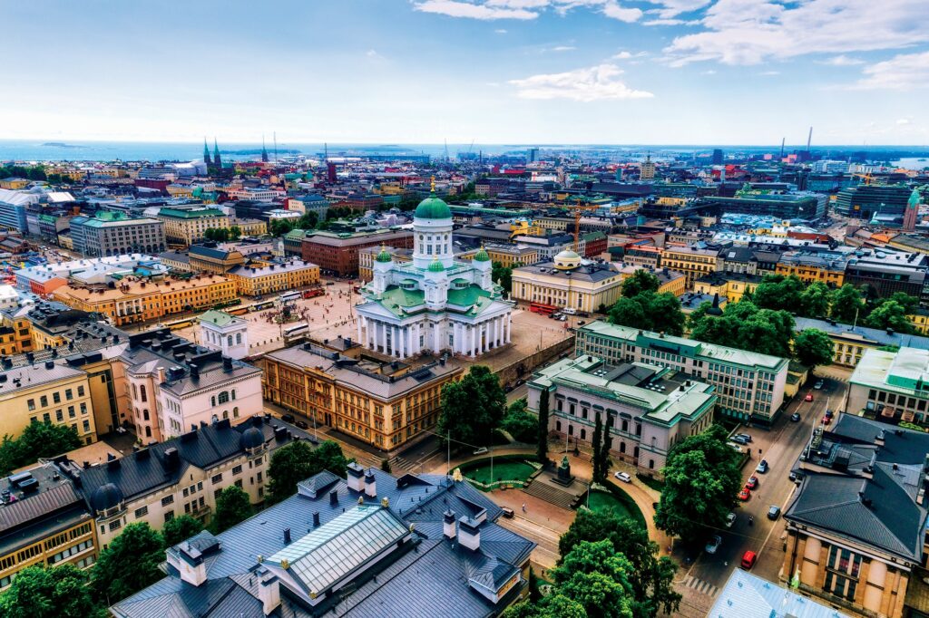
Helsinki (the Helsinki Cathedral in the center) is one of the first European cities to have a completed a virtual 3D city model.
The results of the 3D simulations, viewable in the same online platform, unravel not only which buildings in the city have higher than usual energy consumption, but also when. And as the simulated results are displayed in richly-detailed 3D images, the model’s creators expect that their citizens will use this virtual urban replica to effectively work together with architects, engineers, and utility companies in finding ways to implement feasible energy-saving solutions. Other pilot projects that exploit this virtual 3D model are currently on-going, including the creation of a fully-connected digital twin city in Helsinki’s harbor district of Kalasatama.
As a representation of Helsinki’s built environment, its city information model is a rich digital rendition of the various layers and components that can be found in a thriving urban landscape. But merely collecting a remarkable amount of digital data, including some 50,000 oblique aerial photographs, is not enough to carry out the impressive simulations at the scale accomplished by Helsinki. The way the data is stored also plays a vital part.
Data format is important
Instead of just drawing two-dimensional polygons, the Helsinki model represents buildings in two levels of 3D geometry (or LOD for level of detail): from simple flat-roofed cubes (LOD1) to more complex shapes that characterize irregular roof surfaces (LOD2). This type of 3D city modeling approach and building typology follows what is known as the CityGML schema.
The City Geography Markup Language (CityGML) is an open data format for the representation, storage, and exchange of virtual 3D city models. It was adopted as a standard for creating 3D city models by the Open Geospatial Consortium (OGC), an international body that defines interoperability standards for the geospatial sector.
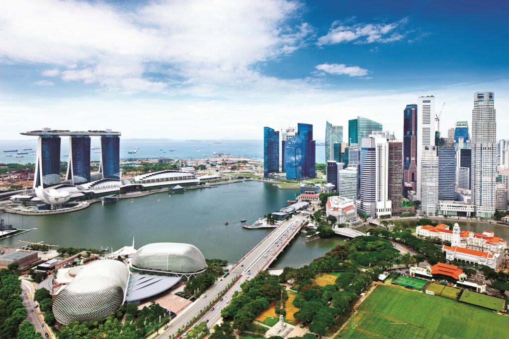
Singapore’s virtual 3D city model is also based on the CityGML format.
Because CityGML operates within a conceptual model containing a set of objects that one usually encounters in an urban environment (terrain, buildings, bridges, roads, and vegetation), each of them can be represented in various levels of detail according to their three-dimensional geometry, topology, and semantics.
The last one, semantic information, is CityGML’s most important feature because it provides the key to identify each urban object, thus enabling the system not to mix up buildings from roads and other entities. With CityGML, in-depth thematic queries and analytical tasks are now possible in 3D unlike before.
Surely there are other means to create virtual 3D city models, such as the use of computer graphics and meshes that are popular in the video-game industry. However, they lack the semantic information and open data structure that CityGML provides. Being an open-source format also allows for data interoperability and exchange, meaning anyone with the right skills can create, view, and use any CityGML-based 3D models in compatible softwares.
By this very nature, third-party tools called Application Domain Extensions (ADEs), can likewise be built and integrated into CityGML models. The thermal building simulations in Helsinki, for instance, were executed using independently built ADE components. It comes as no surprise that the development of CityGML-based 3D city models and ADEs are now popular among private companies (such as Bentley, Safe Software, and Virtual City Systems) and start-ups. Meanwhile, cities eager to take part in the digital mapping revolution have also opened up their CityGML datasets to the public sphere.
We built this 3D city
New York, for one, is a U.S. pioneer in this regard. It has already created its virtual 3D city model in CityGML format and made it universally accessible. Based on data collected from a 2014 aerial survey, NYC’s immersive 3D model contains roads and parcels, as well as edifices in a blend of two levels of details to differentiate its more regular-looking buildings (modeled in LOD1) from its iconic skyscrapers such as the Empire State building (modeled in LOD2).
Keen-eyed readers may have already seen the Big Apple’s 3D model in action. Working jointly with the New York Times in 2016, researchers at the Tandon School of Engineering used the New York CityGML data to figure out the shadows casted by buildings in entire neighborhoods. This was a novel approach at that time when architects were limited to simulate shadows from single buildings.
The result of this new way of 3D simulation showed swathes of the city that are dark during the day due to shadows cast by buildings on surrounding areas, block-by-block, and per season. In this city that never sleeps, sunshine-blocking tall structures affect the prices of real estate properties. Potential buyers would also like to know whether future development projects could disturb their access to natural light.
Another city that is harnessing its virtual 3D city model to support real estate decisions is Singapore. Home-buying activity in this rich tropical city has been curtailed by the COVID-19 pandemic and potential owners can expect to wait for weeks to get a slot to view a property. To get the housing market back on its feet, Mogul, a property classifieds portal, launched this year Singapore’s first virtual 3D map containing the digital look-alikes of some 150,000 buildings.
Using their smartphones, tablets, or computers, interested customers can now view in Mogul’s website the listed properties as they appear in situ, complete with virtual renderings of the edifices and their environs. As such, one can check not only the building’s design in 3D, but also its immediate panoramic views.
What made this immersive 3D home listing possible is OneMap3D, the city’s dynamic visualization platform developed by the Singapore Land Authority. This city-state’s virtual 3D model is bigger than Helsinki, however, covering more than 700 square kilometers. But it is similarly based on the CityGML format. According to its developers, OneMap3D has been built “to enhance the country’s geospatial capabilities and to provide new geospatial solutions for businesses, government, and the wider public.”
The prevailing capabilities of CityGML-based virtual 3D city models, as seen in Helsinki, New York, and Singapore, go beyond the typical three-dimensional visualization that one expects from traditional 2D mapping. What it also demonstrates is an important aspect that was not possible before: the power of simulating the city at various scales. This ability to conduct scalable simulations means that 3D models can be counted upon to support a wider range of urban applications from the ground up.
Rooftops, for example, are now highly sought-after as cities look for clean power sources. Occupants of homes and offices are enticed to lower their electricity bills by installing solar panels on top of their buildings. But not just any. With the help of virtual 3D city models, highly-detailed renderings of roofs are being used by engineers to identify urban zones that receive more sunlight.
These top spots will be where photovoltaic cells can be installed for more efficient solar energy capture. This 3D approach has been successfully tested in the cities of Vitoria-Gasteiz in Spain, Trento in Italy, and Warsaw in Poland.
On the ground level, virtual 3D models have likewise been used to help cities prepare for extreme natural events. For instance, citizens who participated in a digital mapping project in the flood-prone region of Rhône River valley in France, have benefited from interacting with a virtual 3D model of their territory by raising awareness about the risks of living close to a river. Meanwhile, urban planners in Lisbon, Portugal, have used their 3D city models to assess the vulnerability of buildings to earthquakes by visualizing how structures respond to different ground-shaking magnitudes.
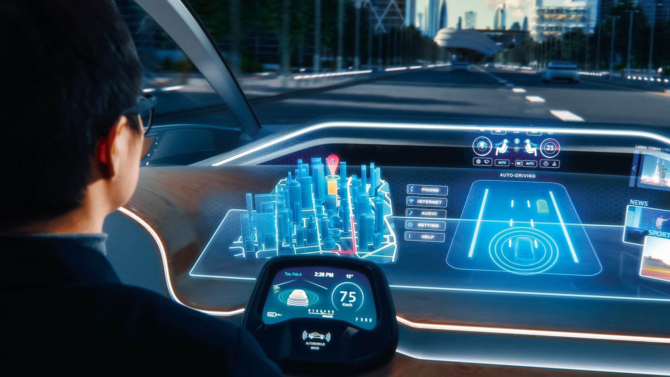
Urban transport and mobility, an important topic nowadays as fuel prices surge and the transition to electric vehicles is favored, likewise benefits from the rich street-level dataset that CityGML models can keep.
In Germany, the city of Dusseldorf is testing its virtual 3D model to simulate traffic and improve driving safety. While in the city of Ingolstadt, a German carmaker is preparing for future automation by testing its vehicles within a driving simulator that uses a CityGML-based virtual streetscape.
Recently, Japan released what could be the most ambitious virtual 3D city model project accomplished by a country to date. Its Plateau Project has just finished creating immersive 3D digital copies of Tokyo and 55 other cities, and they will be adding more.
And by making its CityGML data publicly accessible, this government-backed initiative aims to nudge both the private and public sectors to develop innovative tools based on the virtual 3D models. Several case studies are now being tested in the country, including the visualization of new urban spaces in Nagoya as well as the simulation of pedestrian traffic in Kyushu to assist in earthquake evacuations and pandemic-related distancing.
A Virtual Promise?
For all their potential, virtual 3D city models are still a novelty among many urban planners and engineers. Currently, there are only a few countries in the world with 3D models of their cities, and not all of them are stored in the CityGML format. It may take a few more years for professionals who are trained in GIS and CAD to shift to a platform that is suited for big city data because it requires a huge investment to acquire fresh digital skills as well as to purchase new digital hardware. City managers must be willing to do both if they want to go virtual.
Driving in a virtual city with an interactive 3D navigation app on an augmented reality dashboard in an autonomous vehicle.
Furthermore, the use of CityGML format remains challenging despite being a global standard. Like any human-based design activity, inconsistent and inaccurate information can still be introduced, while missing data remains common.
And because CityGML is intended to be a data exchange model, users must first convert them to a different file format (such as CityJSON) in order to be displayed. Although file conversion results to faster on-screen 3D visualization, this however downgrades the spatial data querying capability of the original CityGML data. Unless software that handle the data are well designed, virtual 3D city models will provide little good.
All these challenges are surmountable and should not deter 3D cities from rising. As urban areas start to create their own digital avatars now, more will surely follow suit, forming the first building blocks of digital twins for the smart cities of the future. Guidehouse Insights, a consulting firm, reckons that by 2031 the annual municipal digital twin revenue will grow to $2.5 billion.
For now, it may seem hard to imagine that digital 3D cities will become widespread because even developed countries have digital divides. But just look at the progress of GIS mapping. Today, practically every city has been digitally mapped, thanks largely to the growth of the number of GIS users, the convenience of accessing datasets, and the positive impacts of open-source standards in the geospatial industry.
To be just as successful, virtual 3D city models should replicate this feat. Ignoring this would be squandering a big opportunity to improve our cities.