january 2017 Archives
Inspecting Over the Line With UAV

One of British Columbia’s first aerial inspection firms takes on a challenging maritime mission using a UAV. Featured image: The Raecon team flies a UAV across the Strait of Georgia, performing an aerial power line inspection. AS DAWN BROKE off the Sunshine Coast of British Columbia, Canada, the Raecon Industries team set out by boat […]
Sky Control: Lakhta is Russian Forward in Urban Development

Integrated geospatial solutions play a key part in building Europe’s tallest skyscraper. A new chapter in urban development is being written in Russia’s north-west corner. On the outskirts of Saint Petersburg, construction is underway on the new Lakhta Center, an ultra-modern facility that blends commerce, recreation, and cultural activities. In addition to incorporating hundreds of […]
Automating the Mundane: AI Geospatial Analysis

Customized geospatial exploitation services provide solutions for the defense, homeland security, and aerospace markets. You don’t have to work for huge organizations, such as the U.S. Air Force or the U.S. Forest Service, to appreciate the benefits of customized geospatial exploitation services or capabilities. Even small companies and public agencies are increasingly challenged with extracting […]
Getting in Touch with Your Inner Bad Elf

Bad Elf: delivering (very) affordable accuracy—simply—for mapping and asset management users. The device is a Bluetooth peripheral GNSS receiver that can feed more-reliable and precise positions to any location-based app on your smartphone or tablet. Having just returned from a visit to Bad Elf’s offices in Scottsdale, Arizona, I was itching to put this little […]
App Happy: Streaming Utility Surveys
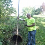
A new app standardizes workflow by turning a list of surveyed points into underground 3D utility maps. Imagine that you’re surveying an underground waterline in your city. You use your survey devices to record the locations of the pipe system, including the manholes, the water valves, and their depths. Using your tablet on-site, you’re able […]
Wishing You a Happy, Healthy 2017
My, how time flies. Three years ago this month, we announced to the world our intent to transform our mainstay monthly magazine Professional Surveyor, which had been serving the surveying and precision measurement community for more than three decades, into the greater-encompassing pub you have on your screens. And what a great ride it’s been […]