Outlook 2020 Archives
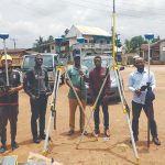
UAVs Beyond Visual Line of Sight

Beyond visual line of sight (BVLOS) is where the cutting edge of commercial UAS technology shakes hands with ever-lagging regulations. With such rapid developments in the technology, aviation authorities worldwide struggle to keep up with UAS capabilities, particularly in an industry where safety is paramount. In some countries, BVLOS has already shown itself to be […]
The Reality of Digital Construction

In the last two decades, we have seen technology make its way first into the construction project office through construction management web applications, then into pre-construction through BIM and VDC (virtual design and construction), and finally into the field through mobile applications that are often intended to replace paper plans and specifications. With communications, business […]
GNSS: Triple-frequency Constellations
Triple-frequency observations for high-accuracy positioning has been studied for years. It’s proven to greatly improve RTK performance (fix rate, reliability, and precision) in challenging scenarios for dual-frequency RTK, for example with a very a long base line, very active ionospheric motion, and a severe multi-path environment. Triple-frequency observations also help shorten PPP convergency time significantly. […]
3D and Geospatial Infrastructure

When I look ahead to the future of geospatial infrastructure and 3D, the words that come to mind are: more, faster, and … more! Humans are poor prognosticators when confronted with exponentially increasing or improving factors, and today we see an explosion of capability and content in the geospatial world that will lead to new […]
Trends in Terrestrial Laser Scanning
Within the domain of lidar/remote sensing technologies, terrestrial laser scanning is currently the most widely adopted. Mapping drones have quickly become popular, but terrestrial laser scanning is used for more types of mapping and as-built survey applications. Other airborne (photogrammetry and lidar) and vehicle-mounted mobile scanning/mapping systems are also widely used, but there are far […]