Within the domain of lidar/remote sensing technologies, terrestrial laser scanning is currently the most widely adopted. Mapping drones have quickly become popular, but terrestrial laser scanning is used for more types of mapping and as-built survey applications. Other airborne (photogrammetry and lidar) and vehicle-mounted mobile scanning/mapping systems are also widely used, but there are far fewer in the market than terrestrial laser scanning systems.
Today, terrestrial laser scanning is mainstream, which means there are plenty of reputable vendors, costs have come down, scanners work well, software is stable, multi-functional industry standards exist, and there are many experienced staff around. Of particular benefit to the surveying and engineering community is the fact that organizations can source 3D laser scanners from their long-time preferred manufacturer or dealer with confidence that the scanner will perform well. Now, all major survey equipment manufacturers and long-term specialty laser-scanner vendors offer good solutions.
As a mainstream technology, terrestrial lidar’s focus is on productivity in the field and in the office. Data quality will always be an important factor in selecting a scanner, but, today, most high-end tripod-mounted laser scanners deliver very good quality data.
The hottest new segment is SLAM-based walkaround mobile scanning. Introduced in just the last few years, these can be push-cart, backpack, hand-carry, and/or handheld.
Why the rapid take-up? Scanning while walking can often deliver 5 to 10 times more field productivity over tripod-based scanners. In the process, they give up accuracy and data quality/scan noise versus tripod-based systems, but their field productivity gain is so large that they’re catching on quickly. In many cases, they’re also more affordable than high-end, tripod-based laser scanners.
My outlook is that scan data from these walk-around systems will eventually become less noisy, which will improve point cloud visualization and make feature extraction/modeling easier in the office. Point-cloud-processing software today is also mainstream. Almost all major CAD systems have decent point-cloud handling capabilities, and there are plenty of good, third-party software choices, including point-cloud plug-ins for CAD.
Point-cloud software offered by 3D laser scanner manufacturers is also popular, especially for registering multiple scans together.
For this critical step, emphasis is also on efficiency, both in the field and is the office. This is increasingly being done automatically on the instrument, more efficiently in the office, and/or via uploading scans to the cloud for third-party processing. I also foresee this trend continuing.
Increased automation for modeling and better efficiency in managing and sharing very large data should also continue. The main problem today with point-cloud software is the need, especially for organizations that have been doing laser scanning for some time, to deploy (too) many different types of software for specific tasks, such as meshing point clouds, modeling point clouds into specific elements, creating animations, etc. Unfortunately, I don’t foresee achieving the holy grail of a single, “one-push-button” software to create complete models and maps from point clouds.
Another strong trend is improving user-friendliness. This applies to operating scanners and processing point clouds into deliverables, including friendly deliverables. The user-friendliness of one-push-button scanners and walkaround mobile scanning systems has enabled service firms to deploy less costly field labor. They’ve also opened the floodgates to new users.
On the deliverable side, more software vendors are offering intuitive 360º, panoramic laser scan and photo images—a laser-scanned site version of Google’s StreetView. Users love this deliverable, and I foresee it one day becoming ubiquitous.
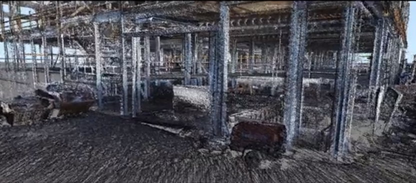
Banner image: Laser scanning’s hottest new segment is walk-around mobile scanning, with potential 5-10X field productivity gains over tripod-based scanning. Credit: NMCN Construction.