xyHt in print, January 2016 Archives
The Long Drive

Topcon Positioning Systems’ president and CEO Ray O’Connor talks about automation, integrated solutions, smart phones, golf, and the coming era of continuous representation of reality. The occasion of our conversation with Ray O’Connor was a visit to the headquarters of Topcon Positioning Systems in Livermore, California, which included a tour of their manufacturing facility, a […]
Web Mapping, Part 2
It’s as easy as 1, 2, built. In my last article in this series (December 2015), I briefly discuss the essence of what a web map is and the basic components. This part looks at the easy web mapping solutions that I briefly touch on in the last piece. I then discuss and provide the […]
Mapping as a Service

Fueled by the convergence of cloud computing, digital automation, and internet distribution, subscription mapping creates new opportunities. Subscription aerial mapping sets out to rid the industry of its dated legacies. One in particular is the commissioning of aerial mapping projects. The process can be bureaucratic, expensive, and subject to a long approval. This could lead […]
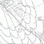
NGS Finds a Real-Time Solution

An Iowa RTN contributes to the National Geodetic Survey’s Geoid Slope Validation Survey of 2014. The gravimetric geoid model will become the zero-height surface for the new geopotential reference frame, which will replace the North American Vertical Datum (NAVD 88) in 2022. The Geoid Slope Validation Survey of 2014 (GSVS14) is the second survey conducted […]
The Vanishing Divide

New solutions bridge the gap between CAD and GIS. Editor’s note: In our continuing examination of CAD-GIS integration we’ve presented several approaches and products. Internationally, a tremendous amount of work has been done towards integration, both in academia and in commercial software; here we introduce you to Graebert GmbH, German developer of popular CAD software […]