We at xyHt think this topic is one surveyors should be talking about. Instead of placing this reader’s letter to us as a comment under Dr. Ghilani’s article (linked below), we are making it a post itself to encourage discussion underneath. Editor Gavin Schrock, PLS, started us off, below.
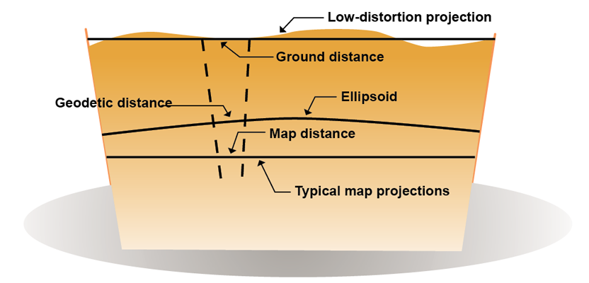
Professor Ghiliani’s article, Transformation of Observations (xyHt, March 2015), states that Low-distortion Map Projections have both advantages over State Plane Coordinates and disadvantages. At a seminar on GPS this last summer a very bright surveyor presented an information-rich 8-hour program in New Mexico. In it he extolled the virtues of Low-distortion Map Projections. At one point as proud as punch he stated that Oregon now has a separate Low-distortion Map Projection for each of its 40 counties. Can you imagine such a mess? He further stated that in one jurisdiction where the authority was checking the geodetic information required to be supplied on maps by land surveyors that something like 80% of the data submitted was in error. Surveyors are being asked to be accomplished geodesists.
Is the tail wagging the dog?
When I suggested that Earth Centered Earth Fixed Coordinates, ECEF, are one system worldwide and the only “conversion factor” is a single transformation involving two angles, he immediately agreed and said he would love to adopt such a system, “if the surveying community would agree.”
With Earth Centered Earth Fixed Coordinates we need just a single transformation. If that is lost and on the ground bearings are available from existing points (sound familiar?), we can recreate the rotation and locate ourselves with the earlier work. A single set of ECEF coordinates at one point and a rotation angle is all that a local surveyor need put on her or his plat to “geographically” reference the survey.
What is the job of the land surveyor? To find the latitude and longitude and ellipsoidal height of each of our client’s corners? I don’t think so. But we have been captured by the technology. When you get in your work truck do you care how fast the fuel pump motor is running? You care about the speed of the vehicle but not so much the rotational rate of the tires. Same with my surveying: I want ground distances and bearings and care little about the geodetic height of the point or the transformations any more than I care about the algorithms used to calculate sines and cosines.
We should be asking our software developers to allow us to do just this. We work on the ground and let the software do the transformations and rotation. Skip Low-distortion Map Projections and State Plane Coordinates. They are approximations, no matter how elegantly wrapped up in multidimensional equations. We are half-way there; we have the ECEF technology we just need to capture it.
Michael Daly
Arrow Engineering
Gallup, NM
arrowengineering1@gmail.com