As the National Geodetic Survey (NGS) completes its transition from the State Geodetic Advisor Program to the Regional Advisor Program by the end of 2016, the states are changing their roles with NGS as well.
In the past, the participating states have been contractual partners with the NGS, providing roughly half of the funding for NGS to provide a state advisor, as well as providing a work space, computer resources, and other daily support, while NGS provided the advisor with a vehicle and support from headquarters. However, at its peak, the state advisor program never had more than 30 states involved, leaving many states with no NGS advisor assigned to them.
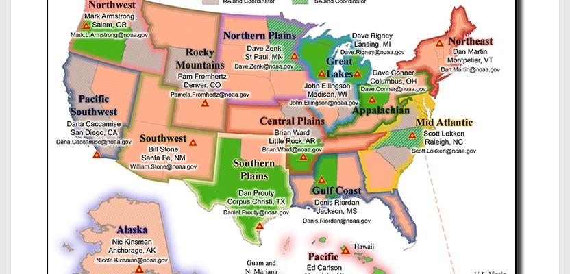
As the NGS began to look towards the transition to the new reference frames in 2022, part of the preparation plan was to transition to a program where every state would have access to a geodetic advisor. Thus, the Regional Advisor Program (RAP) was conceived and a plan implemented to get there.
The NGS recognized that the RAP would spread their resources across greater geographical areas, thus inadvertently preventing the advisors from being able to provide the same level of focused support and coverage that had been provided in the past. So, while every state would have access to an advisor, the level of support would be diluted. Yes, a sacrifice had to be made, but opportunities were also created.
One of those opportunities, to help offset the spreading of the advisor across multiple states, was for NGS to encourage states to identify a qualified person to serve as the state geodetic coordinator. Although the state coordinator concept has been around for some time, it has only been employed in a few states that typically (but not always) did not have an NGS state advisor. With the NGS transition to the RAP, the time has come to ramp up the state geodetic coordinator program.
When the NGS Pacific Southwest regional advisor, Dr. Dana Caccamise, approached the California Spatial Reference Center’s (CSRC) executive committee members about the concept of appointing the first ever state coordinator for California, one of the immediate questions was: What is the role of a state coordinator and what are the NGS expectations of one?
In response, the NGS drafted a document defining their expectations of the role of, and their involvement with (or not) the state geodetic coordinator.
From NGS:
State Geodetic Coordinator
The State Geodetic Coordinator is not employed by NGS and is assigned by a state government agency or university. The Coordinator serves as a liaison between the state and NGS. NGS will not be involved in the selection process, but will acknowledge the position when notified by a state entity recognized for their statewide interest in geodetic activities and connecting such activities to the NSRS. The selection criteria of a State Coordinator are determined by their affiliate agency/organization, but they should include having the broad support of the state’s geospatial community and expertise in geodesy, surveying, engineering or a related field. The roles and responsibilities of a State Coordinator are also determined by their affiliate agency/organization, but they should include using their technical expertise in geodesy to make informed decisions about and provide guidance for geospatial activities that benefit from connecting to the NSRS. The State Geodetic Coordinator is a primary point of contact in the state for the Regional Geodetic Advisor.
Questions answered. Because of my affiliation with the CSRC, and with the much-appreciated support of my employer, I was selected to serve as the California geodetic coordinator.
This appointment has fostered a closer working relationship with Dr. Caccamise, other NGS advisors, and NGS staff at headquarters. Because of being listed on the NGS regional advisor webpage, I have received inquiries from surveyors regarding survey control preservation and seeking technical advice on the preparation of maps and documents involving geodetic control projects.
It appears that the position has provided California surveyors with an additional resource to consult and it has given me the opportunity to continue to expand and hone my knowledge of geodesy and geodetic surveying. Because California is moving rapidly horizontally, and even more rapidly vertically in some regions, having a state-level coordinator to augment and assist our regional advisor seems like a natural fit.
Even in less geodetically challenged states I believe a state level coordinator would be a valuable resource to land surveyors and the geospatial community and would serve as a vital bridge between the federal and local partners and stakeholders. Not every geodetic issue needs to be elevated to the NGS advisor, and some may not even be appropriate yet still need to be addressed.
In addition to the state geodetic coordinator position, NGS has also defined another role they call geodetic partners.
Again, from the NGS:
Geodetic Partners
A geodetic partner is someone who represents an entity whose geospatial activities are dependent on or improved by ties to the NSRS. Partners may be from the public, academic or private sectors. A geodetic partner is interested in staying informed of updates to NGS products and services, emerging tools and techniques, and NGS’ progress towards developing a new geometric and geopotential datum. Geodetic partners act as points of contact for the Regional Geodetic Advisor to disseminate and receive information about geospatial activities within their area of interest.
So, don’t be surprised if you soon hear rumblings in your state about the move to appoint a state geodetic coordinator. If you are fortunate to be in a position to be considered for this role, I highly encourage you to throw your geodetic hat in the ring for consideration (you know, the one with the propeller on top).
With the new National reference frames coming rapidly, we are all going to be challenged by the transition, including how we will deal with the next version of our State Plane Coordinate Systems or variations thereof. Seize this opportunity and be part of the solution, either as a coordinator or partner. I have a hunch you will find it rewarding, challenging, and intellectually stimulating, and your professional friends and colleagues will benefit as well.