What drew early boundary surveyors to the profession is still what modern surveyors love the best.
From researching a farm’s historic boundaries to creating new ones for a subdivision, land surveyor Ray Page sees a diverse workload. He owns Vermont Survey Consultants in Rutland Town, Vermont, and his work keeps him outside most of the time—in weather of all kinds and in all seasons.
Page does a lot of work with engineers on new subdivision projects, helping create base plans for site designs. On other jobs, Page is out on his own doing heavy amounts of historical research as he tries to figure a property’s actual boundaries. Technology plays a major role in this job, as well.
However, at times a surveyor has to look for landmarks that people haven’t sought out in decades. “I’ve looked for piles of stones on top of a mountain that were put there 200 years ago,” Page said. “There’s a little bit of a treasure hunt involved.”
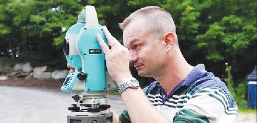
Ray Page surveys a plot of land on Route 4 in Rutland Town, Vermont.
Photo: Anthony Edwards/
Rutland Herald
He particularly likes those “treasure hunt” jobs. Page said it’s very satisfying to do all the historical research, gather evidence, and arrive at a conclusion. He emphasized that his work is strictly evidence-based.
Whenever Page receives a request for a survey, he always asks the person why they’re requesting a survey in order to understand exactly what they need.
Once that’s established, Page looks for information about the property’s boundaries. He researches this information in the town or city land records and his in-house records. He also discusses the land boundaries with adjoining and former landowners and searches for evidence on the property and its vicinity.
On the property, Page measures the property lines and corners. Measurements are typically made using a total station, a GPS, and a good, old-fashioned tape measure. The total station measures distances by laser.
In addition to the boundary information, site improvements including structures, roads, and ponds are located during the survey as well.
After the measuring, Page takes all this information back to the office to perform calculations. He uses computer-aided drafting to document his findings. Also, the corner positions for the property lines are calculated and permanently marked in the field.
To find a property’s boundaries and arrive at a conclusion, Page said, the different pieces of evidence have to “confirm each other.”
“Measuring is not really the only thing you’re concerned with,” Page said. “It’s interpretation of evidence.”
Other resources Page has used in the past include records from the state Agency of Transportation, the courts, the University of Vermont, Middlebury College, and local historical societies.
“You have to get creative with where you look for information,” he said.
Page said the technology in this line of work has come a long way over the years. Today, the equipment includes a robotic total station to measure distances and a data collector, which is a field computer with a built-in GPS and specialized software.
Describing another element of the job, Page said surveyors occasionally have to testify in court as an expert in the case of a land dispute. However, he said that doesn’t happen in the vast majority of situations.
“I think you’ll find that the majority of dispute cases never go to court,” he said.
Page has been in this industry for nearly 15 years. A Shrewsbury native, he got his start in surveying when now-retired surveyor Pete Franzoni hired him in 2000.
Page is a licensed surveyor in Vermont and New Hampshire. He’s also licensed designer in Vermont for water and wastewater permitting. Page’s company does most of its surveying in Rutland County, although Page has traveled as far as Portsmouth for his business.