Tag Archives: lidar

xyHt Weekly News Links: 9/29/17
Teledyne Optech and IGI announce new cooperative agreement and first product offering Hemisphere GNSS Debuts Next-Generation S321+ and C321+ GNSS Smart Antennas Septentrio unveils the new Altus NR3 at InterGEO GeoSLAM Launching Enhanced SLAM Software and Next Generation Mobile Scanner at InterGEO 2017 INTERGEO 2017 Berlin: Geo-IT-event officially opened Applanix Announces POSPac Cloud for Mobile Mapping...
xyHt Weekly News Links: 9/22/17
Phase One Industrial Introduces 190MP Aerial System Orbit GT to showcase new v18 for Mobile, UAS, Indoor and Aerial Mapping at Intergeo, Berlin Hosting massive geodata made easier by new cloud solution LizardTech Awarded U.S. Patent for LiDAR Point Cloud Compression senseFly to launch industry-specific solutions at INTERGEO 2017 Measure’s First Drone Services Franchise Opens...
xyHt Weekly News Links: 9/8/17
This page includes a weekly roundup of industry news links for surveying, UAS, location technology, web mapping, hydrographics, engineering, construction, and more. NPL 322+ New Reflectorless and Prism-only Total Station SimActive Releases Correlator3D™ Version 7.0 Hurricane Harvey Early Predictive Analysis with Wind and Storm Surge Data Blue Marble Provides Free Copies of Global Mapper to...
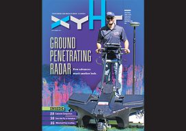
xyHt Magazine September 2017 Issue
To view this issue as it appears in full in print, click the cover: Articles from this issue include: Go for the Beer! Recording, Registration, and Cadastres: Comparing systems for real-property management in the Netherlands and the United States. GPR Revisited: Arrays of multiple sensors and advances in processing breathe new life into the field...
xyHt Weekly News Recap: 7/7/17
Tersus launches a ‘new generation’ NeoRTK system senseFly announces worry-free service package to keep professional drone operators flying Surveying the World of Tomorrow CompassCom to Release CompassTracker App for iOS & Windows Mobile Smart Phones at Esri User Conference Trimble Catalyst high-accuracy, on-demand geolocation service now available worldwide Quorum Launches myQuorum Land On Demand, Bringing Speed...
The GeoDude on the Adoption of Laser Scanning Today
Part 2 Above: Although not yet fully mainstream for topographic surveys, laser scanning is frequently used to topo sites with a lot of detail and hardscape. Credit: Allegheny Surveys. With new and emerging technologies such as laser scanning, many professionals want to know “When is the right time to get in?” They may worry about...