Tag Archives: uas
Assessing the Potential
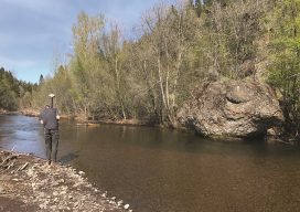
UAS-based Topobathymetric Lidar Surveys Understanding stream channel and floodplain morphology is critical for a number of efforts—from hydraulic modeling and stream-restoration design to aquatic habitat assessment. These applications require description of conditions both inside the channels and in the adjacent riparian zones. Gathering these data has typically relied on individuals on the ground or in...

Cool School
Siberian State University of Geosystems and Technologies Editor’s note: The name, “Siberia” evokes visions of a vast, cold, and perhaps foreboding place. Vast, yes, but also beautiful, steeped with fascinating history and resources and home to a diverse population imbued with a pioneering spirit. To meet the demands for qualified surveyors for the region, a...
Angélica Ortiz Arteaga
BIM Director, IUYET Consortium Mexico A particularly impressive presentation at HxGN 2017 was by the IUYET Consortium about their work on the new airport rail project in Mexico City. The contributions of IUYET in the use of advanced surveying, scanning, mobile mapping, UAS, GNSS, and construction monitoring are splendid examples of the 21st century digital...
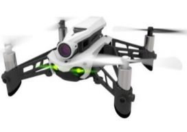
Why Your First Drone Should Be a Hobby Drone
A low-cost way to get hands-on UAS experience is to purchase a hobby drone and practice with it before making a bigger investment in a commercial-grade unit. I’ve talked to UAS professionals who agree . Why? The low cost makes it easy to afford and less painful should you crack it up. And, trust me...

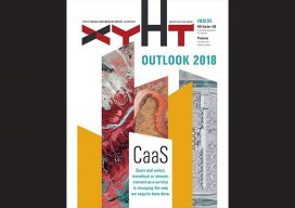
xyHt Magazine January 2018 Issue
Click on the cover below to view the January 2018 issue of xyHt magazine. Articles in the issue include (links will turn live throughout January): Infrastructure, BIM, and the Brothers Bentley: Meeting the needs of the global infrastructure boom, Bentley Systems has forged technology partnerships; moved to erase the workflow barriers among surveying, engineering, and construction; and...

Drone Coding: Fun, Future, and Fundamentals
For Surveying’s Next Generation Attracting the next generation of surveyors is a perennial topic in the geospatial profession. I’d like to suggest adding K-12 UAS coding programs to the list of outreach efforts. The sooner students become interested in the geospatial field, the greater the success of attracting them to the profession. It is widely...