Tag Archives: USGS
Lidar for Floodplain Models: A Project in Florida
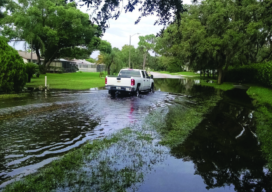
Florida’s topology data gets a needed update with a massive project based on lidar data. Three major hurricanes (Category 4 and above) passed through the Caribbean and the Gulf of Mexico during the 2017 hurricane season—Harvey, Maria, and Irma—and they were three of the five costliest hurricanes in the United States’ history. Hurricane Irma, for...
Surveying Scientists: The USGS Does It Right
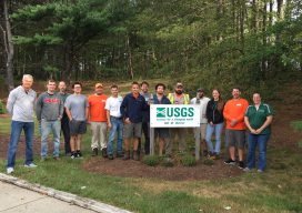
As is often the case in our tightly networked profession, one thing leads to another. In early 2017 I was contacted by the US Geological Survey (USGS) hydrologist, Brenda Densmore, from the USGS Nebraska Water Science Center. Brenda had found me through the NGS State Geodetic Coordinator web page and reached out to me for...

Getting out Is a Good Thing
Field Notes Although I have been active in the surveying profession in several ways over the years, including serving as the editor of Field Notes, I really haven’t ventured out much to seek face-to-face encounters in various venues and settings, but that recently changed a bit and has produced a new perspective for me. In...
Geodetic Control over Time and Space in California
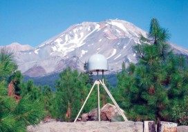
Interview with Scott Martin, Chief of Geodetic Control and GNSS Surveys, California DoT Above: UNAVCO/PBO station P655 with Mt. Shasta in the background. Matteo Luccio: Scott, what is your relevant background and what is your current role? Scott Martin: I’m a state employee with the California Department of Transportation (Caltrans), in the Office of Land...

Shifting Ground: USGS on Earth Movement after an Earthquake
Ken Hudnut, science advisor for risk reduction, US Geological Survey, talks GPS and earthquakes. Editor’s note: In many ways, we are all participants in a grand scientific endeavor that’s on the cusp of helping humankind prepare for some of the most destructive natural hazards–earthquakes and volcanic eruptions. The fields of seismology, geodesy, and surveying have...
Survey Web Tools
How to use them for land survey planning and reconnaissance. When I first used GNSS, it was my usual practice to go to the National Geodetic Survey (NGS) website to gather the data sheets for control monuments in the vicinity of my project area. I would plot these in a program called TopoScout, a topographic...