As is often the case in our tightly networked profession, one thing leads to another. In early 2017 I was contacted by the US Geological Survey (USGS) hydrologist, Brenda Densmore, from the USGS Nebraska Water Science Center. Brenda had found me through the NGS State Geodetic Coordinator web page and reached out to me for assistance. She was being deployed to California to perform GNSS surveying to establish NAVD88 elevations near several tide gauge sites in the California Delta, where she had never surveyed before. Because the area is prone to subsidence, Brenda was concerned about finding quality, trustworthy vertical control to reference her campaign to.
As luck would have it, I had been involved in three major height modernization surveys in the Delta, in 1998, 2002 (Bluebooked), and 2011 (Bluebooked), so I had local knowledge of her area of interest. I was pleased to be able to help her and went away from our conversations impressed by how knowledgeable she was. After all, she was a scientist, not a surveyor, right?
Fast forward to the fall of 2017, when Brenda contacted me regarding a week of GNSS training the USGS had planned for the spring of 2018, which would be held at their California Water Science Center in Sacramento. Brenda asked if I would be willing to present at the training as the state geodetic coordinator and as a California professional land surveyor. After getting clearance, I happily agreed. Over the next few months, we coordinated on content and scheduling. Brenda shared the draft syllabus of the course with me so I would have an idea of what they would be covering during the week, which helped me prepare my materials. I was scheduled for Friday the 13th of April! Oh no!
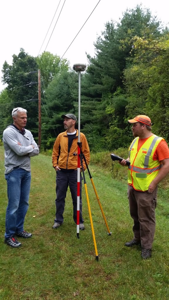
Instructor Paul Rydlund (left) oversees a stationing and elevation profile field exercise. Although incidental to the location, the overhead transmission lines allowed for testing of the impact on data quality. Credit: USGS.
During review of the final course syllabus, I noticed an item that I was interested in hearing regarding work being done to establish and maintain a tie to the NAVD88 vertical datum in the subsidence prone areas of Louisiana. Brenda arranged remote access for me to “attend” this presentation. The content was interesting and introduced creative and well-thought-out approaches to overcome some significant positional stability challenges presented in the region and the ever-present resource limitations. Again, I came away impressed by the knowledge of these surveying scientists. A trend was starting to develop.
Virtually all of my teaching experience and presentations had been given to audiences of surveyors, engineers, or other geospatial professionals, not scientists performing surveying, so I was challenged for a feel of the level of technical information I should include. What happened next changed that immensely.
I arrived a bit early for my scheduled speaking slot, which turned out to offer me even more insight. When I arrived, the students were in the process of taking the end-of-course quiz, so I waited outside of the classroom. Upon completion of the quiz, I was allowed into the room, where one of the instructors, Paul H. Rydlund, Jr., PLS (Missouri) and USGS supervisory hydrologist, went over the quiz questions and answer key with the students. What an eye-opening experience for me, in a very pleasant way.
The quiz consisted of 51 questions, but by question 10 I knew this wasn’t “Button Pushing for Scientists.” The questions covered technical details on the proper planning, execution, and processing/analysis of both GNSS static and real-time campaigns and the underlying fundamental principles thereof. Even after almost a week of intense, extensive training, in both the classroom and field, the students were still engaged. It was clear that they had absorbed the information well, which meant it had been presented well. Everything I witnessed and heard was impressive. These scientists, mostly from the USGS Water Mission area, were learning sound fundamentals to ensure they were collecting the best data possible to support their science. It was also obvious that the accuracy and precision of the vertical component was of key importance to them. I mean, it’s working with water, right?
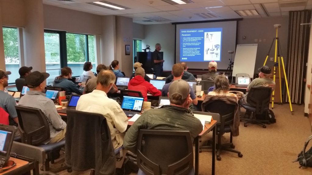
Instructor Paul Rydlund goes over GNSS concepts with the students in the Sacramento facility. Credit: USGS.
By the time Paul got done going through the quiz, two things were apparent to me: 1) I suspected that many experienced surveyors would have struggled with that quiz, and 2) I wasn’t going to need to “dumb down” any of my materials for this group of scientists.
My 90 minutes in front of this group flew by, at least for me. They had come from all across the country and still had flights to catch on Friday the 13th to get back home. But, they hung with me pretty well. Because of my previous experience with Brenda being deployed from Nebraska to California, I felt comfortable exposing them to some of the additional measures we must take regarding checking and maintaining the positions of survey control, even CORS, in dynamic California. It wasn’t impossible that they could be coming to California someday, too. Plus, all of the concepts I conveyed are what I consider “best practices” for assessing survey control in the mission planning phase and useful regardless of where you might work. I got some great questions, which by this point, was no surprise.
As I wrapped up, I thanked the instructors, Brenda and Paul, for inviting me, and the students for hanging in there after a very long and intense week. What I was most thankful for was the opportunity to witness this outstanding training program in person. Surveyors spend a lot of time protecting our turf, often with merit because of poor practices enhanced by the evolution of GPS/GNSS being available to all.
However, I can say this emphatically: The USGS Water Mission scientists using GNSS data collection to support their critical work know what they are doing because their employer has invested in them through this course (which has been taught numerous times across the country) and other resources. This is a model that should be adopted across the nation for scientists using GNSS for data collection. Just take a look at this document.
You might just find something in there that you didn’t know. I know that I did, but I’m not telling!
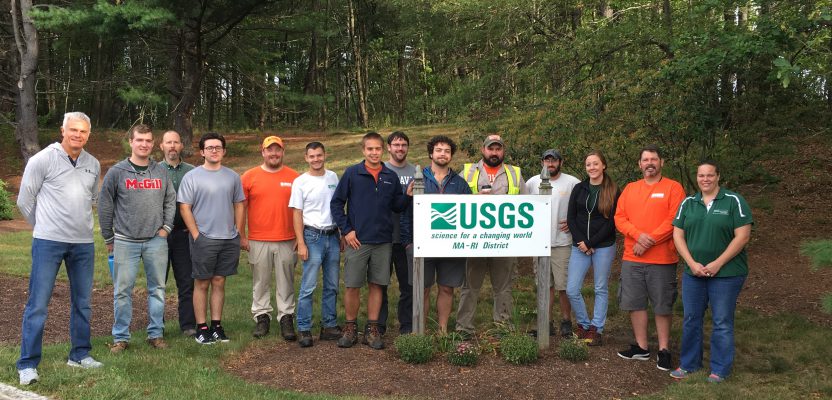
Image at top: Instructors Brenda Densmore (far right) and Paul Rydlund (far left) bracket their students from a class held in Northborough, MA. Credit: USGS.
This article appeared in xyHt‘s e-newsletter, Field Notes. We email it once a month, and it covers a variety of land surveying topics in a conversational tone. You’re welcome to subscribe to the e-newsletter here. (You’ll also receive the twice-monthly Pangaea newsletter with your subscription.)