Category Archives: Hydro/Marine
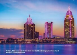
THSOA: New Website and US Hydro 2023
Staying Fluid The Hydrographic Society of America (THSOA) is a 501(c)3 non-profit organization committed to promoting education in hydrography, inshore surveying, inland waters surveying, offshore surveying, positioning and mapping/charting, including related earth sciences. We have organized in a National Board, including the president, secretary, treasurer, and four trustees, and our members by geographical regions, in...
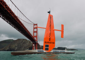
The Ocean Mapping Imperative
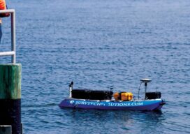
Wind and solar-powered uncrewed surface vehicles offer a boost to global surveying efforts. Since 2017, the Seabed 2030 initiative has raised awareness about the importance of mapping the entire seafloor to support a healthy and resilient ocean for the well-being of the entire planet. This partnership between the Nippon Foundation, the International Hydrographic Organization (IHO),...
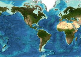
Staying Fluid: The Ocean Decade
More than 23 percent of the ocean seabed is now mapped Seabed 2030 is a partnership between the Nippon Foundation and the General Bathymetric Chart of the Oceans (GEBCO) and aims to map the entire planet’s seabed by 2030. To date, the project has mapped around 23.4 percent of the seabed. The latest data was...
Ocean Observation
Monitoring and comprehensive data collection is now a national security imperative For most of the second half of the last century there was general agreement that the primary existential threat to humanity was the purposeful or accidental exchange of nuclear weapons. While that threat has not been completely eliminated, in the 21st century there is...

The Challenge of Channeling Water
From the Romans to the Everglades, the art of directing water flow has never been easy For thousands of years impromptu land surveyors tried, sometimes successfully, to force water to flow in a direction it did not want to go. This was done to help grow crops in areas where water was not abundant enough...
No Barrier Between Land and Water
Innovative tools and technology help hydrographic mapping deliver detailed data in previously inaccessible areas. Underwater mapping presents unique logistical challenges that are increasingly being met with technology used in creative ways, and by combining multiple types of data to develop a complete picture. From unmanned surface vessels (USV) to multi-beam sonar, advanced equipment yields accurate...