It is high time that xyHt gives a shout out to our new readers who have subscribed since our 2014 launch.
We have gained thousands of readers in surveying, engineering, and the construction sector.
This issue will be circulated broadly at CONEXPO-CON/AGG 2017, one of the largest trade conferences in the world and most definitely the largest in AEC (architecture, engineering, construction). If you’re in the construction sector, you have probably attended one; if you’re not, you should consider attending—it is truly an eye opener.
First-time readers might be wondering what our focus is and its relevancy to construction, and about the odd name. xyHt examines positioning, measurement, and location aspects of AEC: technologies, best practices, and innovation.
With the current talk of 5D and 6D construction, BIM, automation, cloud-based project management, virtual and augmented realities, who is diving deeply into the fundamental “first four Ds”? at is the forte of xyHt.
The spatial-temporal components—the 4D of everything built and operated—are sometimes expressed as xyz + time. We use a geodetic term: x (left-right), y (fore-aft), H (orthometric height), and t (time). You can read more about this term and concept here!
In this issue, we emphasize the 4Ds of construction, beginning with our cover feature on a collaboration in surveying, engineering, and construction, presented as a real-world implementation of “constructioneering.” This is more than just a new buzzword.
Two features highlight the essential role of GNSS (GPS) in AEC and the continuing innovation in that arena. Streamlining layout processes is the focus of a story on layout solutions from Hilti. Articles on scanning and on autonomous construction vehicles are examples of the kinds of 4D-centric content you can expect each month, in print and online.
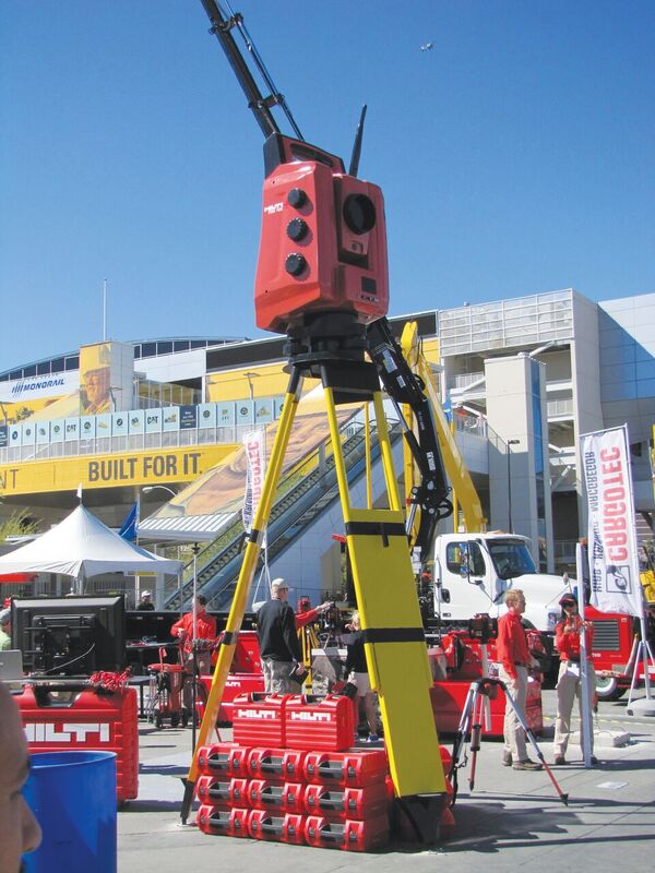
The Hilti display at CONEXPOCON/AGG 2014
Prior to re-branding as xyHt, we published Professional Surveyor Magazine for more than three decades. Many readers told us about a lack of AEC resources covering the spatial (4D) aspects of all related disciplines, including professional surveyors, who perform essential boundary surveys but also provide many other services for the construction sector, as do professional engineers.
We all contribute to construction, the largest manufacturing industry in the world, in the realm of $9 trillion per year. I was amused to see the recent wave of 3D-printer aficionados label themselves as the maker community; construction is very much the “macro” maker community. After all, isn’t a machine=controlled earth mover also a (macro) 3D printer?
Construction, surveying, and engineering share more than we realize (or sometimes care to admit). The spatial DNA of all that we do is the four Ds, and we are here to do the deep dives into the details. Welcome aboard.