Following Mapillary’s announcement yesterday, I sought to get more information about Mapillary and how they have come to be such an interesting prospect in the geospatial world. Mapillary is a pioneer in new ways to capture, share, and utilize street-level images. Yesterday I had the privilege to interview Jan Erik Solem of Mapillary to get the inside information on the announcement.

Mapillary CEO – Jan Erik Solem
ND: In November 2015 there were rumours of this new technology [Mapillary] which was going to revolutionise the way we view the world. What does this news release signify?
JES: We’re moving forward, trying to do more with the images, help our community map, and build better tools and applications. The funding means that we can dive straight into our most ambitious projects.
ND: A crowd sourced “Street view” sounds too good to be true! Is it possible to harness your own environments as well as contributing to the project?
JES: Yes, absolutely. Anyone can contribute photos anywhere. No limits.
Some of Mapillary’s images come from individual projects, such a city’s infrastructure survey or open data initiative (the city of Helsingborg recently uploaded 1 million pictures), but when they are added to Mapillary everyone’s projects are connected without bias. Other organizations use Mapillary’s platform to manage proprietary data, and while this doesn’t contribute to the global photo set, we see them changing how they approach their projects because they can use Mapillary, which is also very exciting. They are using some of our more advanced capabilities, like street sign recognition, to solve real problems.

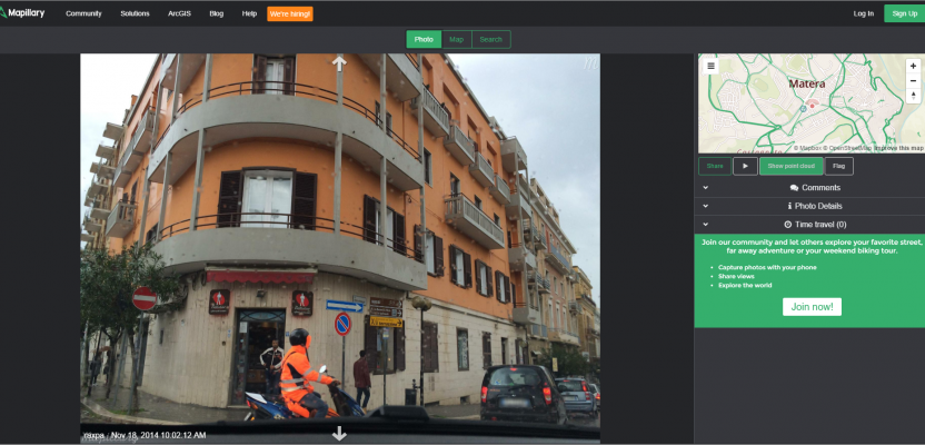
Note the map shows where the photo is and also the field of view
Jan Erik points out that the term “Street View” is a trademark of Google and prefer, the term “Street Photo.” Having viewed the information provided through the interface, it is clear that there is more to be gained than the Google product.
ND: I see that the street photo is linked to the map and that, as you move through the roads, the icon on the map moves as well. Will this function be migrated to Esri ArcGIS Online or ArcGlobe so that we may start to see “smart mapping” (I’m copyrighting that!) in that we can label and identify features in full live 3D?
JES: You can link the viewer to any map. The viewer is open source and there are many examples available here http://mapillary.github.io/mapillary-js/ (Esri, Google, Mapbox…). A proper ArcGIS Online integration is in the works so, yes, there will be smart mapping for all!
ND: You mention Esri. Are we likely to see this as a function on any of the other GIS mapping platforms?
JES: We are excited to be platform-agnostic! We will most likely see integrations to any GIS mapping platform that people think is important.
Jan Erik goes on to show the examples on GitHub that integrate with Leaflet, Mapbox. and Google


ND: Your website says that you can extract 3D models from the data. With ArcGIS Pro and CityEngine gaining popularity, this would be an amazing tool! How does this work? What type of model does it produce? (Would it be a mesh? Textured? Resolution?)
JES: We use a form of photogrammetry (or Structure from Motion, if you prefer that term) to reconstruct all places that are photographed. The model is updated and improved with every image, continuously. We do this for the nice 3D photo navigation and to improve positioning of photos. The models are point clouds, and there is a rough mesh for use in the viewer.
ND: Are you able to give us a taste of how this works?
JES: You can read up on our “behind the scenes” blog post where we try to explain it: http://blog.mapillary.com/update/2015/11/10/pointclouds.html. Also a nice video which illustrates the type of point clouds we get.
ND: What is the vision moving forward? The potential of this is immense so there must be a plan…..
JES: Of course 😉 Our long-term vision is to map the world with photos and create a visual representation of every place that people care about. In addition to that, our ambition is to build tools that understand these places, how they change over time, and make that information available as data for cities and organizations to help them work smarter.
![]()