Soldiers in uniform, fully robed Middle Eastern sheiks, Hollywood producers, and even Morley Safer, reporting for CBS’s 60 Minutes, were among the 8,000 people who shopped for or just came to learn about unmanned vehicles (drones to common society) for use in the air, underwater, or on land at the biggest expo of its kind at the Washington, D.C. Convention Center August 12-15.
Less visible, but definitely there in numbers, were surveyors.
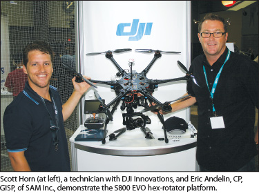
PSM caught up with a few of the land and aerial surveyors who attended this year’s annual gathering of the Association for Unmanned Vehicle Systems International (AUVSI) to find out why they were there and what they were looking for.
Eric Andelin, CP, GISP, of Surveying and Mapping, Inc., Dallas, Texas, explained that his company fields 102 survey crews across the country on a daily basis. “It’s my vision that a company like SAM or a survey company will have a UAV with their crews. This is the place where that technology is being born. Right now it’s in the defense and aerospace market. This conference seems to be mainly about surveillance and defense products, but once the FAA [Federal Aviation Administration] opens the airspace I think that every surveyor is going to have one of these systems.”
Noting that the FAA recently granted authorization for two companies to test UAVs on work in the U.S., Andelin said, “It’s going to come faster than most people are predicting. I don’t think the FAA can grant access to just two companies and deny it to the others. So, you’ve got companies like Trimble who are really ramping up to get these systems into, in their case, the ag [agriculture] market. We at SAM are a corridor company—utilities, pipelines, transportation—we see these systems being used for corridor work, be it large helicopters or small quad or hexicopter systems.”
Acknowledging that SAM is one of the nation’s largest surveying firms, Andelin said that the smaller, less-expensive quadcopter systems would work cost-effectively for “mom and pop” surveying companies. “We’ve got coal inventories, we’ve got pit mines that need to be surveyed—all of those things can be done from an inexpensive platform, and I really see this as democratizing aerial mapping,” Andelin added.
He noted that present were a number of turnkey UAV systems in which a surveyor “can take your UAV out to the field. It has a pre-programmed flight in it. It knows when to take the exposures and the type of overlap required. The surveyor will set that thing up, let it fly; it will collect all the information.
When it comes back, it goes into the software, which then registers all the imagery and creates orthos and surface models. I’ve even seen companies here that offer cloud-based services where they’d do that for you, and these companies aren’t even based here in the U.S. So you collect the data, it gets shipped into the cloud to another company; they do the processing and kick out surface models for you.”
The introduction of the UAV to surveyors is similar to when GPS became available to surveyors, Andelin said. “It opened it up for a lot of surveyors. This is going to do the same thing. It is going to increase their services to their clients, and on the flip side, for those of us who are in geospatial, it’s going to allow us to drill back into a client base that we may have had to walk away from because of acquisition costs.”  Mike Tully of Aerial Services Inc. in Cedar Falls, Iowa, marveled at what he described as an “amazing breadth of innovation, from sensors to aircraft. “A lot of the military technology is finding its way into more affordable civil systems that will mean a lot to remote sensing providers like ourselves,” Tully told PSM.
“To surveyors in particular, this will mean more reach, another tool in their toolbox to supplement the traditional land-based surveying with air-based surveying that has different accuracy characteristics. It definitely gives a surveyor greater reach.”
For aerial mapping firms like Aerial Services, which currently fly only manned aircraft, Tully told PSM, “We think that this technology will eventually enable us to bring the cost per acre down for remote sense data, whether it’s imagery or surface models, and therefore open up markets that today we just can’t touch because it’s too expensive with a manned aircraft and million-dollar sensors to provide data to these newer markets.”
Tully offered an example: “Precision agriculture has for the most part been untouchable. We do work with precision ag today, but to a great extent the market is very small because we’re too expensive. A farmer needs prices down below $1 an acre, which is really hard to do with our traditional equipment.”
He predicts that the smaller UAVs will be used at first to establish the market, then expanding to larger UAV platforms.  Jim Van Rens, president of Riegl USA, predicted that UAVs offer tremendous potential to be able to collect data more cost-effectively, more completely while simultaneously taking “personnel out of harm’s way.”
“The geospatial industry—surveyors, mappers—have known about UAVs for a long, long time. They have been at the forefront of a lot of experimentation. Their expectations are that they want to be able to field these systems. They’re quite frustrated with the FAA and the limitations that have been placed upon them, and they want to look forward to the future of the industry, as everyone does, and they want to be engaged, and they want to be in on the ground level, and they want to know where their businesses are going and what the future trends are, and they’re here.”
Van Rens noted that his firm has provided lidar sensors to governments and firms engaged in R&D. He said that while photogrammetric sensors will be popular on the smaller UAS, lidar with its active sensors provides greater precision than the typical camera system can.
See the full interviews below.
Conference Recap – Transcript of Full Interviews
Eric Andelin, CP, GISP
Surveying and Mapping, Inc.
Dallas, TX
PSM: Eric, why are you at this year’s AUVSI Unmanned Systems conference and expo [the world’s largest event for aerial, hydro, and land unmanned vehicles, August 12-15 in Washington, D.C.]?
EA: SAM puts out every day about 102 survey crews across the U.S. It’s my vision that a company like SAM or a survey company will have a UAV with their crews. This is the place where that technology is being born. Right now it’s in the defense and aerospace market. This conference seems to be mainly about surveillance and defense products, but once the FAA opens up the airspace I think that every surveyor is going to have one of these systems.
PSM: We’ve seen a few other survey company representatives, such as Woolpert that recently acquired a UAS from Altavian, so you are not alone here. What are you seeing?
EA: Correct. Again, with the FAA granting authorization to two companies recently to fly, it’s apparent that it’s going to come faster than most people are predicting. I don’t think the FAA can grant access to just two companies and deny it to the others. So, you’ve got companies like Trimble who are really ramping up to get these systems into, in their case the ag [agriculture] market. We at SAM are a corridor company—utilities, pipelines, transportation—we see these systems being used for corridor work, be it large helicopters or small quad or hexicopter systems.
PSM: That’s great for SAM, one of the largest firms in the nation. But is there something you see here for the smaller survey firms?
EA: Yes. I actually think that the smaller quad systems, when put together with some of the software technology that’s being shown here—I actually do believe that mom and pop surveying companies can use these things. We’ve got coal inventories, we’ve got pit mines that need to be surveyed, all of those things can be done from an inexpensive platform, and I really see this as democratizing aerial mapping.
PSM: Can you give us an example of how a small survey firm might avail themselves of something you’ve seen here?
EA: Yes. Although they are not targeting the surveying profession here, there are certainly some turnkey systems and there are companies that do build those. With these systems you can take your UAV out to the field. It has a pre-programmed flight in it. It knows when to take the exposures and the type of overlap required. The surveyor will set that thing up, let it fly; it will collect all the information. When it comes back, it goes into the software, which then registers all the imagery, and creates orthos and surface models. I’ve even seen companies here that offer cloud-based services where they’d do that for you, and these companies aren’t even based here in the U.S. So you collect the data, it gets shipped into the cloud to another company; they do the processing and kick out surface models for you.
PSM: Have you seen any systems that you are particularly interested in?
EA: I’m more interested in the quads [quadricopters], the hexicopters, the octicopters, just because I think, flying under 400 feet which is the RC [remote controlled] regulation, that airspace is going to be much more attainable in the near future than, say, being in commercial air space.
So, although we do a lot of corridor work and we will use UAVs at some point to do that, I think that’s farther out than the quad systems. The quad systems are inexpensive, which—really at this point because the technology is changing so fast—I find it really hard to invest a lot of money in an acquisition platform.
PSM: What kind of investment are you talking about?
EA: Depending on whom you are working with. If you are looking at one of the more-known survey supply companies here or geospatial companies here, you are probably talking about $60,000 to $80,000 for a system. But also, if you look down to the hobbyists where all this technology is coming from, you’re looking at maybe $10,000 for a system that can capture photogrammetric data.
PSM: Will this get the surveyor’s foot in the door?
EA: Absolutely. I liken it to when GPS came into the market. It opened it up for a lot of surveyors. This is going to do the same thing. It is going to increase their services to their clients, and on the flip side for those of us who are in geospatial it’s going to allow us to drill back into a client base that we may have had to walk away from because of acquisition costs. Now, all of a sudden, if you’re a geospatial company and you have survey crews, you can send a system out with a survey crew, you can capture that data, you can do that type of work, which, again, you had to walk away from.
PSM: Can you give us an idea of something that you’ve walked away from and can now possibly re-enter?
EA: The inventory market is one. You’ve got stockpile inventories, you’ve got coal inventories. Along the Arkansas River you’ve got sand inventories for cement. Those are very difficult for a company our size or any geospatial company to be involved with because usually they’re site-specific; you have to drive or get the aircraft to that location, and they may cover three states. It’s very difficult to bring that kind of traditional acquisition equipment into that space affordably.
PSM: What kind of advice would you give to someone who is not here but is a professional surveyor and whose career depends on the new technologies?
EA: A lot of what you already know will go into this type of service. The big challenge for most people is going to be either learning how to fly these aircraft or getting employees that are capable of flying these aircraft, monitoring them when they’re in the air, and ensuring that the type of data that comes from them is suitable for mapping. But again, much of what we already know—GPS, IMU, targeting, control, bringing survey in—all of that remains the same. So, it’s not that big a hurdle to get involved with UAVs.
PSM: Have you flown one?
EA: Just for fun. I have a few toys that I play with, and I recommend everybody start that way. You know you can go back to the AR Drones, you can buy the DJI systems for, I think, $600. We see them all the time in Austin: people flying them everywhere, but the basics are the same when it comes to quad or hex or octacopters. They all fly pretty much the same way.
The neat thing and what we’re seeing here is that again there are autopilot functions being developed in these things. They take off, they fly the routes they need to fly; you don’t have to do that. And they know where to land. As long as you have somebody on staff or you have the knowledge of how to set up a project, you’re golden.
Mike Tully
Aerial Services Inc.
Cedar Falls, Iowa
PSM: Mike, why are you attending the AUVSI?
MT: Mainly, to stay abreast of this developing technology that will revolutionize remote sensing in our country.
PSM: What are you seeing?
MT: An amazing breadth of innovation, from sensors to aircraft. A lot of the military technology is finding its way into more affordable civil systems that will mean a lot to remote sensing providers like ourselves.
PSM: We’re seeing a few aerial and land surveyors walking the expo. What is this going to mean to their world?
MT: To surveyors in particular, this will mean more reach, another tool in their toolbox to supplement the traditional land-based surveying with air-based surveying that has different accuracy characteristics. It definitely gives a surveyor greater reach.
PSM: What does this mean for Aerial Services, Inc.?
MT: We think that this technology will eventually enable us to bring the cost per acre down for remote sense data, whether it’s imagery or surface models, and therefore open up markets that today we just can’t touch because it’s too expensive with a manned aircraft and million-dollar sensors to provide data to these newer markets.
PSM: Can you give us one example of a market that has been heretofore untouchable?
MT: Precision agriculture has for the most part been untouchable. We do work with precision ag today, but to a great extent the market is very small because we’re too expensive. A farmer needs prices down below $1 an acre, which is really hard to do with our traditional equipment.
PSM: Is there anything in particular that is catching your fancy?
MT: Some of these copters could be useful tools in a number of markets, and other small UASs have a lot of potential in the near term because we might be able to fly them in the near term commercially. Right now we can’t because of FAA regulations, but it’s conceivable that they’ll make exceptions and provide some opportunity there.
PSM: Aerial Services flies manned aircraft. This obviously has the potential to be a budget-saving opportunity for you. What are you looking at?
MT: It looks like today we might be able to get a respectable remote sensing system for $60,000 to $80,000. The capabilities per dollar are only going to improve in the coming months and years. Over the next five years or so, we’ll start seeing some of these small innovators merging with larger ones, and we might start seeing some standards driving system platforms. So we’ll see some consolidation and a stronger presence of larger companies that win out on some of this innovation and technology.
PSM: Have you flown any of these AUV systems?
MT: Yes, I have. We work with the University of Northern Iowa. We have a COA established around Cedar Falls, Iowa, with the university and are flying a small UAS with them and just learning what the technology has to offer and what its benefits and limitations are.
PSM: How difficult or easy are they to fly?
MT: That depends on the machine. The fully autonomous machines are considerably easier to fly than the remote controlled/radio controlled machines, which is what we have today. Those require considerably more skill to fly and are more apt to have incidents, you know crashes on landing or on take off. So, the fully autonomous craft seem a little more adept at remote sensing that we want to do.
PSM: You don’t see the need for being a pilot to fly one of these, as some have suggested?
MT: Well, you do have to be a licensed pilot to operate these today in these COAs, according to the FAA regulations. But the traditional skills that a pilot has will not be necessary [after FAA regulations change in 2015] to fly some of these craft.
PSM: So, surveyors should not be scared off.
MT: That is yet to be determined because of the FAA and the regulatory environment. No one knows for sure how reasonable they will be or if they’ll still require licensed pilots to operate these things.
Jim Van Rens
President, Riegl USA
PSM: Why is Riegl at a UAV convention?
JVR: The UAV business at the moment is focused on government issues in the typical drone-type areas that everyone knows about, but Riegl sees that there is great geospatial impact that drones, and a potential for unmanned airborne vehicles, to be able to collect data and to take more and more of personnel out of harm’s way when being required in conditions that are not optimal for human life and to be able to collect data more effectively, more cost-effectively of course, but more completely.
PSM: We are seeing more of our surveying and aerial mapping clients here than we both expected. What are they telling you, and why do think they are here?
JVR: The geospatial industry—surveyors, mappers, things of that nature—have known about unmanned aerial vehicles for a long, long time. They have been at the forefront of a lot of experimentation. Their expectations are that they want to be able to field these systems. They’re quite frustrated with the FAA and the limitations that have been placed upon them, and they want to look forward to the future of the industry as well as everyone does, and they want to be engaged, and they want to be in on the ground level, and they want to know where their businesses are going and what the future trends are, and they’re here.
PSM: Riegl is not a manufacturer of UAVs. However you’re here with a product that is of interest to a lot of people here who do manufacture UAVs. Have you had conversations with them about what you manufacture?
JVR: Of course. Riegl has provided lidar sensors to a number of governments and a number of firms that have been engaged in R&D. Our platforms are a little too heavy for a lot of the small drones that operate in low altitudes. We understand that. What’s going to be prevalent and dominant in those smaller UAVs are photogrammetric sensors. But, nevertheless, you need to have lidar because it’s an active sensor with much greater precision than you would find in a typical camera system.
PSM: There are platforms of all sizes and dimensions here. Do you see some that are applicable to what you currently manufacture?
JVR: We have a system on the Schiebel platform (that is one of the main sponsors here), and of course we’ve got a number of systems that are installed in the larger UAV platforms that are more typically associated with government operations. However, there are a few other Riegl sensors on smaller experimental platforms that are operated by universities and research institutes. But really, what we are seeing here is, you can find a UAV platform for $500 or you can spend $30 million here. A lot depends on what the requirements are. But the future for the geospatial industry, which is really what we’re looking at, is more at the low end of things, and so Riegl is actively looking at this market to direct its product development.
PSM: So you’re going to be taking what you see here and taking it back and saying this is where we need to be in the next three to five years?
JVR: Absolutely.
PSM: What are you going to tell the folks back in Austria [Riegl’s home country]?
JVR: It’s a no-brainer. You have to be smaller, you have to be lighter, you have to be cheaper.
PSM: Surveyors here tell us there is an entry level for every surveyor.
JVR: That’s true. If you take one of the small $500 UAVs put a very inexpensive digital camera on board, you can do scene documentation quickly and effectively without much of a problem.
PSM: Have you flown any of these UAVs?
JVR: No. I’m jealous of anybody who has.
PSM: We’ve spoken with a number of surveying company employees who are here who have been testing UAVs. When are you going to get your hands on one of these?
JVR: The engineers at Riegl USA are anxious to get one to experiment with. At the moment we’re utilizing fixed-wing aircraft to do a lot of our tests. I’m sure that when the right platform comes along we’ll have one on board and we’ll experiment with it.