Kespry offers much more than a bird’s eye view.
Take a computer scientist from Stanford University (who’s worked in Silicon Valley doing research for BMW on self-driving cars and smartphone integration) and add some grads from MIT and Cal Tech (with a passion for flight, physics, and computer science). Present them with the challenge of flying computers via state-of-the-art drone technology. Finally, give them $11 million in seed money and tell them to find an industry most in need of precisely this technology.
Kespry, a company named by co-mingling birds of prey Osprey and Kestrel, is what they’ve come up with (mostly because the web address kespry.com was available). While they are initially focusing on serving the business of aggregates, the business of surveying will soon be in their sights.
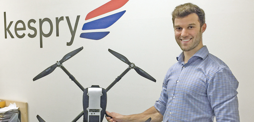
Company CEO and founder Paul Doersch, a Stanford alum, saw the challenge as a desire to solve real-world problems. He found that aggregate and construction material businesses have struggled to find a method that would allow them to accurately and affordably estimate the volume of material piles.
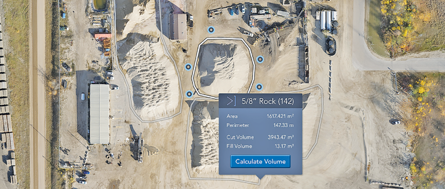
Recent stockpile features include being able to measure volumes of odd-shaped aggregate piles against walls and automatically calculating weight from aggregate material density.
Fly a Stockpile
Their system is an all-in-one package consisting of a drone, an iPad installed with a Kespry-specific app, and cloud services for automatically processing the information acquired by the drone. Training to use the system is surprisingly minimal.
Doersch explained, “The way the customer uses it: he calls us up, and we send him a box with everything in it. He takes the drone out, pops in a rechargeable battery, clicks the battery in, puts the drone on the ground, and opens up the iPad. On the iPad he outlines the property that he can see on our app, he sets the height the drone should fly at, and he clicks ‘take-off.’
“The drone automatically starts flying and goes back and forth in a pre-programmed grid pattern. The drone automatically knows the camera’s viewing angle, where the ground is, and the capabilities of the 24-megapixel camera. So, the operator just sits there drinking his coffee for 20 minutes until the mission is complete. There are no joysticks, no flight training. The app is specifically designed for this application only: I want this region mapped. There is no option of unspecified way points; there’s no concept of manually steering it around.”
Resolution on the ground is about 0.5cm per pixel to 1.5cm per pixel, depending on how high the drone flies. Typically, the drone captures about 10 gigabytes of photos during a flight, and this is automatically uploaded to the iPad via WiFi, then up to the cloud.
“By the time the operator is back at his desk, the data is waiting for him,” Doersch continued. “The system is seamless. He goes into his air-conditioned office where it is not 110 degrees like it is outside; he logs into www.kespry.com, and he can see the data that he’s just captured. Now it takes between 30 minutes and six hours to create the 3D model, depending on how large the area is, but either way it’s the same day because the server is doing a bunch of crunching.”
The operator can see a bird’s-eye view of the entire site and can zoom to see people walking around with their hardhats on.
“But the killer app—” Doersch said, “the value that they’re getting right now is that they can outline their stockpiles, all of them, and for each one they can calculate the volume within seconds. To export it, there’s a button that says ‘download.’
“There are five or six default file formats. One of them is LAS pointcloud; one is OBJ mesh; there is a DSM digital service model more like a topo map format; there is an orthographic photo format; and, for customers who are more advanced, they can contact us and we just flip a switch and they can have whatever format they want, for example, DXF for Autodesk. There are something like 35 formats that we already have available. We just check that box, and the client gets what they need.”
Rent a System
What makes their package unique is that they won’t sell you a drone and related software; instead, they will lease it to you.
Doersch explained that Kespry’s business model was arrived at by viewing the client’s perspective. Cost is always a concern, particularly in implementing start-up technologies. Buying or leasing a drone and related technology, along with the cost related to learning the system plus frequent access to cloud computing, can easily become expensive.
As a result, Kespry has adopted an annual lease system for their product. Clients can use the drone and cloud services as frequently as needed throughout the year without additional fees.
Next in the company’s sights is the field of asset management. Doersch understands that many construction firms have difficulty maintaining logistic awareness of the location of their machinery.
The challenge Kespry faced entering this field is the variability of job sites and their conditions. This variability makes it difficult for a drone to be programmed in a way that can handle the vast number of situations.
As a result, Kespry partnered with visual computing technology company Nvidia, which has developed an artificial intelligence module called the Jetson TX1. This module allows for drones and autonomous robotic systems to recognize the images they record as specific objects and, through the use of complex algorithms, adapt to new situations as they arise.
Kespry is certainly a young company worth watching as they continue to evolve.