A Louisiana company upgrades its aerial photography camera hoping its business will soar
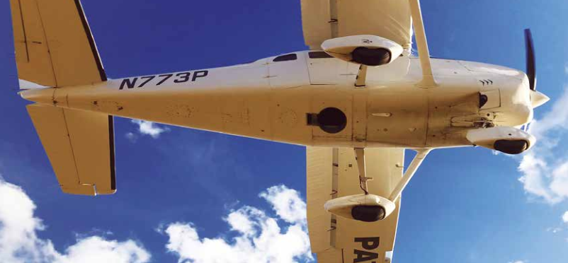
Featured image: Looking up into the belly of a Cessna 206 airplane. The camera is looking down through the hole.
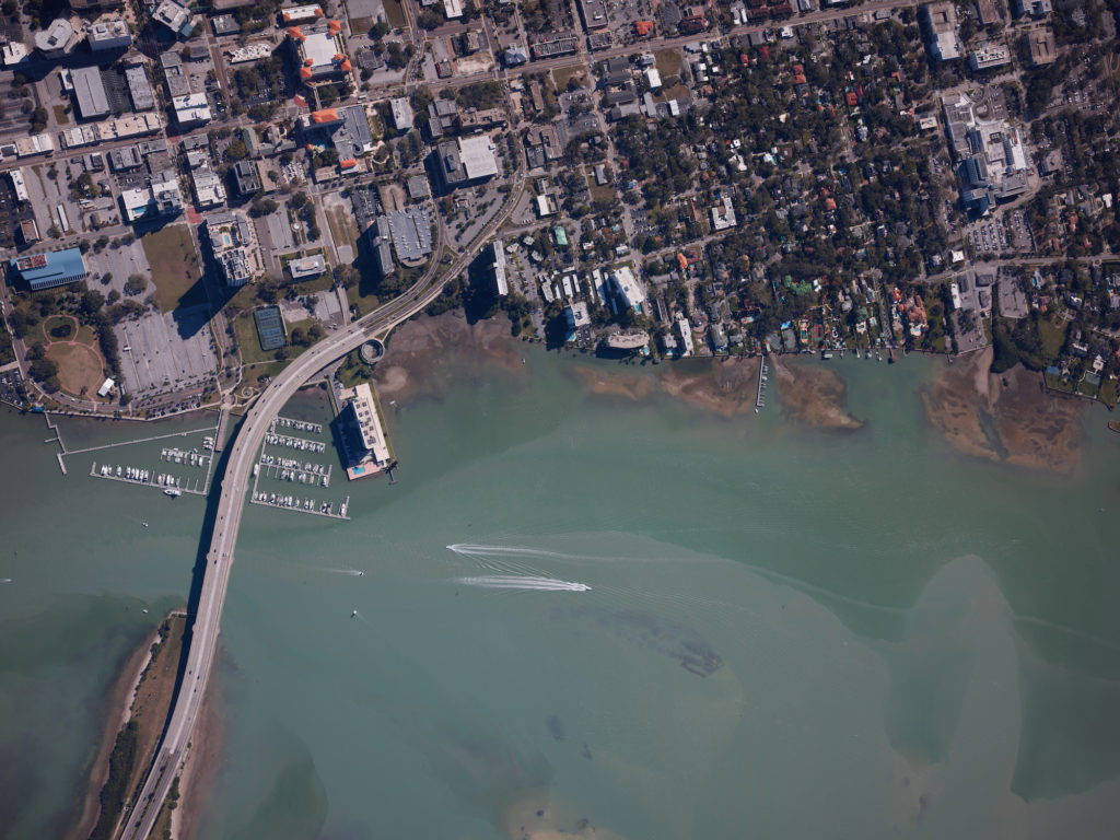
Infrastructure like bridges (this one in Tampa, Florida), airports and oil and gas pipelines require regular aerial mapping for maintenance, installation and wetland identification.
Editor’s Note: Aerial firms, whether they are using piloted platforms or UAS, often find themselves at a point where their existing low-end cameras or systems limit their aerial photography potential. We are seeing more of this as aerial data drives expanded value for asset management, 4D construction, digital twinning, and more.
In the past, Air Data Solutions (ADS), of Natchitoches, Louisiana, had utilized DSLR camera systems to capture survey data. While a DSLR solution had met the requirements of past projects, ADS had outgrown the aerial photography technology.
ADS began by providing simple aerial photography to farmers and landowners. Starting in property management, ADS’s clientele has expanded, requiring more sophisticated data acquisition services. Don Cummins, president of ADS, knew that by investing in image quality and processing efficiency he could grow his business and access new opportunities in aerial imaging services.
Client Needs
With a recent investment in a high-resolution aerial system, ADS’s clients have expanded to include oil and gas companies, natural resources and the 4-band imagery market. One customer, Total Midstream Integration (TMI), requires high-resolution 4-band imagery for their pipeline right-of-way projects.
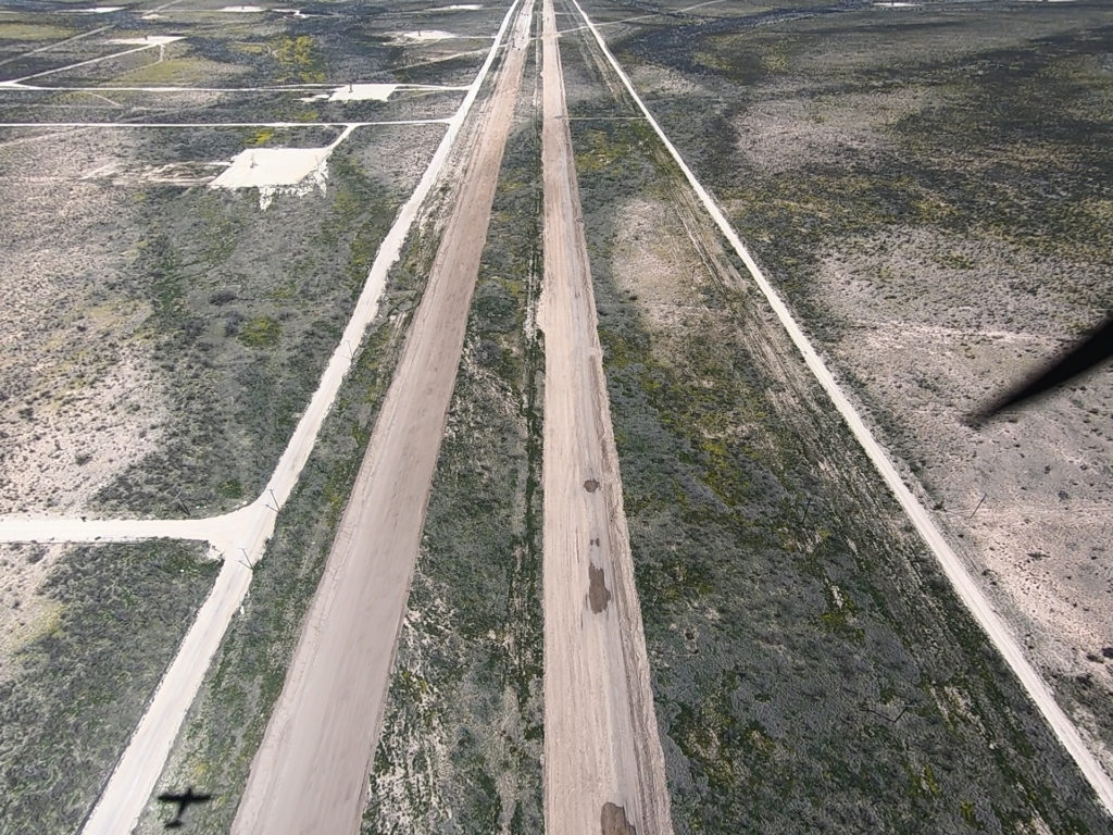
Critical infrastructure, like oil and gas pipelines, require regular right-of-way mapping for maintenance, installation and wetland identification. When ADS was appointed by TMI to capture data along miles of right of way, it needed to collect RGB images for mapping, route planning and structure identification. TMI was also required to collect Near Infrared (NIR) images to identify vegetation stress and map wetlands. Vegetation stress can be an early indicator of oil and gas leaks. TMI’s requirements along with other clients in ADS’s growing business, required ADS to upgrade its imagery collection technology and improve flight and processing efficiency.
ADS was determined to offer better quality images, improve processing times and increase productivity in the field. ADS needed a new camera system that could be installed in the Cessna 206 single-engine aircraft in its fleet. By utilizing an existing aircraft, the company could better manage costs and minimize crew training required for a new aerial imagery system.
The New System
To meet TMI’s requirements while improving its own productivity, ADS turned to a Phase One Industrial Aerial System. The Phase One system included two synchronized 100 megapixel aerial cameras and iX Controller mounted in a SOMAG DSM400 gyro stabilizer with a Applanix GNSS/IMU system.
The system is compact and light enough for one person to install in an aircraft. The cameras capture RGB and NIR imagery concurrently. Phase One’s iX Controller and iX Capture software compliment the system. In addition to the aerial system, ADS also purchased iX Flight, Phase One’s flight management system and iX Plan for flight planning.
The Phase One Industrial camera system has reduced data collection times considerably. With the previous DSLR system it took eight hours to capture six-inch ground sample distance (GSD) photos over a 100,000 acre area. The medium format 100MP Phase One system can cover that same area in only three hours, flying 500 feet higher while improving resolution considerably, down to four-inch GSD.
Reducing flight times allows ADS to fly when lighting conditions are at their best and when weather windows are short. The Phase One 100MP system has shown a 43 percent increase in overall productivity, while utilizing ADS’s current fixed-wing platform. ADS’s flight crew can collect imagery over a much larger area per flight hour than was possible in the past.
Flight planning and execution can be an overlooked aspect of aerial data collection. By utilizing Phase One’s iX Plan software, ADS has markedly improved productivity and reduced hours in the air. Proper flight planning expedites image processing by optimizing image capture to meet the mission’s requirements. Less time in the air frees up aircraft availability for other projects and reduces costs with every flight hour saved.
In the air, Phase One’s iX Flight software package reduces pilot and sensor operator workload. iX Flight gives the pilot the tools needed to maintain precise trajectory and altitude while the operator can focus on image collection.
The iX Capture software gives the sensor operator full control over the simultaneous operation of the 100MP RGB and NIR cameras. Real-time feedback from iX Capture gives the operator full control of essential camera settings and allows adjustments inflight. After landing, iX Capture provides outputs in original and distortion-free standard imagery formats required by ADS’s clientele or for further processing and analysis.
Medium Format Camera Systems
Another advantage of moving to a medium-format camera system is the ability to capture data in what might be considered poor, even unacceptable, lighting conditions with a DSLR system. The 100MP aerial camera that ADS chose, with CMOS sensor technology, proved capable of producing acceptable images for visual analysis down to sun angles as low as two degrees.
With new aerial photography technology comes new business opportunities. By expanding its capabilities with 4-band configuration and flight management software, ADS can now bid on projects that it was not able to in the past.
With what the company estimates to be a more than 40 percent increase in productivity, ADS can fly larger areas in less time while providing the highest quality deliverables possible. As they say, the sky is the limit, or can be—but only if one’s existing tools are not limiting.